

I did my first Mogollon Rim hike in 2011, when I hiked from the Geronimo Trailhead to Washington Park. But that was below the Rim, on the Highline Trail. My first above the Rim hike was a year later, at Woods Canyon Lake, still one of my favorite places in Arizona. But that wasn’t a canyon. My first actual Mogollon Rim canyon crawl was East Bear Canyon, in 2014. And thus was born my desire to hike every named canyon on the Rim.
Today I hiked three of them: Kehl Canyon, West Kehl Canyon and Middle Kehl Canyon. ✅
The various Kehl Canyons are located between Kehl Ridge and Blazed Ridge, which is flanked on the east by Miller Canyon:
- Kehl Canyon runs 5.0 miles from the edge of the Mogollon Rim, through Kehl Spring, to East Clear Creek. (The first mile is basically Rim Rd. / FR 300.)
- West Kehl Canyon stretches 2.2 miles from FR 308, past Mud Spring, to Kehl Canyon.
- Middle Kehl Canyon splits the two, 1.5 miles from FR 308 to Kehl Canyon.
Kehl Spring Campground serves as the trailhead, but you could also park off FR 308 at either FR 308E, near West Kehl Canyon, or off FR 308 at FR 308A, near Middle Kehl Canyon. 🚙
Regardless of where you park, if you do the loop in the attached GPS route (see below), the mileage and accumulated elevation gain (AEG) are about the same: 8.6 miles, 750 ft. AEG. There are options for shorter loops:
- North Loop: Starting from FR 308E, heading clockwise, hike the bottom 0.3 miles of Middle Kehl Canyon, north in Kehl Canyon for 2.3 miles, then 2.6 miles south in West Kehl Canyon back to where you started. The north loop is 5.2 miles and 400 ft. AEG.
- South Loop: Starting from Kehl Spring Campground, hike north in Kehl Canyon for 1.6 miles, then south in Middle Kehl Canyon for 2.4 miles back to where you started. The south loop 4.0 miles and 400 ft. AEG.
If at any point you get tired of canyon crawling, there are forest roads that parallel the canyon bottoms, anywhere from 20-200 ft. upslope: FR 308E for Kehl Canyon, FR 308B for Middle Kehl Canyon and FR 6110 for West Kehl Canyon.
Due to the Bush Fire preventing all traffic along AZ-87, we took I-17 and AZ-260 to the Mogollon Rim. Traffic was normal in the morning, but heavy late afternoon on our way back on AZ-260, as Payson-bound traffic routed around the road closure. Just before we reached Kehl Spring Campground, I stopped to video the Bush Fire smoke, which obscured all views south, even though the fire front was 40 miles away. 🔥
The bottom of Kehl Canyon runs right through the campground, so I started my hike heading out the back of camp site #7.
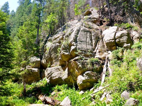
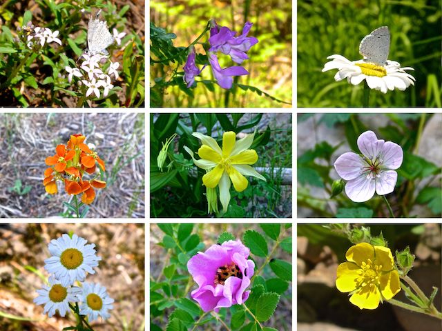
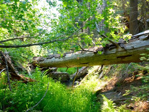
Kehl Canyon is immediately tighter than the beginning of any other Mogollon Rim canyon I’ve so far hiked. Not bad, but tighter, with no shelves or meadows to speed travel. I don’t know if ferns can “peak” like spring flowers, but there were tons of them. False hellebore / corn lily were also plentiful. The most common actual flower was yellow columbine, followed by some white thing that was neither daisy, lily, poppy nor fleabane. I also spotted western wallflower and Richardson’s Geranium.
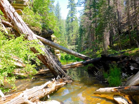
There was evidence of water the first 1.6 miles down Kehl Canyon, and a small, but loud, pour to a clear, waist deep, pool at the junction with Middle Kehl Canyon. The junction would make a great campsite.
The next 1.3 miles of Kehl Canyon considerably tightened until I came to a waist deep pool flanked by steep rock formations. I didn’t want to get wet, but neither did I want to bail, so in I went. On a smaller scale, it reminded me of hiking the Gila River — literally, hiking the river — in 2015. Having gotten soaked, I didn’t hesitate to splash right through any further pools. 💦
I wanted to stop for lunch at the mouth of West Kehl Canyon, but didn’t find just the right combination of shade, soft ground and a decent back rest until I was a half mile up West Kehl. My photos don’t bear it out, but it was slow travel, with uncertain footing, pools, deadfall, etc. In other words, “tight”.
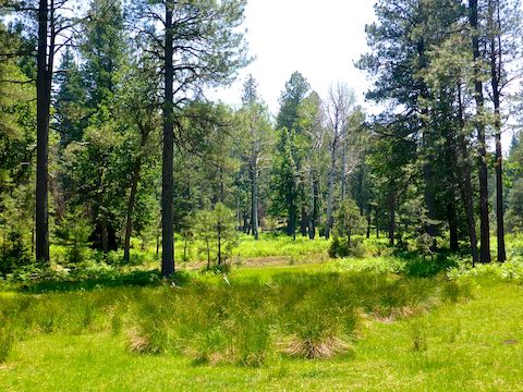
A mile up West Kehl Canyon, it began opening up. By the time I reached bone dry Mud Spring, FR 6110 was just a few yards away, in a small meadow. I didn’t want to do any more canyon crawling than necessary, so the solution was obvious.
After a ½ mile on FR 6110, I turned left onto FR 308E, which was quite rocky for the ½ mile I was on it. Okay for walking, but I wouldn’t drive my SUV up it. Where FR 308E turns north, I took a short break before dropping into Middle Kehl Canyon for my final canyon crawl of the day.
Like West Kehl Canyon, I remember the initial stretch of Middle Kehl Canyon being more congested than my photos otherwise suggest. A ½ mile south, there was a leaning, but still standing, pine with the largest trunk I’ve seen on the Mogollon Rim: It was at least 60″ diameter! Speaking of which, most of the trees in the various Kehl Canyons are pine, with few oak or other deciduous species. 🌲
A ¼ mile south of the massive pine, Middle Kehl Canyon intersects FR 308B, by which point the canyon bottom travel is fern patches. Instead of heading up the spur on FR 308B, I continued at the bottom of Middle Kehl on an unnumbered jeep trail.
After another ½ mile in Middle Kehl Canyon, I turned off the unnumbered jeep trail, up an obstacle-free draw, before crossing a burn area on FR 308A, back to the Kehl Spring Campground.
Directions: From Phoenix, head north on AZ-87, the Beeline Highway, through Payson, Pine and Strawberry. (Alternately, take I-17 north, then AZ-260 east.) 2.6 miles north of AZ-260, turn right onto Rim Rd. / FR 300, which is currently in by far the best shape I’ve ever seen it. In 6.8 miles, just before FR 141, turn left into the Kehl Spring Campground. The day use fee is $8.
GPS File: Kehl_Canyon_Loop
Distance: 9.67 mi.
AEG: 796 ft.
Time: 4h 48m
Hiking Video
Hiking Kehl Canyon, Mogollon Rim from Preston McMurry on Vimeo.