

Miller Canyon is a 13-mile canyon that flows downhill, north from the Mogollon Rim at Hi View Point to East Clear Creek, just downstream from C.C. Craigan Reservoir. Miller Canyon is bounded by Miller Ridge, Blazed Ridge, McCarty Ridge and Battleground Ridge.
Thirteen miles of canyon crawling, let alone at least that distance trudging back to the trailhead on forest roads, is more than I can handle. (The furthest I’ve ever walked in a day is 35 miles, while hitchhiking across Utah in 1983, when I was 20.) So, today I opted to hike the middle portion of Miller Canyon, north of FR 141H. It is an area I know well, from previous hikes in McCarty Draw, Crackerbox Canyon and East Miller Canyon.
I was on my own today, as my wife had to stay behind to care for our new kitten who the vet “transitioned” the day before. There wasn’t much traffic heading north on I-17, nor east on AZ-260, for the Labor Day weekend. Not at 7:00 a.m. anyway. It was a perfect 58℉ when I started hiking at 8:05 a.m. 😿
From the trailhead, I thought about heading directly across FR 320 for the obvious low ground, which I knew would take me into Miller Canyon. Instead, I headed north on FR 320 for .25 miles, splitting left on FR 6235, which is closed to vehicular traffic. (Several dead trees have been hauled across the road.) 🚫🚙
Where FR 6235 turns north, I turned left, down a draw. You could as easily continue west, down the spur. Either ends up on FR 9350E, or the “Old FR” as I call it. The Old FR has not seen vehicular traffic in years.
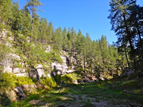
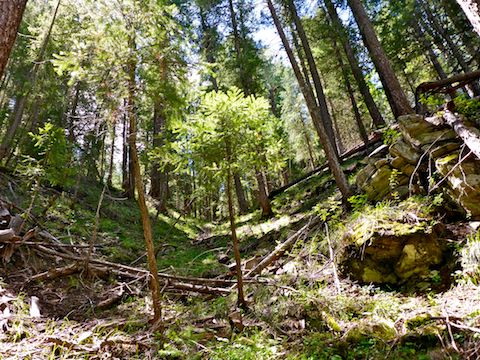
The Old FR heads north, a couple of contours up from the bottom of Miller Canyon. The walls are often sheer, but are frequently broken by draws which may more easily be descended to the canyon bottom. FR 6350E is smooth, easy, walking and dotted with mushrooms.
Middle Miller Canyon is 4.5 miles of relatively easy canyon crawling. It is never more than 200 ft. deep. For the most part, it is higher and steeper on the east slope; lower and more moderate on the west. It is 20-100 ft. wide at its bottom, with no major obstacles that require low crawling, or side-sloping a higher contour line. There is no tangled brush or grab & stabs.
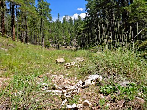
A week after the summer monsoon, Middle Miller Canyon had lots of pooling, more in the northern half. The pools were 2-18″ deep. There was a noticeable, but inaudible, trickling flow. Despite much elk sign — both bones & scat — the water looked pretty clear. Dozens of water crossings are required, and most can be done totally dry, though you may need to wade the larger pools. 🛶
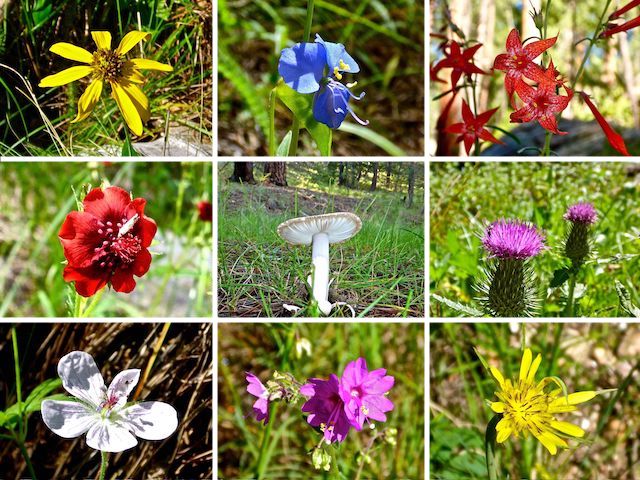
Starting when I descended from the Old FR to Miller Canyon’s bottom, until I exited the canyon three hours later, there were flowers end-to-end. I know we’ve had a great monsoon, and I was hoping for some flowers, but I never expected anything like what I found in the canyon. Later, up on Miller Ridge, the only flowers I saw were scattered lupine.
When I reached the junction of Miller Canyon and East Miller Canyon, I turned right, up East Miller Canyon, hoping to find an easy way up to Miller Ridge. I went about a quarter mile, but found nothing but cliffs, or draws so steep & choked with deadfall, that they didn’t look safe. It would suck to fall and break something out of cell range, though I do carry a Personal Locator Beacon (PLB) registered with the National Oceanic and Atmospheric Administration (NOAA). If I hit the switch on that, the same cavalry is coming for me that goes for downed fighter pilots. Minus the Navy SEALs. 📡
I doubled back up Miller Canyon maybe a hundred yards, where I recalled seeing a doable route up to Miller Ridge. It was steep, and had some deadfall, but no tripper vines or grab & stabs that would throw me off balance. Better yet, it had a game trail. So, I followed that 150 ft. up, using the odd upright tree for a handhold or foot brake. I made the top in 12 minutes.
On the hike back along FR 320, I kept myself amused by singing, badly, my usual array of shower songs: “Joy to the World” (Three Dog Night); “Bad Bad Leroy Brown” (Jim Croce); “Mercedes Benz” and “Me & Bobby McGee” (Janis Joplin, of course); “Zip-a-Dee-Doo-Dah” (from Disney’s “Song of the South”), and another I can’t remember.
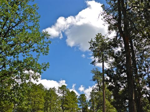
Halfway back to the trailhead, I sat on some pine needles, reclined against a tree, and took off my shoes and socks. While they dried out, a bit, I ate lunch. I could have stayed there all day, watching the clouds. ⛅️
On the way back to AZ-87, I had to dodge a couple of yahoos going too fast, too wide, on the forest road. There was tons more traffic — all heavy duty pickups hauling 5th wheel trailers, dirt bikes, ATVs and boats. Thankfully, I was heading the opposite direction of the Labor Day rush hour. 🙏🏻
Traffic on I-17 southbound was not bad, but I thank the Good Lord I was not heading the opposite direction as it was a 30 mile traffic jam from Phoenix to Sunset Point. Everyone “getting away from it all” by going to the same place. 🙄
Directions: From Phoenix, head north on AZ-87, the Beeline Highway, through Payson, Pine and Strawberry. (Alternately, take I-17 north, then AZ-260 east.) ~11 miles north of AZ-260, turn right onto FR 141. (It’s bumpy, but not as bad as heavily-travelled Rim Rd. / FR 300). In 8.0 miles, turn left on FR 141H. It is rockier yet. FR 141H crosses Miller Canyon. In 2.4 miles, turn left onto FR 320 which is rocky, but not as bad as FR 141H. In a mile, there is a large grassy clearing on the right: Park there.
GPS File: Middle_Miller_Canyon
Distance: 10.36 mi.
AEG: 579 ft.
Time: 4h 07m
Hiking Video
Hiking Middle Miller Canyon, Mogollon Rim from Preston McMurry on Vimeo.
Lovely canyon hike.
I was surprised at the amount of flowers!