

Earlier this year, I switched my regular hiking day from Thursday to Wednesday, as the latter seems to have less traffic. (Probably due to fewer people taking early weekends.) Plus, hiking on Wednesday seems to give me more time to finish all my post-hike tasks: Photo editing, hiking video creation, blog writing, and all the many sub-tasks those require — which usually takes me three days. 📆
This week, I had time to hike on Wednesday, but delayed a day so I could celebrate — if that is the right word? — Veterans Day with a ruck march and some land nav. With comfortable footwear and without knee-deep mud.
This hike follows FR 3037 for 1.7 miles beside Pinto Creek, then 4.0 miles on Haunted Canyon Trail #203 to the Tony Ranch cabin. The 78-acre ranch was homesteaded in 1915 by William Toney [sic], who lived in the 12×30 ft. two room tin-roofed cabin with his wife and seven children. Toney mostly ran cattle, but also planted an apple orchard and grew wheat, beans, and other crops.
Now, Tony Ranch is managed by the Superstition Area Land Trust (SALT), to preserve Haunted Canyon against encroachment by the nearby open pit copper mines which you drive through to reach the trailhead. (See directions, below.)
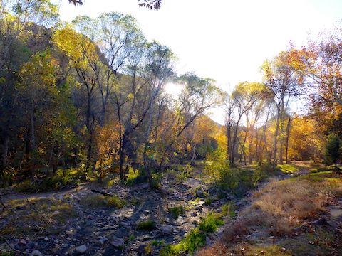
At one time, you were allowed to drive to the loop at the end of FR 3037, but now there is a locked gate, so you get to walk to Haunted Canyon Trail #203. Despite being on a forest road, FR 3037 is a pleasant stroll. Pinto Creek had a trickle of water, and the morning sun just peeking over the canyon walls made the late fall color pop. 🤗
I counted four pump stations / water gauges along FR 3037. The mechanicals are protected by razor wire-topped fence. In several cases, there were post-mounted, locked, small metal boxes nearby. (Which I assume contained stream gauges.) Perez Cabin is across Pinto Creek from the second gauge. The cabin is partly collapsed and filled with pack rat nests & hantavirus.
Pinto Creek was an inch deep, with a trickle of water. I wonder how much of that was due to the third, and largest, pump station, which was absolutely gushing water? I saw no water at the other pump stations: I assume because the copper mine’s were sucking it all up.
FR 3037 ends after 1.7 miles in a loop at the fourth pump station / water gauge. There’s also an old corral there, but the only vehicles allowed that far now are from the mines, one of which I passed. Haunted Canyon Trail #203 starts on the right. 👻
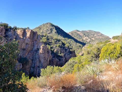
Crossing a spur, Haunted Canyon Trail #203 climbs 200 ft. in ¾ mile, which seemed steeper than it was. Probably because stinknet-covered spur is highly exposed, despite being dotted with juniper. It was only 43℉ when I started 90 minutes earlier, so I actually appreciated the sun. Otherwise, Trail #203 climbs a very consistent 100 ft./mile all the way to Tony Ranch.
After a mile Haunted Canyon Trail #203 drops back down to the bottom of the canyon, which it crosses many times in the final three miles to Tony Ranch. I’ve heard the canyon can be quite wet, but two months after the summer monsoon, it was dry except for a few small puddles. The most pleasant part of the hike, the canyon bottom has lots of shade, even in early afternoon.
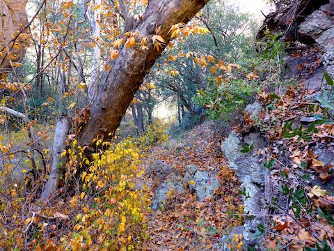
Haunted Canyon Trail #203 is really well plotted and built. I missed a handful of creek crossings, for a few feet here or there, but if you pause for a couple of seconds, where Trail #203 continues should be fairly obvious. (No need for the spray-painted red arrows on several boulders.) 😒
There are few cacti, but catclaw all along Haunted Canyon Trail #203. I got painfully snagged on several occasions. I’ve heard poison ivy lines the canyon bottom, but I at least managed to dodge that. The deadfall is minor and easily avoided. Haunted Canyon has many caves — including the legendary “Cave With A Thousand Eyes” — but I spotted only one small alcove.
Just after entering the signed Tony Ranch property, Haunted Canyon Trail #203 splits: Right continues 3½ miles north to FR 287A; straight heads ⅓ mile towards the cabin. Tony Ranch Spring is in 250 yds., next to the trail. Can’t miss it. The spring was barely a trickle, but the small spring box was nearly full. (With many bees.) The trail then crosses a small meadow before reaching Tony Ranch cabin.
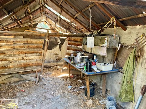
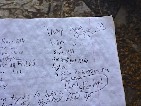
There’s an array of rusty metal junk outside Tony Ranch Cabin. In the cabin’s front room, to the left, there is a dodgy metal bed frame meshed with plastic cord. Right is a wood table and metal cabinet, with various bits & bobs, including the logbook. The back room was empty. I was not sure the rickety wood bench would support my fat rear end while I signed the log. 📝
After spending nearly an hour at Tony Ranch cabin, I started back. Thankfully, other than the short climb out of Haunted Canyon up to the grassy spur, it was all downhill. I really thought I was hauling, but somehow I only averaged 2.4 mph. At least, for once, I made it back to my patient wife ahead of time. (Even if by only 30 seconds.)
Directions: From Phoenix, head east on US-60 through Gold Canyon, Superior and Top-of-the-World. A ½ mile east of milepost 239, when you see a black-on-yellow 50 mph four-way intersection sign, take the next left onto Pinto Valley Mine Rd., which drives through the middle of two large open pit copper mining operations. Mind your speed, and follow the “FR 287” signs, so you don’t get squished by any massive dump trucks. In 7.2 miles, just before crossing Pinto Creek Bridge, turn left onto FR 3037. There’s a small parking area on the right, just before the locked gate.
GPS File: Haunted_Canyon_Trail_203
Distance: 12.06 mi.
AEG: 1,009 ft.
Time: 4h 56m
Driving Video
Hiking Video
Hiking Haunted Canyon Trail #203, Tonto National Forest from Preston McMurry on Vimeo.