

Avoiding 110° Phoenix, yet again, for the relatively frigid climes of Prescott.
Morning shade was nice, but it got warm as noon approached, and part of the hike was through an old burn area. Did a bit of exploring, and ad-libbing, so my mileage is more than the official route. The little canyon up to Bean Peaks’s west edge was a pleasant surprise, and MTB-free as well.
The way across the Bean Peaks ridge was obvious, but it was still festooned with an incomprehensible melange of pink and orange ribbons. (Tie pink & orange ribbons around this burnt old pine, it’s been two hours now, and it’s half past nine … la-la-la.) 🎶
I searched both Lima Bean Peak and Pinto Bean Peak, it’s northerly twin, for geocaches and summit logs, but found nuthink! There were some modern “inscriptions” on Lima Bean Peak, though.
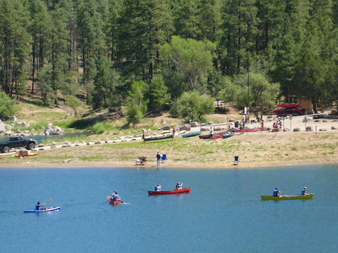
I’d heard the dams on Upper and Lower Goldwater Lake were fenced and signed off, but I had to look for myself. You never know; sometimes things change. After checking out the lower dam, I got in the small, and very lush canyon below it. It was so thick with reeds and vegetation, that it was a bit difficult thrashing through, but worth it anyway to avoid the many MTBs on Goldwater Lakes Trail #396. (Though I must admit the bikers were all polite, and not banzaing the trail.) There was a small trickle of water, ending in a pool just before the intersection of #396 and Bannon Creek Trail #61.
Not sure why I was walking so slow, compared to last week’s trip from White Spar to Mt. Francis, then down to to East Copper Creek. That was 12.2 miles / 1933 AEG / 2.57 mph, to 9.47 / 1599 / 2.28 for this one. Despite the stats appearing less, I was significantly more wore out by the end. Maybe it was warmer and less breezy? Next time I’ll park at Upper Goldwater Lake so I can take a post hike dip. (“No swimming” sign, or not.) Recuperated with a wood-fired Mediterranean pizza and Blue Moon beer (BYOB) at the T-Bird Cafe in Peeples Valley.
GPS File: Bean_Peaks_Loop
Distance: 5.68 mi.
AEG: 1,070 ft.
Time: 2h 19m
Hiking Video
Bean Peaks Loop, Prescott National Forest from Preston McMurry on Vimeo.