
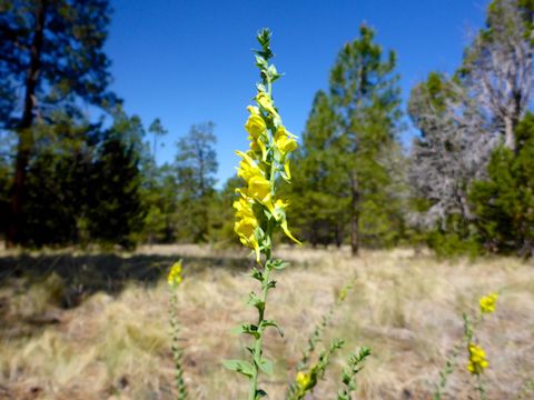
, which can also be purple, but these were always obviously pink. Dunno ...")
Since I began mountain biking again six months ago, my goal has been to do one “away” ride per month. Today, I visited the Campbell Mesa Trail System, tucked into the southeast corner of Flagstaff, just inside the Coconino National Forest. The system has five loop trails:
- Sinagua Loop: 1.1 miles, 50 ft. accumulated elevation gain (AEG).
- Continental Loop: 1.7 miles, 70 AEG. Nice views of Mount Elden. Popular with walkers.
- Anasazi Loop: 2.6 miles, 150 AEG. Also popular with hikers.
- Walnut Meadows Loop: 2.6 miles, 110 AEG. Best MTB “flow” of the five.
- Campbell Mesa Loop: 4.1 miles, 240 AEG.
The latter two accessed via the Sinagua Loop or Ansazi Loop. Plus there are short connectors to the Arizona Trail and Flagstaff Loop Trail.
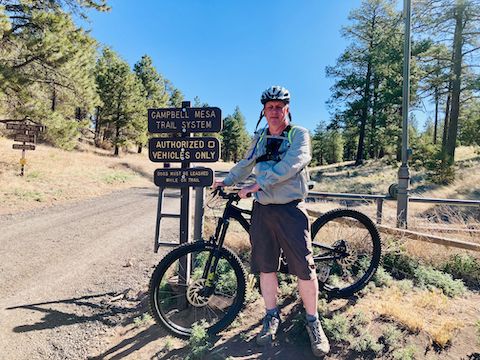
The Campbell Mesa Trail System is for hikers, bikers and horses. (Or snowshoeing and cross-country skiing during snowier months.) As the signs say: “No unauthorized” vehicles. While I was getting myself ready, two pickups drove out. Turns out there are a couple of small ranches up the gravel road near I-40 — at least one of which is running livestock on Campbell Mesa, as I crossed two gates during my ride.
My plan was to bike a 10-mile “mega loop” including part of Ansazi Loop, most of Campbell Mesa Loop, all of Walnut Meadows Loop, part of Sinagua Loop, and all of Continental Loop. And, if I felt frisky, do it a second time. Or maybe just do one of the shorter loops again. 🤔
I started biking up the dark gravel road for 250 yds. To the left, by the info kiosk, is Continental Loop. To the right, Sinagua Loop. I went straight ahead, under the powerlines, onto singletrack Anasazi Loop. After 200 yds., Anasazi Loop splits: Left for clockwise, right for counter-clockwise. I went left.
I passed several hikers on Anasazi Loop and Continental Loop, always approaching cautiously, calling out “passing left” when I was 50 ft. away, and offering a friendly “howdy” as I went by. Everybody was friendly, with the exception of a gal with headphones on who had no clue I was behind her. Stay alert! Stay alive!
There are many small climbs on the Campbell Mesa Trail System, but the two steepest ones are 75 ft. @ 5.9% on Anasazi Loop as it approaches Campbell Mesa Loop, and 60 ft. @ 4.0% on Walnut Meadows Loop from the Arizona Trail intersection (grade calculator). There’s climbs that have more gain, or more distance, but those two are the steepest. This fat man made it up both without dabbing. 💪
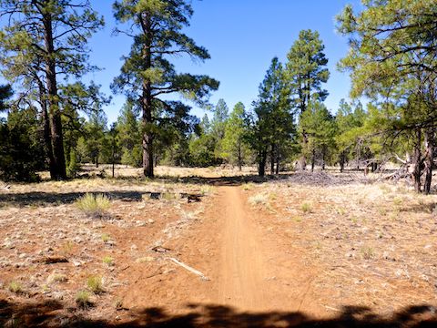
… Which was no easy task due to the often rocky trail surface. (Rocks either causing loss of traction, or a step you need to lift over on climbs.) Frequent switchbacks on MTB-optimized trails, such as Campbell Mesa Trail System, also make it harder to maintain pace. Personally, I’d trade switchbacks for the risk of bombing a descent.
At 1.4 miles, at the top of that 5.9% climb, Campbell Mesa Loop splits left from Anasazi Loop. At 2.5 miles, I initially split left onto Flagstaff Loop Trail. I only went a few yards before correcting my mistake. (I carry the same crappy Garmin 62S I hike with, rather than spend extra on Strava.) Instead, stay right.
Every mile or so on Campbell Mesa Trail System, a log crosses the trail. Saving construction & maintenance, the trail section is always cut out rather than build an A-frame. At 4.9 miles, after a couple of moderate climbs, I made a sharp left off Campbell Mesa Trail onto Walnut Meadows Loop. 🧭
Walnut Meadows Loop crosses a powerline at 5.6 miles. Because of switchbacks, I slow rolled the sketchy bits down to the Arizona Trail intersection, at the 6.2 mile mark. Stay right, or you will end up at heading towards Fisher Point. The 4.0% climb up from that intersection was thankfully less twisty, so I made it up without too much problem.
At 7.1 miles, while paralleling the blufftop above Old Walnut Canyon Rd., Walnut Meadows Loop re-crosses the same powerline. At 7.6 miles, I split left onto Sinagua Loop. It looked like my route would take me on a long climb up a powerline road, but luckily it was only a few hundred yards.
Just after re-entering the forest, at 8.1 miles, I headed straight across a trail intersection, paralleling the powerline back to the dark gravel road. I went straight across that as well, past the info kiosk, onto Continental Loop, which I rode counter-clockwise. ℹ️
The mild climb up Continental Loop, to the bluff above the Rio de Flag, has really nice views of Mount Elden. The surface was mild. However, the downhill to close the loop was probably the rockiest part of my ride. Being somewhat straighter, I attacked it as much as an old guy can, and my experience was actually smoother than Walnut Meadows Trail.
Because I knew I was running low on GoPro battery, I rode Continental Loop as fast as I was able. I made it back to the dark gravel road with 100 ft. of power to spare. I would definitely ride Campbell Mesa Trail System more often if I lived closer! 👍
Directions: From Phoenix, head north on I-17, then east on I-40. Take exit 201, south onto Country Club Dr. In just under a mile, at the driving range, make a left onto Old Walnut Canyon Rd. In just under another mile, opposite the Peaceful Valley Memorial Park religious shrine, turn left into Campbell Mesa Trailhead. Park there: Only “authorized” vehicles are allowed to proceed further.
GPS File: Campbell_Mesa_Mega_Loop
Distance: 10.41 miles
AEG: 467 ft.
Time: 1h 39m
Biking Video
Mountain Biking Campbell Mesa Trail System from Preston McMurry on Vimeo.