

Potato Lake Draw is a shallow “canyon” at the west end of the Mogollon Rim. Starting at Baker Butte, Potato Lake Draw runs 2½ miles, past Potato Lake, to Quaking Aspen Canyon. (Itself also more of a “draw”.) Today’s plan was to hike off trail down Potato Lake Draw to Quaking Aspen Canyon, then loop back via mostly decommissioned Coconino National Forest roads.
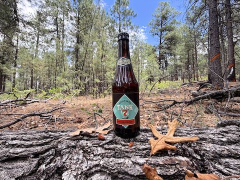
Potato Lake Draw was my 72nd Mogollon Rim hike, above or below the Rim, and my 38th different Rim canyon. I try to do six or seven Mogollon Rim hikes per year, usually starting around the second week in May. Today was my latest start in years, mainly because I cancelled last week in favor of finally getting a new phone, an iPhone 17 Pro. Potato Lake Draw was it’s first photographic field test.
The trailhead is on FR 9362T where it crosses General Crook Trail. It is a popular camping spot and, unfortunately, shows it. There’s trash, but worse, quite a bit of used toilet paper. Presumably. I didn’t look too close. If you don’t have a portable toilet, for God’s sake at least bury it. I have. I occasionally spotted TP for probably a quarter mile down Potato Lake Draw. Hopefully, the Forest Service cleans it.
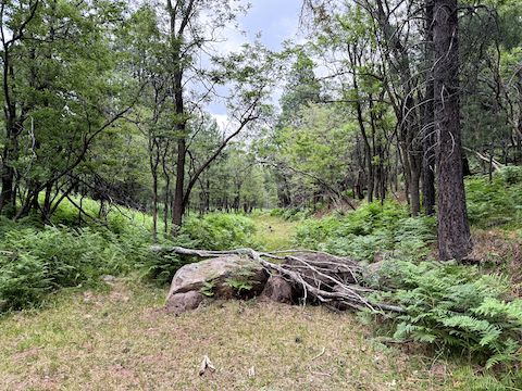
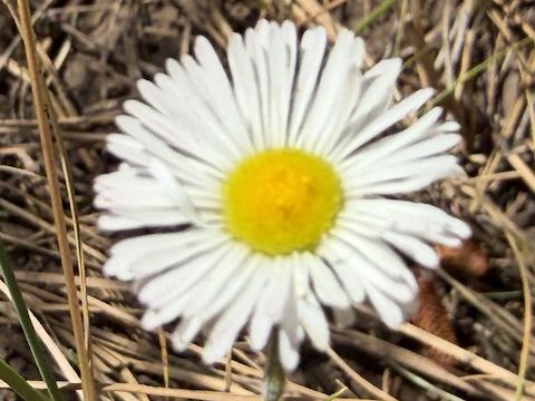
I thought Potato Lake Draw would be a mellow off trail hike, but instead it was on a decommissioned continuation of FR 9362T for the first 1.4 miles. Potato Lake Draw itself is wide & shallow, never more than 100 ft. deep. Other than spots of wild raspberry, or copious bracken fern up to 6 ft. high, the slopes are open. While I was on FR 9362T, the only flowers I saw were dandelion and white clover.
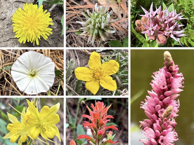
Top Row: dandelion, white clover, showy milkweed.
Middle Row: field bindweed, woolly cinquefoil, amphibious bistort / water smartweed.
Bottom Row: yellow columbine, paintbrush. (More High Country Flowers)
FR 9362T splits left, uphill, after 1.4 miles. But I stayed on whatever old jeep trail is at the bottom of Potato Lake Draw. Maybe it’s FR 147B? (The shorter, more direct, Potato Lake access route.) As I continued down the draw, there was a wetland to my left, and a barbed-wire fence protecting it. The fence cuts the trail off at 1.8 miles: Just walk through the tube gate on your left, then get back on trail.
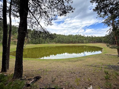
I walked around Potato Lake, keeping enough distance I was able to fit the whole lake in frame. The lake pix at least look okay, focused, even though the color seems a bit dull, and resistant to my normal post adjustments. I nailed the woolly cinquefoil, but mullein, American vetch and amphibious bistort were especially difficult to focus on. The latter two took 10 minutes each! And were still 💩.

From Potato Lake, it is two miles back to the Baker Butte trailhead. So, a 4.5 mi. / 540 ft. AEG (accumulated elevation gain), in & out “lasso” hike. True loops can be created using the network of other decommissioned jeep trails, on either flank, or General Crook Trail. Starting from FR 147B, you can make a 2.7 mi. / 280 ft. AEG loop using the FR 9362T cut across. My loop is 7.2 mi. / 785 ft. AEG.
After checking out Potato Lake, I started my bonus miles loop. (The hike video, below, ends at Potato Lake.) I squeezed through the too-tight, no bicycles, pedestrian v-gate, heading 0.5 miles east on FR 147B to the end of Potato Lake Draw, a culvert at Quaking Aspen Canyon. I turned north on FR 147 for 0.4 miles to the first rail fences. Then I turned left on FR 147C, stepping across a no-vehicles rail.
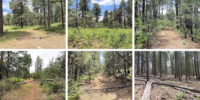
Top Row: FR 147C at FR 147; off trail through bracken fern & wild raspberrry; FR 6084.
Bottom Row: FR 9362T finally ends at FR 613; FR 6022 is steeper than it looks; cross-country to trailhead.
In 0.25 miles, FR 147C seemed to split. I went left. (FR 147C actually goes right.) My trail soon petered out, but was easy cross-country travel, including stepping across a barbed-wire fence, for 0.25 miles. I encountered a dense wild raspberry patch at the top of the climb, before arriving at the end of FR 6084 after 4.2 miles. The other end of FR 147C joined FR 6084 at 4.3 miles.
FR 6084 terminted at our old friend, FR 9362T, at the 4.5 mile mark. Left on FR 9362T cuts across to Potato Draw. I went right. FR 9362T ended at FR 613 — which is a car-drivable dirt road — at 5.1 miles. I was making haste. I turned off FR 613, onto gated FR 6022 at 5.8 miles. FR 6022 was steep, petering out at 6.4 miles. I never did find FR 9381S, heading cross-country until I was nearly back to Baker Butte.
Though my loop ends after 7.2 miles, I logged nearly a mile extra due to wandering, and attempting to take photos. Hopefully I will figure out this iPhone 17 Pro soon. Certainly cost me enough! 💸
FR 9362T Trailhead Directions: From Phoenix, head north on AZ-87, the Beeline Highway, through Payson, Pine and Strawberry. (Alternately, take I-17 north, then AZ-260 east.) 2.6 miles north of AZ-260, turn right onto Rim Rd. / FR 300. In 1.7 miles, on the northeast slope of Baker Butte, turn left onto FR 9362T. Park in 200 yds., just past the General Crook Trail.
GPS File: Potato_Lake_Draw_Loop
Distance: 8.16 mi.
AEG: 852 ft.
Time: 3h 22m
Rumble Video
Vimeo Video
Hiking Potato Lake Draw, Mogollon Rim from Preston McMurry on Vimeo.