

Today’s Mogollon Rim canyon crawl is down an unnamed canyon. Let’s call it “Porcupine Canyon”, after Porcupine Ridge, which forms its west flank. After exiting the canyon, this hike loops back to the trailhead via Porcupine Ridge forest roads. Dye Ridge is the canyon’s east flank.
The head of the Porcupine Canyon is right at the intersection of Rim Road and FR 34B. For security reasons, I don’t like my SUV being so obvious, so instead I parked down FR 34B, at the FR 34I — “I” as in India — intersection. Porcupine Canyon empties into West Chevelon Canyon after 4½ miles.
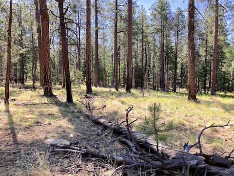
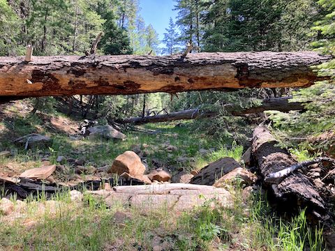
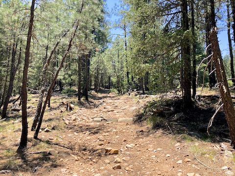
Though I did not start from the head of Porcupine Canyon, it was still easy “dropping in” to its bottom. It was smooth travel for about a half mile, then tightened up. I high crawled under some deadfall, scrambled over others. The deadfall and brush was thickest from the 1½ to 2½ mile mark. Not bad, but physical work — especially since I had done only one hike of any significance in the past five weeks.
Wood’s rose was the most common flower, all along Porcupine Canyon. I don’t recall seeing so many elsewhere. Woolly cinquefoil were second most common. Lemmon’s star are not common, but today there were many. Conversely, yellow columbine are fairly common on the Mogollon Rim, but there were few. Orange agoseris are rare, but today I lost count at 10. Wild strawberry were fairly common.
I also found spreading fleabane, alpine false springparsley, New Mexico groundsel, red and yellow pea, Canada violet, yellow salsify, and dandelion. I only saw pygmy bluet on FR 34H, and silvery lupine by the FR 34I trailhead.
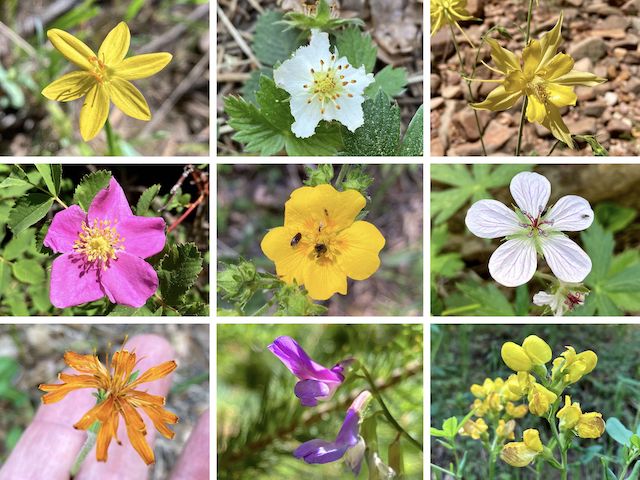
Top Row: Lemmon’s star, wild strawberry, yellow columbine.
Middle Row: Wood’s rose, woolly cinquefoil, Richardson’s geranium.
Bottom Row: orange agoseris, American vetch, spreadfruit goldenbanner.
The walls of Porcupine Canyon never got too deep or steep. I saw no obvious bail points, but scrambling out at any point would not be difficult. More so than other Mogollon Rim canyons, there was evidence of people being in it. (Occasional beer cans, with a couple dozen scattered just short of the 3-mile mark.) I grabbed what I could, but it was too much garbage to carry it all out.
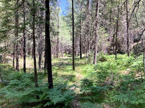
After almost three hours — including photography breaks — I arrived at the bottom of FR 34H. (West Chevelon Canyon is just around the corner.) Rather than enjoy the mid-day shade, I chugged up FR 34H. I intended to turn off FR 34H after a mile, taking FR 34I back to the trailhead. Despite walking slow, and thorougly scanning, I didn’t find FR 34I. It would be the same distance as the route I ended up taking.
The first half mile of FR 34H is strictly high clearance, 4×4. The remaining 1½ miles of FR 34H is SUV-drivable. FR 34B is car-drivable all the way back to where I started — where FR 34I is quite obvious. Go figure. Maybe I’ll do a future hike to map that, then head over the side of Porcupine Canyon to grab all those beer cans.
Directions: From Phoenix, head north on AZ-87, the Beeline Highway, into Payson. Turn right on AZ-260. In 29 miles, after cresting the Mogollon Rim, take the first left onto Rim Rd. / FR 300. In 9.3 miles, there is a t-intersection. Turn right onto FR 34. In 0.3 miles, turn right on FR 34B. In a mile, at FR 34I, park on the left.
GPS File: Porcupine_Ridge_Canyon
Distance: 7.57 mi.
AEG: 451 ft.
Time: 3h 33m
Rumble Video
Vimeo Video
Hiking Porcupine Canyon, Mogollon Rim from Preston McMurry on Vimeo.