
")
Prescottstyle (Paul) is my frequent hiking & mine exploring buddy, especially when I am up in Yavapai County. Paul knows Yavapai like the back of his hand.
We had planned to hike into the Sierra Prieta to watch the Whiskey Off-Road mountain bike race last week. But with a chance to catch Dave Landau at Laff’s Comedy Caffe down in Tucson, I begged off. Turned out to be a fortuitous bail, as Prescott got a couple of inches of snow the day before the race. ☃️
So, this week, Paul lined up some ruins for us to explore in Skull Valley, about 12 miles southwest of Granite Mountain. (In keeping with ruins etiquette, I won’t provide the exact location, but the video and photos ought to give enough clues to dedicated ruins explorers.)
My wife dropped Paul and I off five miles down a very nice dirt road. While we were hiking, she was back in Prescott shopping. 💸
We could have headed straight up the east slope of the ridge on which the ruins sit, but that approach is steep — 500 ft. in a half mile — and choked with catclaw, so instead we decided to come at the ruins from the west. We walked a bit further down the road, until we came to a gated ranch. There, we turned west up somewhat up a somewhat rough forest road.
The forest road climbed 300 ft. in a mile to a saddle, near a spring. From the saddle, it is 200 ft. in 0.4 miles to the ruins. (Or half the angle, and with much less brush, than if we had taken the ridge head on.) An old feed bin marks the saddle. Not sure if it was for cattle or sheep. 🐄 🤔 🐑
There are three small hilltops on the ruins ridge. The lowest is just above the feed bin saddle.
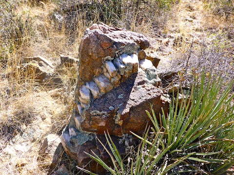
Halfway up the west slope of the first hilltop, we found a rather long vein of, in Paul’s words, “Bull quartz in a matrix of Prescott granodiorite”. (Paul is our mineral expert.) To me, they looked like big, rocky, Oreo Cookies.
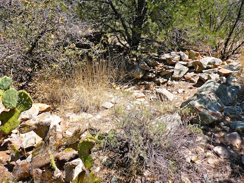
Between the first and second hilltops there is a small, hardscrabble, meadow littered with old, dry, cow patties.
After having problems the last month or so with my crappy $140 camera, this hike I switched from a 64 gig chip to a 32 gig chip. It seemed to record video segments much better, only once or twice puking a write error after eight seconds. (Whereas the 64 gig was so bad, I would have to reshoot a video segment as many as eight times to get one to properly write to the chip.) Not ideal, but a vast improvement.
Paul, on the other hand, fell victim to camera gremlins, as neither his wide angle nor telephoto lens would focus. Eventually, he figured out he had accidentally bumped some switch to the wrong position. At least he got the the cool “Bigfoot” photo out of it! 👣
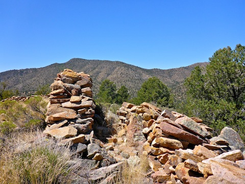
The west wall of the ruins is visible from the second hilltop. The entrance, of overlapping walls, is in the north wall. The south wall is about 10 ft. lower than the north wall.
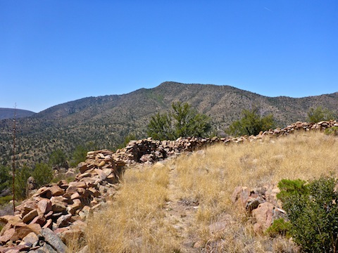
The ruin’s main structure is about 50′ x 70′. The 2-4′ high walls are made of stacked random stone. Not cut, and not mortared with mud. At least no mortar remains.
There was evidence of some old, but not ancient, fire rings in the grassy middle of the ruins. There are no detectable rooms, nor beams.
I spotted three flowers in the middle of the ruins: A Dudleya (one of my favorite flowers), an Indian Paintbrush, and a New Mexico Thistle. 🌺
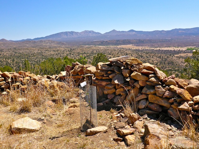
There is what appears to be a hunting blind in the southwest corner. (A cache of water & toilet paper covered by camouflage.) An obvious foot trail runs from the cache, along the south wall, to the southeast corner, where a tree has been planted. Not a marijuana plant, as you might suspect. The planting is protected by wire mesh and is tagged. (I did not look to see what kind of plant it actually is.)
Just below the east wall, there is much smaller, but still decent-sized structure: Maybe 10′ x 20′, with 18″ of remaining wall. Just below that, is an even smaller structure, maybe 6′ x 8′, with a 12″ high wall.
We did not find any sherds, petroglyphs, or other artifacts in any of the three structures. The general impression I got was that it was an old indian ruin that had been adapted to more modern use, as a cattle or sheep pen. (If the 1880s could be considered “modern”.) The Skull Valley ruins reminded me of the Hill 3464 ruins / corral, except much, much smaller.
Paul said the hike would be six miles, more with addons. In the end, it was less than four, including our wandering. It was getting toasty, and there was little shade, so we skipped the extras in favor of lunch & beers at the Iron Springs Cafe.
Directions: Somewhere west of Prescott, in Skull Valley.
GPS File: Uh, uh, uh. Watch the video and maybe you can figure out where the ruins are. 😉
Distance: 3.80 miles
AEG: 642 ft.
Time: 2h 00m
Hiking Video
Mysterious Ruins in Skull Valley from Preston McMurry on Vimeo.