

Miller Canyon flows north from the Mogollon Rim at Hi View Point, 13 miles to East Clear Creek, just upstream from C.C. Cragin Reservoir. Miller Canyon is bounded by Miller Ridge, Blazed Ridge, McCarty Ridge and Battleground Ridge. McCarty Draw, East Miller Canyon and Crackerbox Canyon flow into Miller Canyon.
Because 13 miles of potentially very physical canyon crawling is more than I wanted to swallow in one bite — never mind the equally long egress via forest roads — I chopped Miller Canyon up into three parts: I hiked upper Miller Canyon (3½ miles) in 2020, and middle Miller Canyon (4 miles) in 2018. Today, I hiked the final 5½ miles. 💪
The Mogollon Rim offers no guarantees as to how easy a canyon crawl might be, even in the same canyon from one monsoon to the next. That said, I did hike a mile in the middle of today’s adventure when I did McCarty Draw, and it was smooth sailing: wide and gravelly, no obstacles. My problem was finding a way in to Miller Canyon that did not involve cliffs, and where I could loop back on forest roads.
I considered possible lower Miller Canyon routes every Spring and Fall, when I do my general hike planning for the next six months (when and where to hike, if not yet the exact route). After four years, I finally got it on my calendar for this week, but only came up with a practical route the day before. 🗺
I changed it 10 minutes after I started hiking.
The lower Miller Canyon GPS route I attached below is an 11-mile loop. Four miles of that is a warm down walk along Battleground Rd. / FR 123. Because my wife is so supportive of my hobby, I thought it would be nice, after I was done hiking, to show her something cool as well. So, before I started hiking, I drove down FR 123 and FR 123A to where I wanted her to pick me up, to save time. She was comfortable: Both roads are in great shape.
I started hiking north on FR 9724V at 9:50 a.m. After ¼ mile, where FR 9723U splits right, I split left through a gateless fence. I intended to follow FR 9724V to the rim of Miller Canyon, then turn northeast down a spur with slightly wider spaced contour lines, to the canyon floor. But 50 yds. after the split I saw a wash to my right. It was wide and shallow, so I went that way.
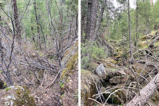
The wash was easy travel for a half mile. (I only had to duck one fallen tree.) But then I arrived at Miller Canyon’s rim. After I worked my way around a fairly decent pour, I was presented with the view above, on the left. I could see the canyon floor 150 ft. down. I knew if I started down, I was committed. I took about 10 minutes to pick out a route. 🤔
With the assistance of a fair amount of butt scootching, and Matrix vine dodging, I made it almost all the way down without disaster. (Getting up from taking a photo, I slipped on a mossy rock, bruising my left butt cheek.) Speaking of vines, there very well may be poisonous varieties in there, but all I got was slight itch on my wrist. Can you be immune to that stuff?
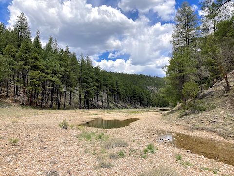
Once at the bottom of Miller Canyon, I took a look around. I was a quarter mile from my intended drop in point, but it looked like the spur to my left (west) might be an easier way down. At least the visible bottom fifty feet looked mellow. Who knows what it was like higher up?
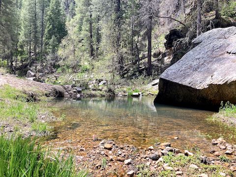
I started hiking north. Lower Miller Canyon was exactly what I expected, but with audibly flowing water, a couple of inches deep, and pools up two feet deep. I crossed the creek dozens of times, and was able to keep my feet dry for an hour, but eventually gave up. Ironically, I lost 30% of my pack water, so I was under-hydrating to conserve resources. (I don’t carry a filter.) I resorted to dipping my do-rag in the cool creek water to moderate my body temperature. 😅
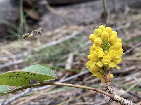
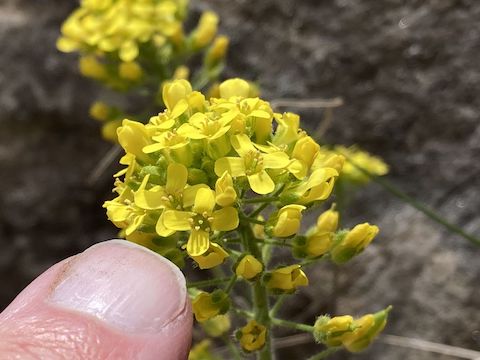
Flower coverage was light in lower Miller Canyon. (High country flowers seem to peak in August, late in the summer monsoon.) I spotted creeping barberry, alpine pennycress, dandelion, Canada violet, bog violet, rough whitlowgrass, some sort of strawberry (I believe Virginia), northern rockjasmine, ashen milkvetch, and spreadfruit goldenbanner.
1⅓ miles into lower Miller Canyon, there is a tight left bend in the canyon. A short saddle cuts across the bend. It would be a good place to avoid a flash flood — not that I saw signs of such. Just past that, on the east side of the canyon, is a possible bail point to FR 123. McCarty Draw is south at 3¼ miles. Just shy of 4 miles, a second bail point is on the south side of lower Miller Canyon.
I’d been walking for several miles with a pebble in my shoe. Around 1:20 p.m., I sat down on a shady, grassy, shelf to remove the pebble, air out my wet feet, and have a bit of lunch. 🥪
It was only another half mile to East Clear Creek. My worry C.C. Cragin Reservoir would be backed up to Miller Canyon was unfounded. East Clear Creek was wide and also gravelly. The Arizona Trail crossing is marked with a fiberglass post, but I missed it and had to double back. From there, it is a 250 ft. climb up to the S-gate, then a 1½ mile walk on FR 123A to the Arizona Trail. Follow the AZT and / or FR 123 back to where you started. My wife picked me up at the FR 123A “no motor vehicles” sign.
My wife picked me up at the FR 123A “no motor vehicles” sign. From there, we drove to the Battle of Big Dry Wash memorial on FR 123E, which was quite bumpy. (I bottomed out my SUV once.) She enjoyed that. The memorial that is. 😁
Directions: From Phoenix, head north on AZ-87, the Beeline Highway, through Payson, Pine and Strawberry. (Alternately, take I-17 north, then AZ-260 east.) 2.6 miles north of AZ-260, turn right onto Rim Rd. / FR 300, which is in the best shape I’ve seen it since the resurfacing in 2020. In 11.2 miles, turn left onto Battleground Rd. / FR 123, towards the Battle of Big Dry Wash. In 3.5 miles, turn left on FR 9724V. Park wherever.
GPS File: Lower_Miller_Canyon
Distance: 8.71 mi.
AEG: 405 ft.
Time: 3h 37m
Rumble Video
Vimeo Video
Hiking Lower Miller Canyon, Mogollon Rim from Preston McMurry on Vimeo.