

In preparation for my 10th, and final, Loop 202 South Mountain Freeway survey hike, I created a new route to follow. After downloading the route from HikeArizona.com — where I do all my route editing — I connected my Crappy Garmin 62S via USB to my Mac, then fired up Garmin BaseCamp. Like I said, I do all my route editing on HikeArizona.com, so all I use Garmin BaseCamp for is to copy routes to & from my Crappy Garmin 62S.
As you might detect from the fact I preface the GPS with the word “crappy”, I have had no end of problems with my Crappy Garmin 62S. Tonight was no different.
I’ve been using computers since the mid-80s, and was a developer before I retired, so you would think I’d know better than to update an application before some critical task, such as leaving for a hike, or going to sleep. You would also be wrong. Hope springs eternal. 🙏🏻
So when I opened Garmin BaseCamp, it prompted me to download version 4.8.7, which I foolishly did. It proceeded to crash my computer at least 10 times. And that was even after going through a whole raft of standard work-arounds, such as re-downloading Garmin BaseCamp. Let’s just refer to it as well, from now on, as “Crappy Garmin BaseCamp”. 🤬
Long story short, here’s a workaround to skip Crappy Garmin BaseCamp 4.8.7: 1) Connect GPS to computer via USB. 2) Drag .gpx file from computer to Garmin->GPX folder. (Not any of the GPX subfolders.) 3) Disconnect Garmin. 4) Start Garmin. Tracks & Waypoints will appear on unit. 5) Wait for new BaseCamp release. ⏱
/Rant
As to my actual Loop 202 South Mountain Freeway survey hike …
As I had on my ninth Loop 202 South Mountain Freeway survey hike, last April, I scheduled my visit for the first Saturday of December, as the first full weekend of the month is the only time San Juan Road is open to vehicular traffic.
From Bajada Trailhead, I followed National Trail 1.5 miles to the east end of Taylor-Morrison’s luxury development. I then went off trail up Main Ridge South. The grab & stabs were minimal, but is steep. I found a 10ft. deep unmarked test shaft along the way. ⚒️
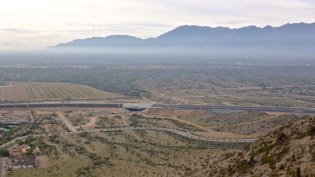
Travel along the top of Main Ridge South was easy, with a few small outcroppings easily avoided. When I first gained the crest of the ridge, I was a ½ mile northeast of the Loop 202 South Mountain Freeway’s big curve at the west end of Pecos Rd. It’s a stretch that spans Waypoint 1 through Waypoint 5. (The former being the old pump station at 3303 Pecos Rd., which disappeared sometime after my seventh Loop 202 South Mountain Freeway survey hike in April, 2018; the latter being near the petroglyph site.)
I briefly considered heading straight over the side of Main Ridge South, but its south side looked much steeper. So, I headed west for a ½ mile, as it gradually descended, before hopping onto Shaughnessey Ave.
At Waypoint 1, right on the edge of the non-eminent domained existing Pecos Rd. community, I noticed that there was a very tall, dark, sound barrier. I had seen the pale ribs from up on Main Ridge South, but could not distinguish the wall from the paved Loop 202 South Mountain Freeway surface. 🔭
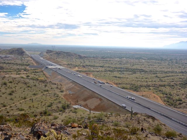
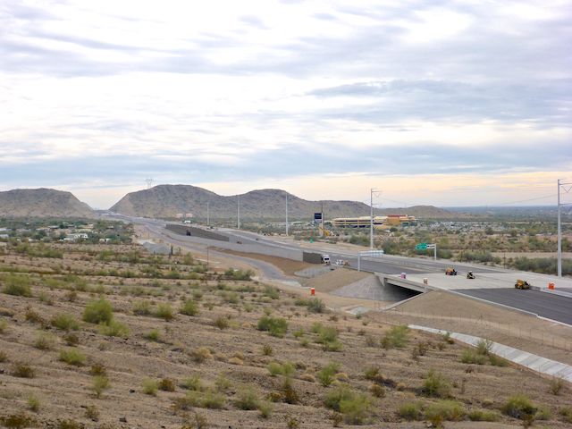
The Center Segment, which is what I survey, has been fully paved. The Taylor-Morrison luxury development also has a sound wall, but it is pale. The entire length of the segment has barriers between the north- and south-bound lanes. Pavement markings and light poles have yet to be added anywhere along the segment. There were a few white-on-green exit signs — e.g. “Vee Quiva Way ↗” — but I’m not sure if that is all the ones the segment will have.
All the bridges, multi-use crossings and culverts have been installed. Only one culvert still had its wooden concrete forms. I could have safely travelled under any of the five multi-use crossings to the narrow strip of public land between the west side of the Loop 202 South Mountain Freeway and the Gila River Indian Community, but workers were still doing finishing work on the crossings. The only underpass currently in legal civilian use is the access road to the Dusty Lane community.
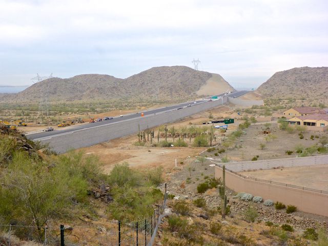
After checking out Waypoints 1-5, I headed up 35th Avenue to the luxury development’s gate, climbed up 50 ft. to the barbwire fence which borders the right-of-way on Main Ridge South, then followed the fence line down the north slope of the ridge. Crossing the ¾ mile wide valley to Main Ridge North, I took care to trespass on neither freeway nor luxury development property. (Some of which people have now moved into.) 💰
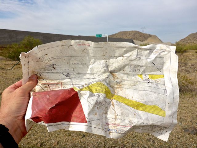
The rock crushing plant at Waypoint 9 is gone, but the sign remains, letting all & sundry know that its permit is good until 2022. Though there are still plenty of junk piles scattered about the west end of South Mountain Park: Today’s neatest find was a terrain engineering schematic that wind had blown out of the construction zone.
I briefly to diverted off the right-of-way to check out the Graffiti Ranch. It had some really nice graffiti pieces, when I first started my Loop 202 South Mountain Freeway survey hikes, but it has been whitewashed the last several years. There’s still enough structure left that it made a shady spot for lunch. (It was otherwise overcast the rest of the day.)
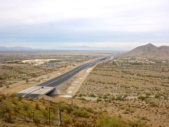
After lunch, I hiked past the dragged gravel spot that used to be Rock Wall Ranch, then began the steep fenceline-following ascent to the top of Main Ridge North. The fence at the top has been moved out from the right-of-way, so I couldn’t get a close look at Waypoint #15, where I used to enjoy my hiking beer, but there were still great views southeast to Main Ridge South, and northwest past Vee Quiva Casino and Dusty Lane, towards the tip of Alta Ridge at 51st Ave. 🎰
Rather than walk through the Dusty Lane community, I followed the South Mountain Park fenceline to the Maricopa Trail on the south slope of Alta Ridge. The Maricopa Trail is a 315-mile loop around the Phoenix metropolitan area, but I was only on it for a ½ mile, as I headed west towards Waypoint 25.5, the location of the last Dusty Lane home condemned to make way for the Loop 202 South Mountain Freeway.
The survey portion of my Loop 202 South Mountain Freeway hike complete, I continued 2.0 miles clockwise around Alta Ridge on some really nice, recently-constructed, trail to the San Juan Trailhead, where I hooked back up with National Trail for the final 1.5 miles to my SUV at Bajada Trailhead.
As I mentioned earlier, this was my last of ten semiannual survey hikes. I hope you enjoyed following the changes to the west end of South Mountain Park, if not necessarily the changes themselves. Hopefully, when the Center Segment opens for business in another month or so, the congestion relief on I-10 through Tempe will have been worth it.
GPS File: Loop_202_South_Mountain_Freeway_20191207
Distance: 11.25 mi.
AEG: 1,577 ft.
Time: 4h 33m
Hike Video
Loop 202 Survey Hike #10 (12/7/19) from Preston McMurry on Vimeo.