

Heading east from Dewey, this is the 1st segment of General Crook Trail.
I have ongoing projects day hiking / biking the Chesapeake & Ohio Canal, Black Canyon Trail and Maricopa Trail. Of course, that is not keeping me busy enough, so I figured I would add the General Crook Trail to my plate. 😆
Who was General George Crook, and what’s the deal with his trail?
In 1871, General George Crook surveyed a supply road west from Fort Apache, Arizona, across the Mogollon Rim to Camp Verde, then on to Fort Whipple in Prescott. The General Crook Road was built in 1872. The Army used the road until 1896, and civilians until 1928, when Rim Road replaced it.
The Forest Service divides the General Crook Trail up into three numbered trails: General Crook Trail #64 from Old Cherry Road (P21) to Camp Verde (P0), General Crook Trail #130 from Camp Verde (V0) to Rim Top Trailhead at AZ-260 (V62), and General Crook Trail #140 from Al Fulton Visitor’s Center (V63) to Cottonwood Wash (V114). I’ll spare you the math: That makes the General Crook Trail 135 miles long. Not sure why the Forest Service designated three trail numbers.
P markers represent miles west of Camp Verde; V markers represent miles east of Camp Verde. That system dates back to the 1870s. As I learned in the Army, there’s a right way, there’s a wrong way, and there’s the Army way. 😉
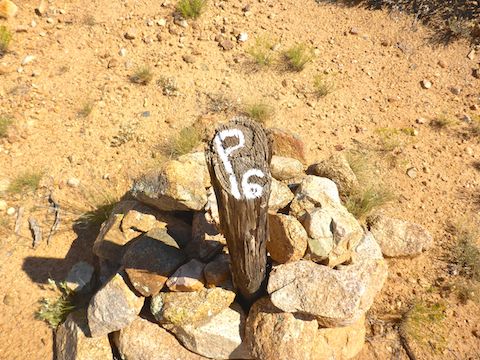
All markers are approximate as the original Army markings were etched on now-faded rocks and fallen trees. Any remaining markers are likely from a mid-1970s Boy Scout project.
Today, I hiked General Crook Trail #64 from Old Cherry Rd. to AZ-169 at CF Canyon (P12).
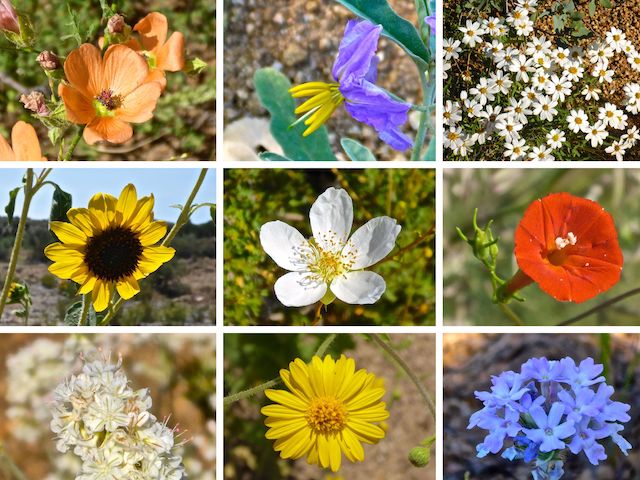
Top Row: Rusby’s globemallow, silverleaf nightshade, blackfoot daisy.
Middle Row: common sunflower, Stansbury’s cliffrose, Trans-Pecos morning glory.
Bottom Row: some kind of buckwheat, ???, southwestern mock vervain.
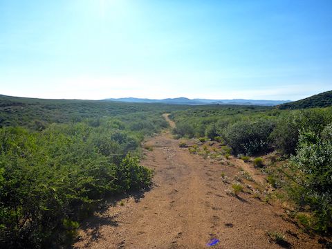
I started hiking out the back of the Old Cherry Rd. pullout, in a small wash. Really, more of a break in the very dense brush. In ⅓ mile, the trail crosses Old Cherry Rd. But the trail on the other side is blocked by a barbed wire fence. Seeing no gate, I walked down the road 100 yds. to a cattle guard, turned right along the fenceline for 100 yds., then picked up the trail again. 🙄
In ¼ mile, the trail dumps back onto Old Cherry Rd., which I followed for ¾ mile on the right-of-way, through a cluster of small ranches. Just on the east side of the ranches, after 1⅓ total miles, was the signed start of General Crook Trail #64. My recommendation is start here.
The next ⅔ mile down to the old stage stop on Ash Creek was the highlight of the day. The creek had 1-2″ of trickling water, there was a large stone corral, a foundation with a scattering of period nails, and some truly massive trees. Hiking to the stage stop would be a fun short hike for oldsters and families with small children.
General Crook Trail #64 turns east along the north side of the stone corral, again crosses Ash Creek, ascends a small hill, then bends south. It starts out as foot trail, gradually transitioning into jeep trail by the time it reaches the old wood & wire corral at AZ-169 after 3⅓ total miles.
While taking photos, I noticed some fire ants milling around, but I figured three feet distance was enough. It wasn’t. One stung me on my neck. I could feel numbness for the next hour. Sprinting across heavily trafficked AZ-169 was preferable to the brush-choked tunnel. 🐜
I walked down FR 9604K for ½ mile. Before reaching SanDam Ranch, General Crook Trail #64 splits left, as foot trail. Vegetation gradually decreases as the trail heads east from FR 9604K. Shade is basically non-existent. There is erosion in the trail surface, but it is otherwise mostly obstacle free. However, it does disappear in some areas that have cheatgrass or even riparian vegetation. Other than a yellowjacket-infested puddle in Racetrack Wash, I never saw water after Ash Creek.
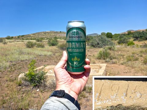
A little over halfway into my hike, at 5.0 miles, General Crook Trail #64 crosses a quality dirt road at Hackberry Wash. There is a foundation and a spring box painted “John 3:16-17”. This would make a good turn around point from either direction, but my always helpful wife was shuttle driving, so I continued.
At 6.0 miles, General Crook Trail #64 apparently has a junction with Black Canyon Trail. It has a fiberglass post marked to that effect, but my information is that the BCT runs from Orme Rd. to FR 9604F. Puzzling. 🤔
After crossing Sour Water Wash, General Crook Trail #64 turns into jeep trail for ¼ mile to the Gray Wolf Regional Landfill fence. On a small hill to the left is a solar array. The landfill is off limits, so I turned right, finding a “T64” marker a few yards later. I followed that catclaw-riddled foot trail down to Racetrack Wash.
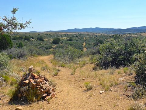
From the 1915 spring box, I followed the landfill fence east for an easy, but trailless, ⅔ mile. I turned north when the fence did, continuing along the fenceline. After ⅓ mile across a small playa, I turned east, resuming General Crook Trail #64. There were cairns, and trail tape, and they didn’t always agree. It was a trudge across Johnson Wash to the CF Canyon trailhead.
Dewey TH Directions: From I-17, take exit 278 west, onto AZ-169. In 1½ miles, just before the cut, between MP 14 and MP 13, pass by the CF Canyon Trailhead on the left. Continue west. In 10.3 miles from I-17, in the midst of a scattered ranch community, turn right onto dirt Old Cherry Rd. In one mile, just past Peacemaker Dr. park in the small pullout on the left.
CF Canyon TH Directions: Either double back from the Dewey TH or, from I-17, turn left (south) between MP 14 and MP 13, onto FR 9604F. (See above.) Park wherever.
GPS File: General_Crook_Trail_P21_P12
Distance: 11.56 mi.
AEG: 623 ft.
Time: 4h 39m
Hike Video
Hiking General Crook Trail: P21-P12 from Preston McMurry on Vimeo.