
")
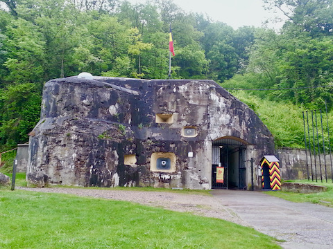
This was our second trip to Fort Eben-Emael, our previous one being when I visited my then girlfriend, now wife, when she still lived in the Netherands, back in 2001. This time, I figured we could hit this on our way back from Brussels to Amsterdam. For a lot of this stuff, if you are interested in history, particularly military history, and are in Europe, and want to see something outside the usual, I could then post a hike description. Thus this stop. And by good fortune, it happened to be the one weekend a month the inner fort was open for tours.
I did not have time to climb up on top of the fort, and wander around the woods and turrets up there, so I settled for a perimeter hike. It was yet another in a seemingly endless series of cold, windy, rainy days. In late May? What the hell!? 🤨
You can read about the perimeter hike in the description, and the photos, so I will describe the subterranean tour portions of my hike. (My wife, despite her bad feet, was game for doing the inside.)
While I actually saw an old hole-in-the-floor latrine, the ones for tourists are just past the ticket booth, in converted officer barracks.
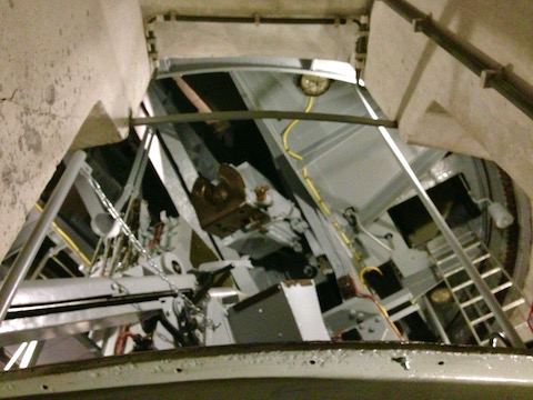
The tour starts at the museum / snack bar. The museum has what you would expect: weapons, medals, shells, uniforms, etc. You can go unaccompanied through the admin areas, which include barracks, power station, chapel, hospital, brig, morgue, some restored gun positions, and a number of timelines in French, Dutch and German. (Sorry, not English; if you get a tour, check to make sure your guide can at least pidgin with you.) Getting deeper into the subterrean fort requires accompaniment by a guide, both for educational purpose, and also because it is potentially dangeous due to getting lost, climbing steep stairs / ladders, and of course banging your head on heavy metallic objects. (Yes, Pam, I did.) 😁
You could have a hell of a game of real-life Dungeons & Dragons in there.
One thing that came up, which I did not mention elsewhere, is fire control. I asked our guide, how they coordinated fire from the different batteries, to lay down maximum coverage in whatever German-occupied grid square they might care to neutralize. His answer was, they didn’t. Instead, each battery was assigned as direct fire support to a division, and only the division commander could order the battery to fire, and then only at his targets. So, even if the Germans had not neutralized the fort, the Belgian general staff had effectively neutralized Fort Eben-Emael through poor tactics. Privates win wars; generals lose them.
GPS File: Fort_Eben_Emael_Hiking_Loop
Distance: 5.30 mi.
AEG: 550 ft.
Time: 1h 45m
Hiking Video
Fort Eben-Emael, Belgium from Preston McMurry on Vimeo.