

Met up with Paul (Prescottstyle) at Bistro St. Michael’s on the northwest corner of Courthouse Square at 0730. I had coffee and a yogurt parfait. (Now that you are impressed with my healthy eating, know that I ate a spicy sausage roll and a donut on the drive up.) Apparently, Prescott has a bum problem, as you need a token from one of the building’s businesses to access the toilet. 🧟♂️
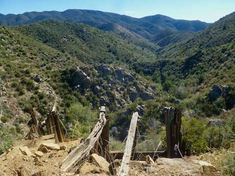
We actually hit the Glen Oaks trailhead at about 0830. We hiked down to the Alliance Mining claim, then along the US 89 shoulder, to FR 710 — the road down to the Climax Mine. Paul knows many local prospector’s, mine claimants, and several other local residents, and also a lot about minerals. Unfortunately, I did not retain all the interesting info — other than which claim Alliance Mining owns, and which hole in the ground is the Catoctin Mine.
Just before the Catoctin Mine, we turned up the wash I had skipped last week on my way to & from Climax Mine. Since then, I had carefully perused MapDex satellite view, identifying an obvious trail through the “grab & stabs” (as I now call the abundant manzanita, cat claw, and various other prickly vegetation). The best that can be said about the route is that it appeared obvious. 🤷🏻♂️
It was not, and neither was it un-stabby. We’d stop & start, go one way, find it blocked off by grab & stabs, try another way, find it blocked, give up and beat bush, repeat many times. By the time we reached the bottom of Board Creek, my shins were bleeding through my pants. (Granted, not heavily, but still …)
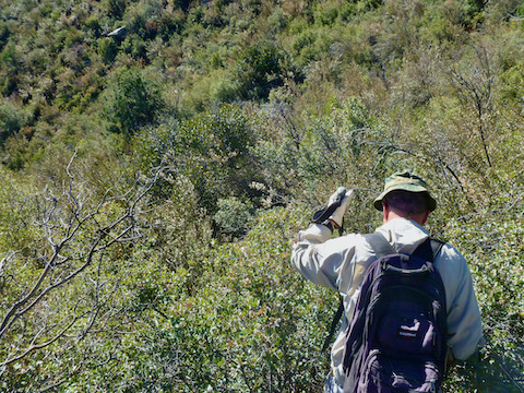
Travelling up the Board Creek — towards some claims/mines I wanted to check out — was slow, but not nearly as painful. Some places we cruised, others we had to dodge grab & stabs, and others required climbing small boulders. No big deal. Eventually we reached a mine I had targetted — and which we were able to spot from the one open spot on the spur we’d previously descended. Paul had hiked this area many times, and passed by on the jeep trail mere yards away, but never had noticed the mine. It did not look safe to explore, so after I took some photos, we headed back towards our Glen Oaks trailhead.
After the hike, I drove north a few miles to East Copper Trail #260, dropping Paul off for a hike up Mt. Francis, where he planned to meet his family for a post-hike hike. 💪
Distance: 5.64 mi.
AEG: 1,447 ft.
Time: 2h 42m