

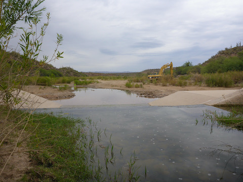
The annual Nature Conservancy San Pedro River watershed wet / dry mapping is coming up Saturday 6/21, so I figured I would go down there and see how my normal segment is fairing. Last year it was, for the most part, dry below Crazy Emily’s place. Though not yet survey weekend — scheduled for June as the TNC wants to do it at the hottest, driest part of the year (worst case scenario) — the water levels were looking really good.
A normal 2-4″ in most places, getting up to knee level in others, with the expected pool areas deeper. Where last year below the major invasive species dam was moist for a few yards, then bone dry, this year it was up to mid-thigh. Serious Mekong Delta stuff. (Complete with muddy, brown, water.) So, we’ll see how it is next month.
Other notes: Don’t recall seeing this before, but the pizza place in Kearny has a photo of Sirena up on the AZT banner, right below all the signed pizza boxes. It’s a neat place, and the people who run it are really nice, so stop by if you are in the area. It’s in the strip mall along AZ-77.
Saw blue herons by Aravaipa Farms, and again by the larger invasive species barrier.
A black bear momma, and her two cubs, have been spotted in the area. Several properties have had bear damage / looting, with Aravaipa Farms losing most of their chickens. I slept really poorly while I was down there, so hoped loitering in the dark would result in a bear pic or two; no such luck.
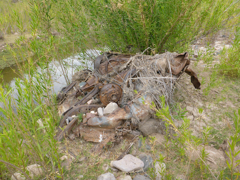
Found two auto wrecks in the creek bed I had not noticed before. Both had been there many years, as evidenced by the brush and mud atop them.
Finished off the day with a brat fry and New Belgium Snapshot Wheat hiking beer.
Distance: 4.00 miles
AEG: 134 ft.
Time: *shrug*
Hike Video
Aravaipa Creek: Pre-Wet / Dry Survey Hike from Preston McMurry on Vimeo.