My wife and I were driving east on AZ-260, about where it becomes undivided, a couple of miles before topping the Mogollon Rim. I reach for my left breast pocket, to turn on my GPS, so it would be warmed up and fully functional by the time we arrived at Forest Lakes for my hike to Canyon Point. My pocket was empty. Pat my right breast pocket also empty. Frantically pat both. Nada. Swearing ensues. 🤬
Rapidly mentally flip through my options: Two hours back to Phoenix, pick up GPS, return to Mogollon Rim? Way too much driving. Just bail home? I need exercise, and I’m not wasting a day like I did the last time I forgot my GPS only six weeks ago. I hope brain rot isn’t setting in. (I’m 64.) What else can I do?
I quickly decided to hike General Crook Trail #140 from Rim Top Trailhead to Woods Canyon Rd., Meadow Trail #505 to Woods Canyon Lake, then the unnumbered trail around Woods Canyon Lake, finishing up by sharing ice cream at the bait shop with my wife. Without a GPS to record a track, I know the trails, so I could later hand draw an accurate GPS route, for posting (below) to this blog.
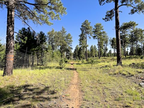
From Rim Top Trailhead to Woods Canyon Rd., smooth dirt General Crook Trail #140 is 3.1 mi., 100 ft. AEG (accumulated elevation gain). Out & back, it is 6.2 mi. — twice the distance, obviously — and still only 135 ft. AEG. If you are feeling highly motivated, General Crook Trail continues 89 more miles, west to Old Cherry Rd., near Dewey-Humboldt. I turned north on Meadow Trail #505.
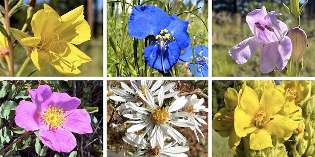
Top Row: yellow evening primrose, western dayflower, wandbloom penstemon.
Bottom Row: Wood’s rose, white prairie aster, mullein.
All-paved Meadow Trail #505 runs 1.6 mi., 70 ft. AEG, from Rim Road at Woods Canyon Vista, to the Woods Canyon Lake bait shop. I hiked — well walked — it for 1.0 mi. to Spillway Campground Rd., where I turned right. (Continue straight to the bait shop.) The many campgrounds along Meadow Trail #505 are the main source of what foot traffic you may see on it.
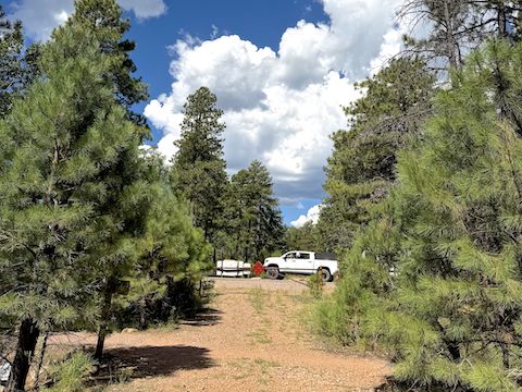
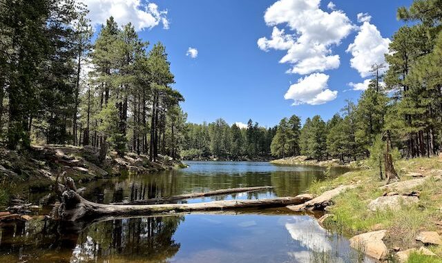
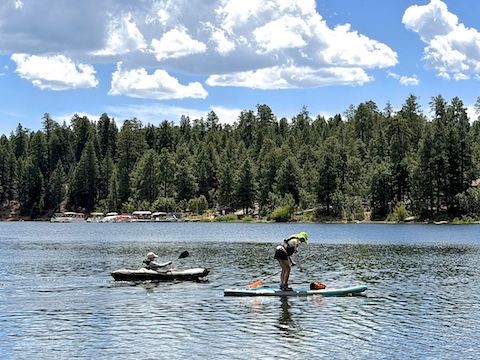
I walked down Spillway Campground Rd., 0.3 mi. to the campground, where day-use parking is currently $10. (Bait shop parking is free.) I could see rain north of Woods Canyon Lake, but some blue sky to the west. (See video thumbnail, below.) I decided to risk hiking around the lake. A full loop of Woods Canyon Lake is 3.6 mi., 315 ft. AEG. Sure seemed longer today.
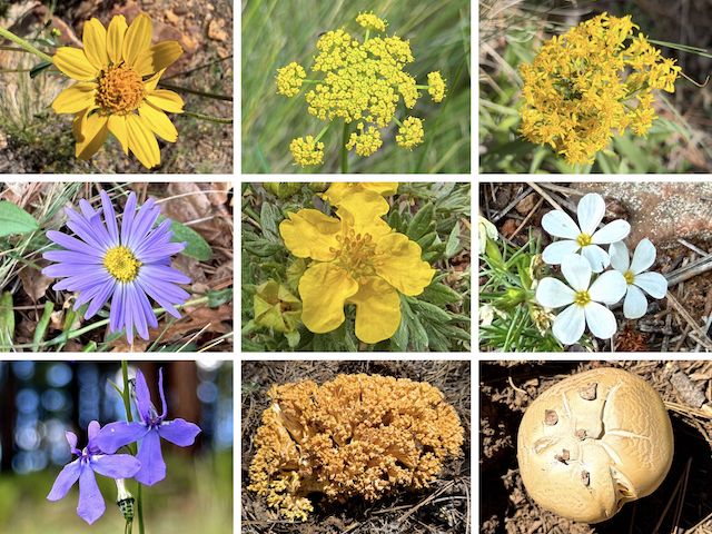
Top Row: ragleaf bahia, alpine false springparsley, velvety goldenrod.
Middle Row: alpine leafybract aster, woolly cinquefoil, Nuttall’s linanthus.
Bottom Row: Apache lobelia, and two mushrooms which I have no clue about.
After crossing the spillway / dam, and hiking up the east side of Woods Canyon Lake, it was somewhere around the first inlet that I saw a red octagon stop sign, promising dire consequences to he who trespassed the bald eagles nesting nearby. Odd. I thought the nesting area was at the west end of the lake, near Rocky Point Trailhead?
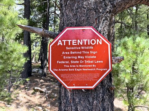
Lacking a GPS, I guesstimate three quarter miles of the “old” Woods Canyon Lake trail was behind the bald eagle nesting zone. If that trail were currently legal, it would cut across the north end of several inlets, saving a bit of hiking distance. Being a good boy, and preferring to avoid Federal Pound Me In The Ass Prison (“Office Space“), I instead followed a lake side trail. There were a bunch more stop signs.
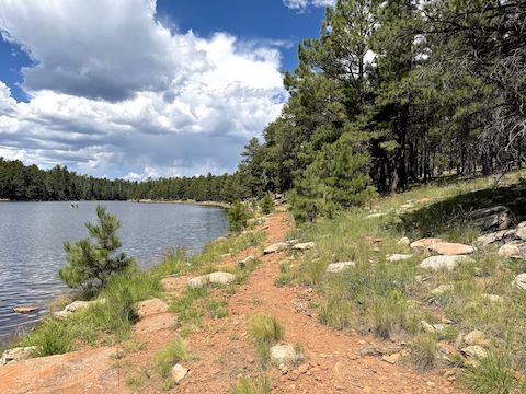
About six miles into my hike, the lakeside trail disappeared. I climbed up a bit to the old trail. There were no stop signs, and there were blue diamond trail blazes. I guess I was past the nesting area. The third inlet was a bit marshy, but I crossed dry. Taking a lunch break, I enjoyed a room temp 7-11 “Philly” cheesesteak. Woods Canyon Creek, the fourth inlet, was wider; it took me longer to find a crossing.
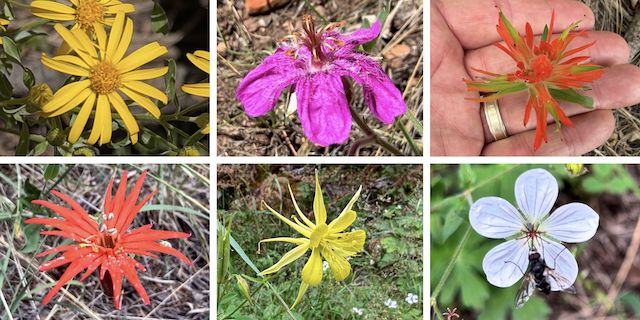
Top Row: hairy golden aster, pineywoods geranium, paintbrush.
Bottom Row: Mexican silene, yellow columbine, Richardson’s geranium (blurred by 💩y iPhone 17 Pro).
Besides the 21 flower species shown above, I also spotted at least one other species of mushroom, red and yellow pea, American vetch, Geyer’s onion, western yarrow, spreading fleabane, dandelion, yellow coneflower, silver lupine, and aromatic false pennyroyal. (The latter three also blurred by my useless iPhone 17 Pro.) Thirty-two species in all. August really is peak season for high country flowers! 🤗
Rim Top Trailhead Directions: From Phoenix, head north on AZ-87, the Beeline Highway, into Payson. Turn right on AZ-260. In 29 miles, after cresting the Mogollon Rim, take the first left onto Rim Rd. / FR 300. Immediately turn right into Rim Top Trailhead.
Woods Canyon Lake Directions: Continue down Rim Rd. / FR 300. In 3.0 miles, turn right onto Woods Canyon Rd., following it to the end at the bait shop.
GPS File: General_ Crook_Trail_Woods_Canyon_Lake
Distance: 8.26 miles
AEG: 395 ft.
Time: 3h 00m
Rumble Video
Vimeo Video
Hiking General Crook Trail #140 & Woods Canyon Lake from Preston McMurry on Vimeo.
