

Jamie Stott was a young man from back East, whose wealthy family was friends with Massachusetts Governor Thomas Talbot. Craving adventure, by October, 1885, Stott was in northern Arizona, trying to establish a small cattle operation. The Pleasant Valley War was a year old.
Though neutral in the Pleasant Valley War, Stott became friendly with cowboys from the dominant Aztec Cattle Company, aka the Hashknife Outfit, allies of the Graham family, who were a feuding with the sheepherding Tewksbury family. A feud which would see a lone survivor, Ed Tewksbury. Not Jamie Stott.
On August 11, 1888, a posse led by Apache County deputy, and Tewksbury ally, J.D. Houck showed up at Stott’s cabin. After Stott served the posse breakfast, he and his ranch hands, James Scott and Billy Wilson, were arrested for “rustling”. A third hand, Motte Clymer, was left behind because he had TB. Why a rich kid being funded by his father would need to rustle has never been explained. Houck claimed he had a warrant, but “forgot it in my coat”. (The alleged warrant has never been found.)
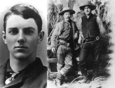
On the way to jail in Holbrook, Houck claimed his posse was waylaid by a “gang of 30”, who took custody of the Stott party, and told the posse to move on. Convenient. Scott and Wilson were hanged first. There was evidence Stott was pulled up, then let down, several times, before he was finally killed. Clymer testified Stott addressed the posse by name, but none were ever convicted. Houck suicided in 1921.
There are two memorial sites for Stott, Scott & Wilson: The first, for all three, is in Hangmans Draw. The second, only for Jamie Stott, is in Stott Canyon. I believe the difference is due to Jamie Stott being hanged separately, and that Stott Canyon is where he was lynched, and buried, whereas Scott & Wilson were buried where they were lynched in Hangmans Draw. Things get mixed up after 140 years.
Hangmans Draw and Stott Canyon are parallel terrain features, on either side of the FR 86 ridge, between Rim Road / FR 300 and Black Canyon Lake. From Rim Road, in & out to the Stott, Scott & Wilson cemetery is 1.0 miles, 215 ft. AEG (accumulated elevation gain); from Hangmans Trailhead, in & out to the cemetery is 2.1 miles, 155 ft. AEG. From FR 86, in & out to Jamie Stott’s grave is 1.8 miles, 140 ft. AEG.
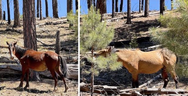
Black Canyon Lake has a pit toilet, so I parked there, rather than Hangmans Trailhead, which is only a dirt turn-around. Black Canyon Lake was way low. So low, Apache-Sitgreaves National Forest installed a couple of Jersey barriers across the boat ramp while I was hiking. Wild horses were enjoying exposed lake bottom vegetation. One foal was so young, I could see a difference in his mobility from A.M. to P.M.
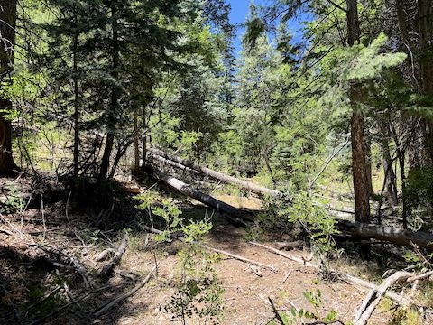
From Black Canyon Lake, I hiked back up FR 86B, then FR 86, past the bottom of Gentry Canyon and Hangmans Trailhead. At 1.6 miles, I split right on an unnumbered jeep trail, into relatively shallow Stott Canyon. Bone dry Stott Tank was 100 yards south of the jeep trail ⅓ mile off FR 86. At 2.1 miles, trailside, there is a small pile of stones that is ostensibly Jamie Stott’s grave, but isn’t.
At 2.2 miles, 50 ft. north of the Stott Canyon jeep trail, is a more grave-like pile of stones, with what looks like remains of a cross, that belongs to an unkown sheepherder. The often dusty jeep trail ends at dry Wilson Tank, at the 2.3 mile mark. From Wilson Tank, it is 250 easy cross-country yards southwest to Jamie Stott’s actual grave.
![Jamie Stott's actual grave in Stott Canyon. The wood cross reads "Jamie Stott ... Aug. 11, 1888 ... Born Sep. 13, 1863 ♡" and it looks like "[1.SS]".](http://prestonm.com/wp-content/uploads/2026/07/IMG_7785.jpg)
After a snack break, I walked southeast on Rim Road / FR 300 to its junction with FR 86. There wasn’t much traffic on the road, but instead of staying on it, I moseyed through the Black Canyon Rim Campground, which has potable water, his & her pit toilets, and 20 camp spots. There were only 3-4 campers getting jump on Independence Day. I imagine Woods Canyon Lake was already packed.
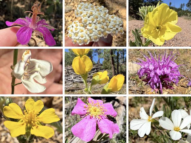
Top Row: pineywoods geranium, western yarrow, yellow evening primrose.
Middle Row: wandbloom penstemon, mountain goldenbanner, wild bergamot.
Bottom Row: woolly cinquefoil, Wood’s rose, Nuttall’s linanthus.
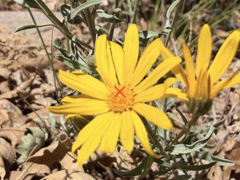
I also spotted scarlet penstemon, banana yucca, spreading fleabane, zion false goldenaster (the blurry flower further up), red & yellow pea, alpine false springparsley, Wheeler’s thistle, and field bindweed. I often held the flowers, so my iPhone 17 Pro would focus on the near background (my hand) rather than some weed or pebble two feet away. Hoping for center frame focus appears to be a bridge too far. 🫤
Hangmans Trail #500 started at the 4.9 mile mark. The initial quarter mile of the decommissioned jeep trail was steep, and very rocky. I wished I had my hiking poles. At the 5.3 mile mark, there is a jeep trail on the right with a “Stott, Scott & Wilson ↑ Gravesite .1” sign. Left to right, the gravestones are for Scott, Stott and Wilson. Each has a small marker, with initial of his last name, at the foot of his grave.
After paying my respects to Jamie Stott, James Scott and Billy Wilson, I continued down much improved Hangmans Trail #500 to Hangmans Trailhead (6.5 mile mark), then FR 86, and FR 86B back to Black Canyon Lake (7.8 mile mark). I finished 90 minutes late, so on the way home, my wife & I stopped for dinner at the Culver’s in Payson. But mostly for the custard. Mint Oreo. 🤤
Black Canyon Lake Directions: From Phoenix, head north on AZ-87, the Beeline Highway, into Payson. Turn right on AZ-260. In 38 miles, just past AZ-260 mile marker 291, turn right onto dirt Rim Road / FR 300. Notice the Rim Road mile markers every mile. In 2.5 miles, turn left on FR 86. In 1.8 miles, Hangmans Trailhead is on the right. Park there, or continue for a little over a mile, turning left on FR 86B to the Black Canyon Lake parking lot.
GPS File: Stott_Canyon_Hangmans_Draw
Distance: 10.35 mi.
AEG: 824 ft.
Time: 4h 05m
Rumble Video
Vimeo Video
Hiking Stott Canyon & Hangmans Draw, Mogollon Rim from Preston McMurry on Vimeo.