
: Rest bench at the intersection of Quartz Trail and Slate Trail. Today was our 19th Proposal Anniversary.")
Normally, on Christmas Eve, I hike Shaw Butte to visit it’s palo verde Christmas Tree. It’s a good work out hike. But not worth a new hiking video. Meanwhile, my lower elevation winter hiking program ran into a snag the last few weeks due to house issues. I’ve been doing bicycle rides, so I wasn’t physically lazy. But making videos keeps me mentally busy, so I needed to do a video-worthy locals hike.
I chose Cave Creek Regional Park (CCRP), which I hadn’t hiked in since Chinese Lung AIDs in April, 2020. Every other visit, I parked at the visitor center on the south side of CCRP, on 32nd St. Today, I hiked in from the east, parking at the Slate Trailhead, off Cave Creek Rd. My plan was to hike a “lasso” of Slate Trail to Cave Creek, Military Trail, Flat Rock Trail, Quartz Trail, then back on Slate Trail.
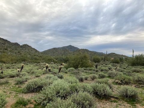
Slate Trail drops 100 ft. in the first 200 yds, a 15% slope, then levels off to a more moderate 5%. After a quarter mile, Slate Trail emerges from between two hills, into the P.A. Seitts Preserve. On the left, a number of new luxury villas are being built. At 0.6 miles Slate Trail becomes road-like, and turns north. Horse properties to the left. At 0.9 miles, the “road” splits. Go left. (Right is to the Old West cemetery.)
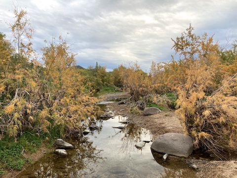
Slate Trail then crosses very lush Cave Creek. Lots of golden mesquite and green grass. The flood plain is about 300 yds. wide, but Cave Creek itself was maybe 10 ft. across. Other than laying down for photos, I was able to stay dry. The “stem” of my hike’s lasso ended at an unsigned trail split on the west side of Cave Creek: Left to stay on Slate Trail (the way I would return), right onto Military Trail.
Military Trail is named after the Stoneman Military Trail, which joined Fort Whipple, in Prescott, to Fort McDowell, from 1870-1890. There’s still bits of old corrals, and other ephemera, along the road.
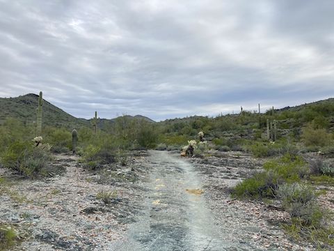
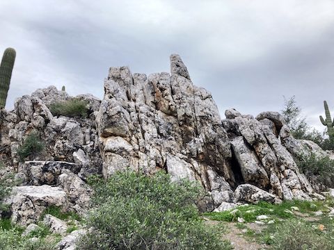
Military Trail heads north, along the west bank of Cave Creek. The most mature, elaborate, saguaro are in this area. In a half mile, the trail splits. Go left. Military Trail heads up Go John Canyon, climbing a moderate 140 ft. at 4% slope. The small hill, just ahead on the right, with a few houses, is Go John Mountain. Military Trail ends after 1.1 mi. — 2.2 mi. into my hike — at Flat Rock Trail.
Flat Rock Trail had the first rest bench I recall, at the Military Trail intersection. I think because Military Trail is still technically in P.A. Seitts Preserve, whereas Flat Rock Trail, and Quartz Trail, are in Cave Creek Regional Park. CCRP benches are either fiberglass “boards” with a backrest, or flat pebbled stone. Both kind have a memorial plaque (see above).
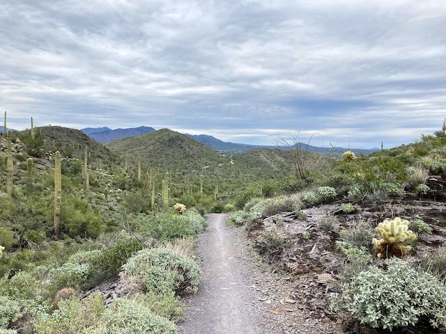
Flat Rock Trail rises 160 ft. at 6% slope. It’s smooth, zippy, flow if you are mountain biking the opposite direction. Flat Rock Trail reminded me of the Beany Baby trail, outside Prescott. Hiking uphill, I barely noticed the climb. Flat Rock Trail ends after a half mile, at Quartz Trail. Which has another bench. 🙄
Quartz Trail is 1.4 mi. long, but I only hiked about half that distance. Quartz Trail drops 190 ft., at 4.8% slope, to Slate Trail, at the 3.5 mi. mark. As you hike south, there is a wash to your right. Quartz Trail crosses the wash at a lush spot just before Slate Trail. Among today’s various trails, Quartz Trail was the only Cave Creek Regional Park segment I had actually put feet on before. (Several times.)
Slate Trail heads south, crossing the same wash in 100 yds. Flume Trail follows the wash south; Slate Trail turns east, rising almost imperceptibly. After crossing a saddle, Slate Trail descends 150 ft. in 0.7 sometimes rocky miles, a 4% slope, back to Military Trail, closing the loop part of the lasso at 4.7 miles. I saw several mountain bikes on this segment. I did not see anyone else all day. 🎄
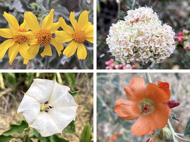
Back at Cave Creek, I took a twitter break in today’s only shade. Not that there was any sun: The clouds never broke. Never rained either, so I count that as a win. I found several flowers next to Cave Creek that had not been there earlier — due to the slightly cooler early temps — including desert globemallow and the day’s only datura. (In Spring, CCRP is considered one of Phoenix’s top flower destinations.)
Starting at 8:05 a.m., I was back at Slate Trailhead in only three hours — one less than planned — and home at Noon, on the dot! Sweet. Time to get to work on the video! 👇
Directions: From the Loop 101 / Pima Freeway in north Phoenix, take exit 28 north, onto Cave Creek Rd. In 11.3 miles, turn left on Surrey Dr. There is legal trail parking on the right, or drive ¼ mile uphill to the Slate Trailhead.
GPS File: CCRP_Slate_Military_Flat_Rock_Quartz_Trails
Distance: 6.29 mi.
AEG: 645 ft.
Time: 2h 14m
Rumble Video
Vimeo Video
Hiking Cave Creek Regional Park (CCRP) from Preston McMurry on Vimeo.