

McClintock Draw is a small canyon on the Mogollon Rim, between McClintock Ridge and Dane Ridge. McClintock Draw extends for only 2¾ miles, before emptying into Dane Canyon. (Which in turn feeds Barbershop Canyon, East Clear Creek, Little Colorado River, Colorado River and, finally, the Gulf of California.) I planned to hike down McClintock Draw, climb out, then loop back on FR 9616B & FR 321C.
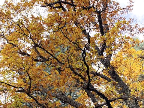
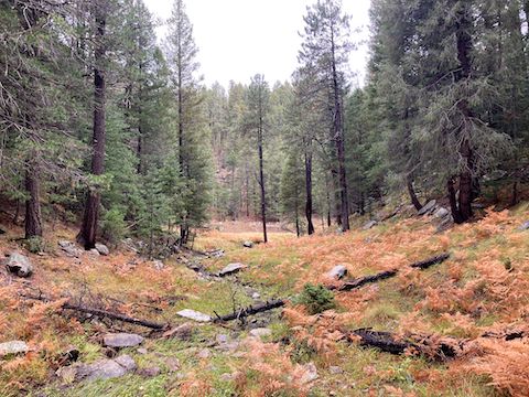
Like most Mogollon Rim canyons, McClintock Draw starts out shallow and fairly wide. Unlike most of its neighbors, the head of McClintock Draw has a fair amount of deadfall. Not large; easily avoided. Also on the ground were many brown leaves. There was still some color above, but not much. The best remaining color was actually up on Rim Road, at the head of Barbershop Canyon and East Bear Canyon.
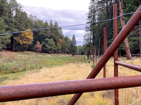
After ⅓ mile in McClintock Draw, I picked up FR 9737R. As evidenced by being covered by grass, and its own occasional deadfall, FR 9737R is decommissioned. (No motor vehicles allowed.) FR 9737R is a mile long, ending at FR 321C. About 200 yds. after joining FR 9737R, it enters a narrow wetland prairie, travelling up its west side. The prairie has three non-contiguous (now semi-) fenced enclosures.
The distance I hiked today is about a mile more than the entire McClintock Draw loop’s distance. Besides measuring the wetlands enclosures, I backtrack, meander, etc. After 1¼ miles non-meandering distance, FR 9737R ends at FR 321C, at the north end of the third wetlands enclosure. If you loop back on FR 321C to your trailhead on FR 218C, it would be a 3.1 mile, 330 ft. AEG hike.
Other than few bedraggled fleabane, I found no flowers above FR 321C. Despite the rain, no fungi either. (Like clockwork, it drizzled for fifteen minutes every hour of my hike.) Below FR 321C, where the canyon crawling occurs, I identified alpine leafybract aster (Symphyotrichum foliaceum), alpine false spring parsley (Cymopterus lemmonii), Canada violet (Viola canadensis), mullein (Verbascum thapsus), orange wallflower (Erysimum capitatum), Apache lobelia (Lobelia anatina), and four kinds of fungi.
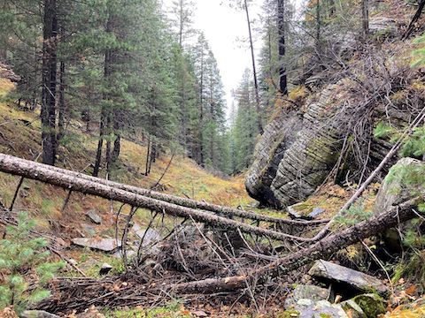
The next quarter mile of McClintock Draw is a mild bushwhack. Part of the Cabin Loop, Barbershop Trail #91 crosses McClintock Draw after 1½ miles. If you loop back on Barbershop Trail #91, and FR 321C, it would be a 3.2 mile, 360 ft. AEG hike. Both options, as well as the main McClintock Draw loop, are in the GPS file attached below. 🧭
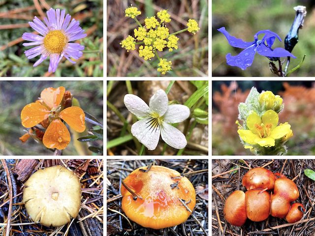
Top Row: alpine leafybract aster, alpine false spring parsley, Apache lobelia.
Middle Row: orange wallflower, Canada violet, mullein.
Bottom Row: various fungi. (More high country flowers.)
The final mile of McClintock Draw is more congested. Nothing too extreme, but more work and slower going. If you need to bail, and are too far from Barbershop Trail #91, go west (left): It’s not too steep, nor too high (80-100 ft.) or tangled. East (right) is more vertical, and higher by over a hundred feet.
I arrived at the mouth of McClintock Draw, at Dane Canyon, at 11:38 a.m., after 2¾ miles, and 1h 45m of hiking. (Not counting picture taking or meandering.) Following an animal trail, it took me 10 minutes to climb 130 ft. up to decommissioned FR 9616B. You could take FR 9616B left or right: I went left.
Just past the four mile mark, FR 9616B joins FR 321C. At 4¾ miles, a locked tube-steel gate blocks FR 321C. (Which I guess is also decommissioned?) FR 321C then splits right, apparently drivable. Instead, split left onto 218C, back to the trailhead at 5½ miles. (I was surprised a guy was 5th wheel camping so late in the season.)
I’ve hiked 37 different Mogollon Rim canyons. McClintock Draw was my 70th overall Mogollon Rim hike, above or below the Rim. I try to do six or seven Mogollon Rim hikes — canyon crawl or otherwise — per year: 2011 (1), 2012 (1), 2013 (3), 2014 (4), 2015 (4), 2016 (3), 2017 (3), 2018 (6), 2019 (3), 2020 (8), 2021 (7), 2022 (8), 2023 (6), 2024 (9), and 2025 (4). Our Asia trip took a chunk out. Totally worth it. 🌏
Directions: From Phoenix, head north on I-17 to Camp Verde. Take exit 287, east onto AZ-260. In 33.7 miles, turn left on AZ-87. In 2.6 miles, turn right onto Rim Rd. / FR 300. In 18.6 miles, turn left on FR 321. In 1.5 miles, turn left on FR 218C, then park.
GPS File: McClintock_Draw_Mogollon_Rim
Distance: 6.43 mi.
AEG: 572 ft.
Time: 2h 38m
Rumble Video
Vimeo Video
Hiking McClintock Draw, Mogollon Rim from Preston McMurry on Vimeo.