

This week was our annual summer trip to Mount Lemmon. You could hike up from Tucson, but if you do you are much stronger hiker than I. The trails that circle the Santa Catalina Mountains ridgeline — such as Knagge Trail #18 — are mostly outwith my fat ass’s ability. Because you have to start down then, when you are tired, hike back up. I prefer to hike up, then down.
Not easy on top of Mount Lemmon, but I manage to put together some hikes that are within reason.
Today’s plan was a lasso of Sunset Trail #90 to Marshall Gulch, Aspen Trail #93 to the summit of Marshall Peak, Marshall Gulch Trail #3 to Marshall Gulch, then Sunset Trail #90 back to the start. Start from either Butterfly Trailhead or Soldiers Camp Trailhead. I started at Butterfly Trailhead, as it has a picnic table and pit toilet. (Which smelled hideous, and had a cleaning chart with no entries for July!) 🥴
Starting at 9:15 a.m., I hugged the Mount Lemmon Highway shoulder for 100 yds. to Soldiers Camp Trailhead. This hike starts out the back of the trailhead, but which way to go? The dirt road splits three ways. After five minutes of confusion, I figured out I should take the middle option. Go straight.
As you walk past weekend cabins, the road splits again. Stay left. A quarter mile from Soldiers Camp Trailhead, the road splits a third time. Following trail signs, stay left as the route becomes Sunset Trail #90.
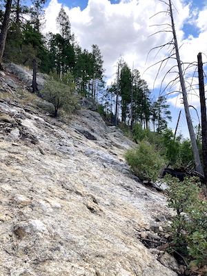
After 0.5 miles, Sunset Trail #90 begins descending. In 50 yds., there is an excellent view point down Sabino Canyon. (See the GPS route attached below.) Much of the next half mile is off camber granite, like you see in the photo. Or rocky steps that are just out of leg reach. Mind your step: You won’t get seriously injured if you fall, but granite will tear your skin up. I just bumped a knuckle, and it bled.
At the bottom of Sabino Canyon, Sunset Trail #90 turns north. On the opposite side of the canyon, atop a bare rock wall, is the Aspen Trail #93 view point. Sunset Trail #90 reaches Marshall Gulch Trailhead after 1.2 miles. An earlier sign incorrectly claiming it is “1.6 miles” to Marshall Gulch, and “0.5 miles” back to Soldiers Camp Trailhead, is not even remotely accurate: It is 1.2 miles, total.
It took me a minute to find the start of Aspen Trail #93. From Sunset Trail #90, make a sharp turn back to your left. Aspen Trail #93 begins climbing, passing through shady pines. The second Sabino Canyon view point is at 1.4 miles. A group of other retired guys were taking a break there. Just past that, Aspen Trail #93 enters the small grove of young quaking aspen that appears to have given the trail its name.
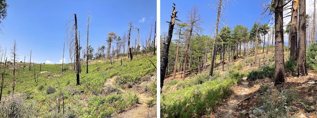
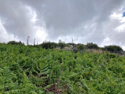
After the aspens, Trail #93 pitches up, gaining 600 ft. in just under a mile. The post-fire foliage is dense, gradually petering out. I was glad I had applied SPF 90 back at Butterfly Trailhead. At 2.2 miles, Aspen Trail #93 reaches a stand of still surviving pine trees.
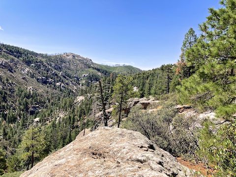
I briefly considered taking that route to Marshall Peak’s summit, but instead stuck to the GPS track I was following. Aspen Trail #93 works the 8130 ft. contour for the next 0.8 miles. At 2.5 miles, there is a clear view southwest to Tucson and, eighteen miles away, Davis-Monthan Air Force Base.
At 2.8 miles, Aspen Trail #93 reached the point I was expecting to take to Marshall Peak’s summit. I was hoping for, but not expecting, a trail. And there was none. Not even a crushed vegetation use-path through the copious, deadfall strewn, brush. I looked up the 26.7% grade, saw dark clouds gathering above Marshall Peak’s summit, and decided “no thanks”. 👋
At 3.0 miles, there is an obstacle-free draw (11.8% grade) up to the Marshall Peak ridgeline that pairs with the easier approach a half mile back. I’ll take that route in the future. From that draw, Aspen Trail #93 descends to Marshall Saddle at 3.7 miles. I got a kick out the Dead Barney Dinosaur Boulder at Marshall Saddle. (See video thumbnail, below.) 😆
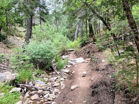
Riparian, and undamaged by fire, Marshall Gulch Trail #3 descends 500 ft. in 1.3 miles, back to Marshall Gulch Trailhead. As popular as it is, I was surprised there was no one else on it. However, I did bump into one hiker on Sunset Trail #90, which was much easier heading up.
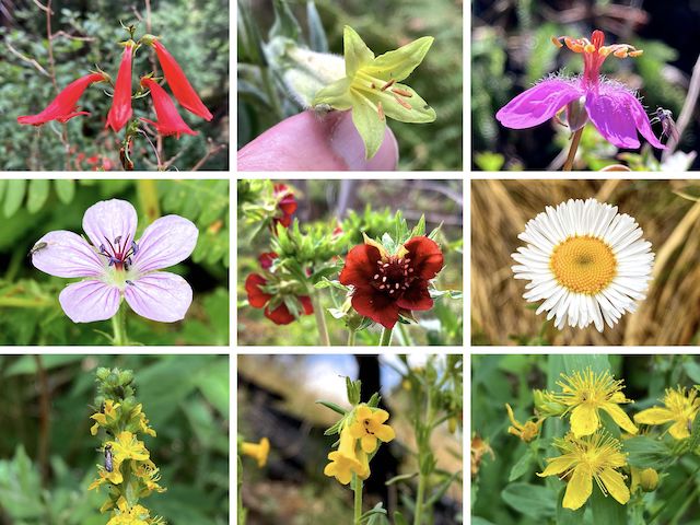
Top Row: scarlet penstemon, giant trumpet, pineywoods geranium.
Middle Row: Richardson’s geranium, red cinquefoil, spreading fleabane.
Bottom Row: roadside agrimony, manyflowered stoneseed, Scouler’s St. Johnswort.
Scarlet penstemon were the most common high country flowers, particularly along Aspen Trail #93, which also had a fair amount of bee-loved — get it!? 😆 — Fendler’s ceanothus, though not nearly as profuse as last year on Mint Spring Trail #20. I also spotted yarrow, mullein, alpine false springparsley, pygmy bluet, yellow columbine, aromatic false pennyroyal, and western evening primrose. Roadside agrimony and giant trumpet were personal firsts.
After I finished my hike, my wife & I chatted at the Butterfly Trailhead picnic table. She said that most of the people who headed down Butterfly Trail #16 were only gone a brief while. The exception was a couple who rolled up arguing, then disappeared into the stanky pit toilet, continuing to fight. (And apparently not 🔩.) Rehydrated, and with a fresh pair of socks, it was back down the hill to La Hacienda for another birthday dinner. 🌮
Directions: From I-10 in Tucson, take Exit 256. Head east on Grant Rd. for 8.5 miles. Turn left onto Tanque Verde Rd. In 3.3 miles, turn left onto the Catalina Highway. In 27.0 very twisty miles (speed limit 35 mph), Butterfly Trailhead is on the right. In another 100 yds., Soldiers Camp Trailhead is on the left.
GPS File: Sunset_Aspen_Marshall_Lasso
Distance: 7.08 miles
AEG: 1,186 ft.
Time: 3h 12m
Rumble Video
Vimeo Video
Hiking Marshall Peak Loop, Santa Catalina Mountains from Preston McMurry on Vimeo.