

Heading east from Dewey, this is the 10th segment of General Crook Trail.
The original General Crook Trail, surveyed by General George Crook in 1871, was ~200 miles from Fort Apache, up the Mogollon Rim to near what is now Show Low, then west to Camp Verde, and on to Fort Whipple (in Prescott). To avoid crossing canyons & cliffs, I believe it followed the military crest of the Mogollon Rim until it began descending to Camp Verde. Pretty much what is now Rim Road.
“Vanished Arizona: Recollections of the Army Life of a New England Woman“, mentioned Martha Summerhayes stopping at Stoneman Lake, but that would be a 50-mile detour. Perhaps a different body of water went by that name in the 1870s? Or the route she travelled was later shortened? In any case, no two sources agree on the General Crook Trail route. 🙇🏻♂️
The modern day hiking — and biking — version of the General Crook Trail ends after 135 miles, six miles from the Mogollon Rim in Clay Springs. Today’s route between Rim Top Trailhead (V71) and Forest Lakes (V80) begins the modern trail’s edging away from the Mogollon Rim.
I had done a map & satellite recon, and was generally familiar with the area, having already hiked the next General Crook Trail segment, from V80-V89, and biked Larson Ridge to Chevelon Canyon. I figured the route from Rim Top Trailhead to Forest Lakes would be like latter. At worst like minutes 4:50-6:00 of the Larson Ridge video. 📽
So, my plan was to ride from Forest Lakes to Rim Top Trailhead, stopping for photos along the way. Then double back while filming with my GoPro (for uninterrupted footage). About 19 miles roundtrip.
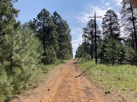
Starting across AZ-260 from V80, I began riding dirt Old Rim Road / FR 99 at 8:45 a.m. After ¼ mile, FR 99 splits north. I stayed on the “business route”, now FR 936, through Forest Lakes. Road was great. Not much traffic. Forest Lakes is small, mostly Phoenicians’ summer homes. (One place was on the market for $699k.) The school doubles as a library and church.
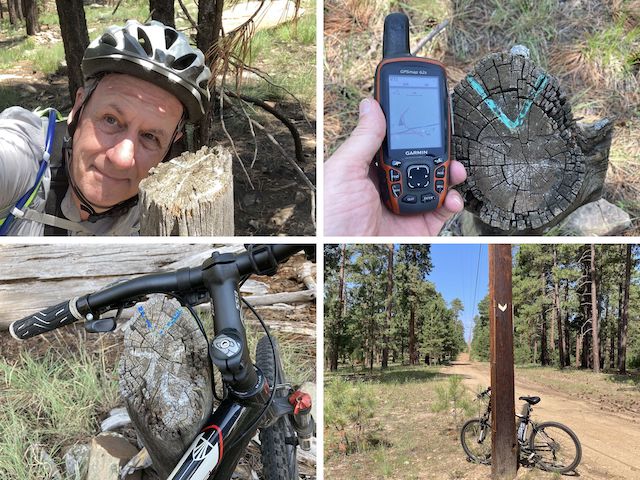
Old Rim Road got rougher after leaving Forest Lakes, but not too bad. Despite riding slowly, scanning left & right, I never found Boy Scout mile markers V79, V78 or V77. I thought General Crook Trail continued along Old Rim Road to Horse Trap Trailhead: Instead, at the FR 237 pit toilets, it angles left, crossing the powerlines. I rode across the powerline prairie. V76 was just inside the west treeline.
The 1⅓ miles to mile marker V75 crossed a brushy draw, a small creek, and up the rocky opposite slope. I walked most of it. That distance between markers may have been more than a mile, but V75 is almost exactly five miles from V80. Maybe V76 got shifted after the powerline was built? In any case, stay alert for General Crook Trail markers of all sorts! 😉
From V75, the next ⅔ miles vaguely resembled old road bed, so I rode it. The obstacles on old road bed include pine cones, which are like riding over large slippery marbles, and sawed off 3″ high small tree stumps, which act as punji sticks. Old Rim Rd. was just a hundred feet away, and banned for vehicles, why not use it? Well, the General Crook Trail did for the next ⅓ mile to Horse Trap Trailhead on AZ-260.
I was over two hours into my bike & hike — when I expected to already be starting my return trip — and only two thirds of the way through my out route. I also forgot my gorp, so though I had enough water, no new energy was entering my system. I called an audible. I called my wife. I didn’t bail, but asked her to pick me up at Rim Top Trailhead instead of waiting by V80.
Opposite Horse Trap Trailhead, across AZ-260, is the Young Highway, which runs south to the infamous Pleasant Valley. After playing “Frogger” across the AZ-260 construction backup, I rode a quarter mile down the Young Highway, before turning west onto more chevroned & decommissioned jeep trail. I rode for a short while, before walking across a shallow upper branch of Willow Springs Canyon. 🐸
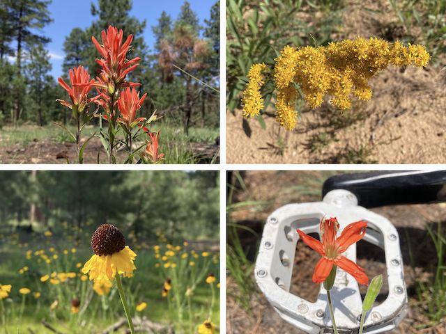
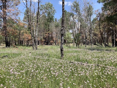
After climbing out of the wash, I rode another half mile to General Crook Trail mile marker V73. I walked my bike down & in, then up & out, another branch of Willow Springs Canyon. A third of a mile west is an invisible third branch of Willow Springs Canyon. No obvious water, but it must trap enough moisture to grow an absolutely incredible amount of Geyer’s onion. Had to be a couple of acres worth!
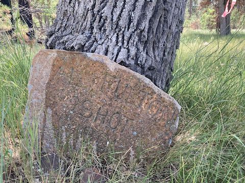
The old decommisioned jeep trail the General Crook Trail had been following petered out at Lake One. I walked my bike around the south “shore” until I picked up another chevron. At the Al Fulton grave, the chevrons follow foot trail, rather the adjacent jeep trail. Oh well, it was only another ⅔ mile to the Mogollon Rim Visitor’s Center. You could avoid another game of AZ-260 “Frogger” by starting there.
After crossing AZ-260 a second time, I headed up (current) Rim Road 250 yds. to Rim Top Trailhead. (V71 is just off the backside of the parking lot.) I finished in a hair under four hours, or what I expected for the full 19 mile out & back ride. I’m not a strong mountain biker, so your mileage may vary. As a hike, the General Crook Trail from Rim Top Trailhead to Forest Lakes would be easy. 👍
As I had intended to film my return trip, I have no “action” video. Never turned on my GoPro. Instead, this week’s video (below) is the photos I took, in reverse order. In other words, the order you would see / experience conditions if you continued travelling the General Crook Trail west-to-east. Enjoy!
Rim Top Trailhead Directions: From Phoenix, head north on AZ-87, the Beeline Highway, into Payson. Turn right on AZ-260. In 29 miles, after cresting the Mogollon Rim, take the first left onto Rim Rd. / FR 300. In 250 yds., on the right, is Rim Top Trailhead.
Forest Lakes Trailhead Directions: Back on AZ-260, continue east for 7.6 miles. A half mile past mile marker 289, turn left onto dirt FR 99. Park right there.
GPS File: General_Crook_Trail_V71_V80
Distance: 10.86 mi.
AEG: 524 ft.
Time: 2h 40m
Rumble Video
Vimeo Video
Hiking General Crook Trail: V71-V80 from Preston McMurry on Vimeo.