

I have not done an away hike or bike either of the last two weeks. For … reasons. Worse yet, my already borderline eating habits have gotten worse, due to the lack of time at home. I feel like a pig. Though it’s been over a month since I hiked, today was a planned bike ride, so that’s what I did.
Larson Ridge is located in the Apache-Sitgreaves National Forest, on the Mogollon Rim, one mile west of the hamlet of Forest Lakes. Horse Trap Canyon forms its west flank; Larson Canyon its east. I’m not sure if Larson Ridge extends south of AZ-260, but its northern tip ends 7½ miles later at the confluence of Larson Canyon and Chevelon Canyon. 🏞
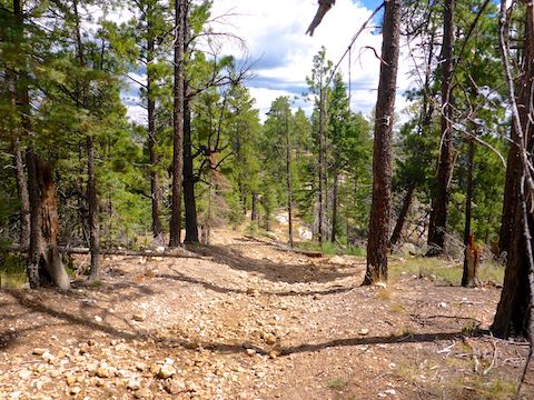
FR 237 extends the length of Larson Ridge, with various decommissiond jeep trails branching off it. FR 237 looked like it would be mostly flat, with a couple of short, small climbs — excepting the final ½ mile, which I planned to hike to a knob that on sat view looked like it would have great Chevelon Canyon views.
FR 237 is easily car drivable along Larson Ridge, for 6½ miles from AZ-260 to the “No Motor Vehicles” barriers on Hill 7398. Because 14½ miles round trip is a long way to hike, the good surface of FR 237 means you can drive as far down the dirt road as you need to for a hike that matches your endurance.
The mild surface and elevation changes means that casual hikers more comfortable with strolling a Phoenix canal can also enjoy the journey along Larson Ridge. Heading north, the sole climb is 60 ft. @ 3.8% up Hill 7398. Returning south, FR 237 gradually rises 450 ft., with climbs of 140 ft. @ 12% and 100 ft. @ 5.9%, with only a slight respite in between. 😅
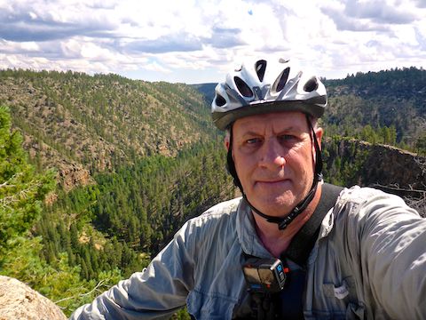
After negotiating one-lane construction on AZ-260, my wife and I arrived at the Larson Ridge Trailhead just after 8:00 a.m. I parked across FR 237 from the pit toilets, as there was better shade there. FR 236 is locked to the west, but my wife later reported that all morning there was a steady stream of logging trucks leaving the wildlife protection area.
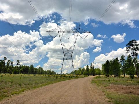
I started biking at 8:30 a.m. (It takes awhile for me to get ready.) In 200 yds., FR 237 exits the forest, passes through a cleared powerline right-of-way, then re-enters the woods. In ⅓ mile, FR 237 again exits the forest, this time travelling under the high-tension lines for ½ mile.
I was surprised there was a white-on-green mile marker “1”, under the powerlines, on the east side of FR 237. As I had only been riding for ¾ mile, I knew he distance was measure from AZ-260, not Larson Ridge Trailhead. I also spotted mile markers 2 and 3, but nothing beyond that. Maybe the count instead continues on FR 172 and FR 237B, which loop through Larson Canyon? 🤔
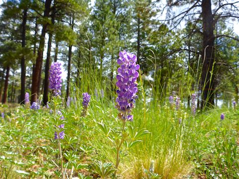
As I wanted uninterrupted footage for my biking video (below), I did not divert down any side roads, nor did I explore off trail. Heading cross country — on foot, to avoid MTB tires chewing up the forest floor — would not be difficult at all: Even by pine forest standards, Larson Ridge is relatively open, and free of underbrush.
There’s some very good vehicle camping spots along FR 237, but not a lot of campers. (Not in mid-week, anyway.) Just two vehicles passed me on Larson Ridge: a Forest Service pickup heading north, and a Jeep returning south. The only pedestrian was a lady with a leashed, but overly energetic, dog. 😒
About 6½ miles down Larson Ridge, on top of Hill 7398, I was not sure whether FR 237 continued straight or split left. I went left, but that seemed to be another camping spot, so turned around, then went straight, passing by some blocking boulders and a fallen tree. Just past where mile marker 7 should have been, trying to lift over a rock, I dabbed.
I was close to where I planned to drop my bike anyway, so I hid it behind some bushes, then continued on foot. Good thing too, as the descent was not only steep, but rocky, with several step-ups there’s no way I could have negotiated back up hill. I’d genuinely like to see a strong rider do it. At least it was easy to walk.
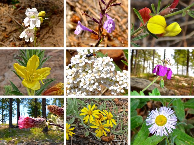
Top Row: Palmer’s penstemon, aromatic false pennyroyal, red and yellow pea.
Middle Row: yellow evening primrose, western yarrow, pineywoods geranium.
Bottom Row: Arizona thistle, showy goldeneye, spreading fleabane.
There’s a final rocky 30 ft. climb to knob at the north end of Larson Ridge. To the right, down and across a relatively flat area, is a hairy razorback ridge, that looks like it is only a few feet across. (Supposedly, this can be used to access the bottom of Chevelon Canyon.) There’s an OP straight ahead, on a flat boulder that was a bit too much for this 60 year old fat man to get up.
The easier to access OPs are to the left. I marked the best one on the attached GPS route: When you reach the turnaround at the end of FR 237, head left towards the triangle shaped point with a flat outcropping. Drop into the notch to its left, aiming at the single small pine tree. Wrap around a few feet to the right. It’s narrow, but not too bad. You can rest against the upslope boulder you wrapped around or, like I did, step across the narrow slot to the final sharp-scooped rock. The view is fantastic! 🤗
I made it from Larson Ridge Trailhead to the north end of FR 237 in about 45 minutes, total biking & walking. I spent 30 minutes exploring and enjoying the views of Chevelon Canyon. My return trip took two hours, because I took a lunch break and shot 134 photos along the way.
Panoramic view: Pano mode on my camera makes the result too vertically narrow to appreciate the depths of Chevelon Canyon. Likewise, landscape mode. (As well as not conveying the canyon’s width.) So, I resorted to manually stitching together four portrait mode photos. Not bad, except for the one on the right …
Directions: From Phoenix, head north on AZ-87, the Beeline Highway, into Payson. Turn right on AZ-260. After cresting the Mogollon Rim, 4½ miles past Rim Rd., turn left onto FR 237. Park in a ¼ mile, by the pit toilet.
GPS File: Larson_Ridge_to_Chevelon_Canyon
Distance: 15.58 miles
AEG: 720 ft.
Time: 2h 49m
Biking Video
Mountain Biking Larson Ridge to Chevelon Canyon from Preston McMurry on Vimeo.