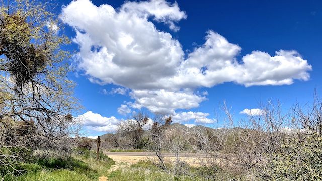
Counter-clockwise from Bronco Trailhead, this is the 24th segment of the Maricopa Trail.
The Maricopa Trail is a 315-mile trail system around the Phoenix metro area (aka, The Valley of the Sun). About 75 miles of that are access trails, with the remainder a 245-mile loop trail. I rode my bike the 90-100 miles of the loop trail that are canals or even city streets: Plus a few dirt trail segments, such as Tom’s Thumb Trailhead to Granite Mountain Trailhead — this hike’s starting point.
This week I did not forget to bring my GPS. Having brought my GPS, I had not forgotten to load today’s Maricopa Trail route. Instead, having arrived at the Granite Mountain Trailhead, I lost my GPS. (It was in my car.) Progress! 👴🏻
Though only 45℉ when I started at 7:20 a.m., it felt warmer. Not bad, really. By the time I finished around noon, the temperature was a toasty 75℉.
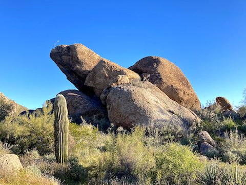
Bootlegger Trail begins right behind the Granite Mountain Trailhead bathroom building, by the blue “If it rains, please refrain” from riding your bike sign (which is ignored) and the red “motorized vehicles prohibited” sign (which includes eBikes, and seems to be obeyed). Bootlegger Trail is wide & smooth. Bend right at emergency marker BL2, to stay on Bootlegger Trail.
Every intersection of designated trails is marked with an emergency marker, with a two letter code for the trail’s name, followed by a number. (The numbers incrementing roughly every half mile.) Other information includes how far it is to other trails, and an exhortation to protect snail darters, and the like. There may be a Maricopa Trail sticker, but don’t count on it. 🧭
Bootlegger Trail ends after 1⅓ miles at emergency marker GM4. Turn right.
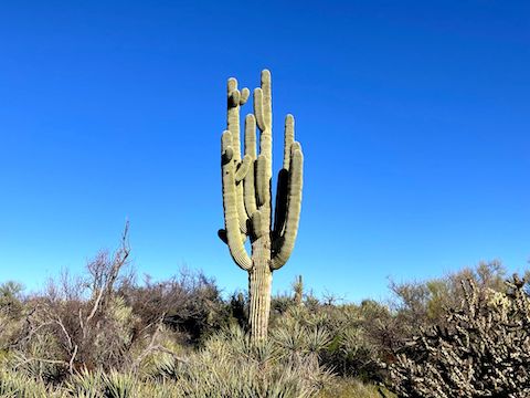
Granite Mountain Trail is smooth, very twisty, singletrack optimized for mountain bikes. The Maricopa Trail portion winds around the northern third of Granite Mountain. The trailside boulders have disappeared, but there are large fields higher up on the mountain’s slope. Granite Mountain Trail has decent views east across the Verde River valley towards the Mazatzal Mountains, and north up the Camp Creek drainage, across the town of Carefree, towards the radar domes on Kentuck Mountain. 📡
Overall, desert flower coverage was light, but best along Bootlegger Trail and Granite Mountain Trail. Red & yellow pea were most common, followed by fiddleneck and blue dick. I found Mexican gold poppy (cinched up tight against the chill) and Coulter’s lupine on Granite Mountain Trail, Lindley’s False Silverpuff at both ends of Branding Iron Trail, and scarlet bugler on The Divide Trail. Also stork’s bill.
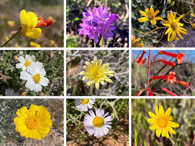
Top Row: red and yellow pea, blue dick, brittlebush.
Middle Row: blackfoot daisy, Lindley’s false silverpuff, scarlet bugler.
Bottom Row: desert marigold, spreading fleabane, California goldfields.
Three miles into this Maricopa Trail segment, I turned right onto Branding Iron Trail.
Branding Iron Trail starts at marker GM7. The track gets narrower, but remains smooth & twisty as it heads west across the short valley between Granite Mountain and Cholla Mountain. The photogenic saguaro begin petering out, replaced by cholla and banana yucca. Branding Iron Trail ends ¾ mile later at marker TD1, the highpoint of this Maricopa Trail segment. I turned right onto The Divide Trail.
The Divide Trail heads north, slowly downhill. Rocky at first, it smooths out. To the west is Diablo Trail, a small system of black diamond mountain bike trails. To the east is “Phase 2C” of the McDowell Sonoran Preserve corridor plan, with an as yet unmapped and undeveloped trail system. I covered The Divide Trail’s two miles in only 44 minutes, including photos. Speedy!
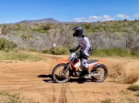
Dove Valley Trail starts at DV17, 5½ miles into this Maricopa Trail segment. Turn left, along an old jeep trail, towards the powerlines. I passed a hiker who said she never sees anyone out there. There’s decent mid-day shade in the washes. The barbed wire fence to the right marks the Tonto National Forest boundary. After just under one mile, Dove Valley Trail ends at a v-gate in that fence.
There is a small OHV trailhead at the junction of FR 2090 and FR 513. The trailhead would be a good turn around point for an out & back from either Granite Mountain TH or Bartlett Dam Rd. Alternately, a Maricopa Trail segment from the OHV trailhead to FR 1058 would be about 8.0 miles. More importantly, the final segment to Bronco Trailhead would be significantly shortened to from 12.8 to 8.2 miles.
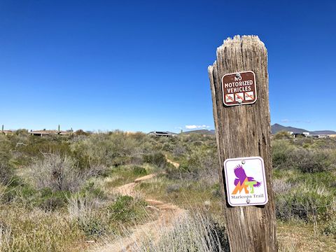
After entering the Tonto National Forest, Maricopa Trail is no longer co-located with another named trail. It just is. Not nearly as twisty, it was still smooth singletrack. There were quite a few small puddles from yesterday’s rain. The trailside cheat grass has certainly enjoyed the wet winter monsoon, and the increase in fuel could bode ill for this year’s wildfire season.
There’s another OHV trailhead where the powerlines cross Bartlett Dam Rd. Personally, I’d stage my shuttle there, rather than trudge the final half mile to the Cave Creek Ranger Station. (Though the station parking lot had by far the best flowers: scads of red & yellow pea.)
I’ve now completed 230.81 miles of Maricopa Trail. Only one (?) tough segment to go!
Granite Mountain Trailhead: From Loop 101 / Pima Freeway, take exit 36 north onto Pima Rd. Head north for 6.7 miles. Turn right on Dynamite Blvd., which in 3.0 miles becomes Rio Verde Dr. Continue straight through two traffic circles for another 3.0 miles to 136th St. Turn left. In 2.0 miles, the Granite Mountain Trailhead will be on your left. There is no entry fee.
Cave Creek Ranger Station: There is no shortcut between trailheads, so head back out on Dynamite Blvd. Turn right on Pima Rd. In 5.3 miles, turn right on Cave Creek Rd. In 4.2 miles, turn right on Bartlett Dam Rd. In a quarter mile, turn left into the Cave Creek Ranger Station parking lot.
Park Map: McDowell Sonoran Preserve North Area Map
GPS File: Maricopa_Trail_Granite_Mountain_TH_Bartlett_Lake_Rd
Distance: 10.30 mi.
AEG: 909 ft.
Time: 3h 28m
Rumble Video
Vimeo Video
Maricopa Trail: Granite Mountain TH to Bartett Dam Rd. from Preston McMurry on Vimeo.
