

I think taking a break day after hiking Rogers Lake & Woody Mountain two days ago was a wise decision. I mean, I could have done this hike yesterday, but at 56, no need to push it. Plus, it gave my wife & I a chance to do tourist stuff while things were open around Flagstaff on Saturday.
We headed out on Fort Vallley Rd. / US-180 to the Arizona Pioneer Museum. I didn’t see a “no Trespassing” sign, so I climbed up in the engine. What little boy does not want to be a train engineer? I guess the “no trespassing” sign was on the other side. Oops. 🤫
Then we went inside, paid our admission, and spent the next three hours reading about local Flagstaff history and checking out the displays.
After lunch at Mama Burger — great floats! — we de decided to head back to our B&B for a nap, rather than continue on to the Riordan Mansion. Neither of us really did get a decent, solid, night of sleep any of the four nights we spent in Flagstaff. No idea why, sometimes 💩 happens.
The only time I had previously been on Schultz Pass Rd., was sometime in the late 80s, when the NAU Army ROTC detachment went up there to practice rappelling off a small bluff. I’m usually pretty good at remembering where I’ve been, even if only once, decades before, but that one I had a hard time locating on the drive in. All I remember is that it was on the west side of the pass. 🤔
There were a fair number of vehicles when we arrived at the Schultz Pass trailhead around 8:20 a.m. Still, I only saw a handful of other hikers between Schultz Pass and the small cave 1.5 miles south of the Snowbowl.
The temp was a perfect 57℉ when I started. Being at the top of a pass, it was breezy, but not cold. The breeze had what I can only describe as a ‘soft’ quality. It actually felt comforting.
My plan was to hike from Schultz Pass up Weatherford Trail #102 to the bottom of Weatherford Saddle, then backtrack, and head north on Kachina Trail #150 to the Snowbowl.
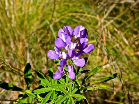
I was not expecting any #flowerporn, or even spot flowers, given the altitude and season. But I saw the first of many lupine only yards onto Weatherford Trail #102.
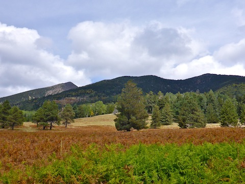
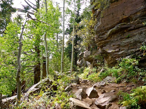
There is almost no deadfall or underbrush along either Weatherford Trail #102 or Kachina Trail #150. The forest floor is mostly grass, extending out into spot meadows from small to large. On Kachina, many of the meadows were dead ferns, rather than grass. If there have been any wildfires in the area, I did not see evidence of it.
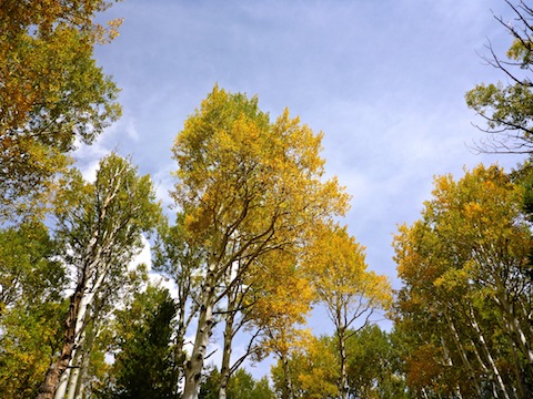
Weatherford Trail #102 had a clear trail surface, making it easy for me to scan for photo ops with out worrying about ankle breakers. 0.75 miles north of Schultz Pass, those ops began with the first patch of aspen. There were young trees, short, with decent fall color. Many of the leaves had already fallen on the trail. 🍂
As I found throughout the day, if the aspen were short, they had decent yellow color. (I never did find any of the elusive red aspen leaves.) If the aspen were medium height, they might have color. The tall, old, aspen were still their normal dark green. I don’t know if elm, maple or oak grow at 9000 ft., but if they do, I did not see them or their fall colors. Other than aspen, most of the trees were the douglas fir, or the ponderosa pine for which northern Arizona is famous.
It’s only a 2.0 mile, 900 AEG, climb up Weatherford Trail #102 from Schultz Pass to the Kachina Peaks Wilderness boundary. The remainder of this hike’s 1900 AEG is up & down, but generally up, on Kachina Trail #150 ending at 9300 ft. at the Snowbowl (or 1300 ft. higher than Schultz Pass). Although I made decent pace, I had to moderate, because I could tell the thinner oxygen was affecting my cardio. 💔
I took a quick break at the Kachina Peaks Wilderness boundary, then headed back down Weatherford to the Kachina Trail intersection. There, I met a couple who I would hop scotch up Kachina Trail with for the next several hours.
Whereas on Weatherford Trail #102 I could not spot any named peaks, on Kachina Trail #150 there are multiple great views of Fremont Peak and Agassiz Peak. There were also several spots with good views of Flagstaff. The massive white disk of the J. Lawrence Walkup Skydome, NAU’s football stadium, in particular, stood out. When I was attending NAU, I spent a lot of time in the Skydome, either taking photos of basketball games for the university newspaper, the Lumberjack, or working on the sports information department’s football stats crew. Anybody else remember Greg Wyatt and Goran Lingmerth? 🏈
As Kachina Trail #150 wound around the southwest slope of the San Francisco Peaks, the views shifted from Flagstaff to Fort Valley and points west. There was obvious smoke west of Fort Valley, that looked like a prescribed, or at least managed, burn. (Rather than a wildfire.) After looking at my photos back home, the fire was on the far side of the Bellemont prairie, so it was probably the South Zone Rx prescribed burn on the Kaibab National Forest.
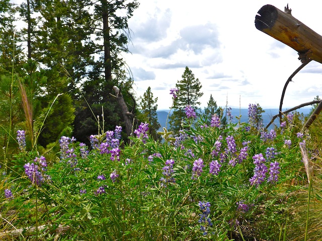
The lupine started becoming more numerous, including a rare white lupine. (Lupine are usually blue or lavender.) Two miles south of the Snowbowl, I saw the most amazing lupine patch of my life: Hundreds of colorful flowers in one dense patch. I was so amazed, I took a break on a nearby log to admire them. 😲
North of the lupines, the otherwise smooth Kachina Trail, started getting broken up, with small boulder step ups and trailside rocky outcroppings. That’s also when the human deluge began. Canine as well. I still enjoyed the forest, but I hike to get away from other people, so it was a bit of a bummer.
I enjoyed the hike, but I think that next year I will visit Flagstaff a week later, for better fall color.
Schultz Pass Directions: From Phoenix, head north on I-17 into Flagstaff, as it becomes Milton Rd. After passing under the railroad tracks, turn left at the first light onto Humphreys St. In 0.6 miles, turn left on US-180. In 2.6 miles, turn right on Schultz Pass Rd. It is car drivable dirt, but narrow & twisty. In 5.4 miles, park at the trailhead on the right.
Snowbowl Directions: From Phoenix, head north on I-17 into Flagstaff, as it becomes Milton Rd. After passing under the railroad tracks, turn left at the first light onto Humphreys St. In 0.6 miles, turn left on US-180. In 6.6 miles, turn right on Snowbowl Rd., which is paved, but very twisty. In 6.5 miles, turn right into the lower parking area. The trailhead is at the far end.
GPS File: Schultz_Pass_to_Snowbowl
Distance: 8.94 mi.
AEG: 1,970 ft.
Time: 3h 35m
Hiking Video
Hiking Weatherford Trail & Kachina Trail from Preston McMurry on Vimeo.