

As is the case with many of my hikes, I’ve had this one on my list for years. I plan, do other things, plan some more, repeat.
I was going to hike Strawberry Mountain on Friday, then Mother Nature decided a few days prior to dump a couple of inches snow all along the Mogollon Rim. ☃️
Not that I am averse to snow hiking, but I started looking at some of the other planned hikes I had fermenting in my queue.
Luckily, it is still early in the season, so the snow all melted off in a day.
Strawberry Mountain was back on!
I met up with Eric, who goes by Strawberry_AZ on twitter, and who lives at the base of Strawberry Mountain.
The informal trailhead is off Fuller Rd., just past a “private property” type sign, 200 yds. south of Ralls Rd. You can legally ignore the sign, as you are on the Kaibab National Forest. The private property is beyond the fence. Don’t cross that.
The hike starts by heading east on an unnumbered jeep trail that parallels the fence. In a half mile, near the corner of the property, is a cattle tank. As central Arizona is in the midst of its wettest ever October, the tank had some water in it. We took the right split in the jeep trail, then started heading cross country towards the northwest slope of Strawberry Mountain. 🍓⛰
After crossing a rather steep wash, we started up Strawberry Mountain. Eric was concerned about cliffs and brush, but honestly it was not bad. I found an elk trail that not only made relatively easy going of the 600 ft. in 0.6 miles, but gave us some great views across Strawberry, towards the KRIM (Payson) tower on the Rim, plus west towards Fossil Creek.
Somewhere along the way, I stepped on the edge of a rock, flipping it into my ankle. That hurt.
As we neared Strawberry Mountain’s false northern summit, I began noticing the distinct absence of fall color.
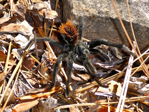
There was a small manzanita forest near the false summit, but they were young plants, yet to grow tall, stout, branches, so travel was bueno. There were still a few flowers, and plenty of mushrooms, to photograph.
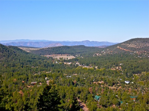
Even better photo ops were available on Strawberry Mountain’s east rim, particularly across Pine, towards Milk Ranch Point. Check out the GPS file attached below for the best photo locations. 📷
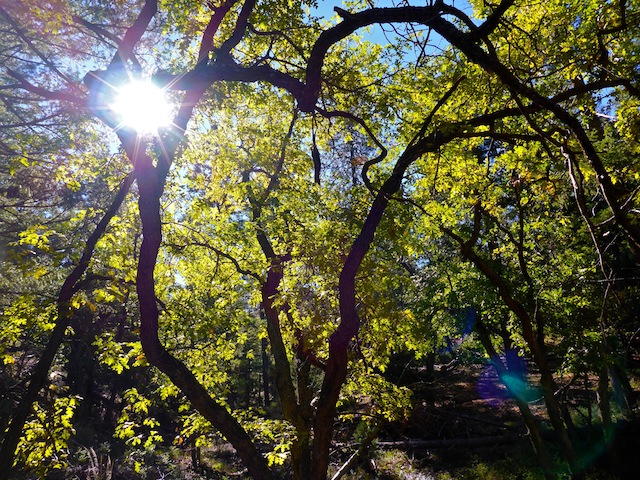
From Strawberry Mountain’s false summit, we headed south, into a forested gully. There was a trickle of water in the drainage. I got a great photo of sunburst illuminated leaves. Then we climbed the 300 ft. towards the true summit.
Strawberry Mountain’s true summit is wide, flat and grassy, with scattered trees. It was also quite muddy due to all the recent rain. Much more so than it’s soil slope. We found a jeep trail, which apparently runs towards Maple Spring Tank. Probably a good thing, as we were speculating on how hunters could possibly drag their elk kill back down the hill.
Somewhere on the summit, I flipped another rock onto my still aching ankle. That was a sore one.
I actually looked for a summit log, but I’m just sad that way. 😜
We followed the jeep trail for a bit, then continued south, cross country, when it turned west. I was looking for a good OP I had spotted on sat view, but which no one I know had yet visited.
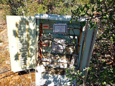
Eric and I hit the south rim of Strawberry Mountain a bit west of the OP. As we worked our way east, we bumped into the oddest thing: A cable television junction box, full of coax cable and other electronic gizmos.
Having done some “cable dogging” in the Army, I know there’s only two ways to run cable without endangering the line: 1) raise it, or 2) bury it. No way anyone is burying cable on a rocky mountain side, and there were no poles, or any cable hanging in the trees. So, the junction box was just … there. 🤔
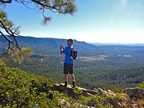
The OP I had seen on sat view was visible from the junction box, so we headed over.
The views were everything I had hoped for! I could see 270°, including Milk Ranch Point, the town of Pine, Houston Mesa, Payson, Buckhead Mesa, Four Peaks, the Mazatzal Mountains, Pine Ridge, Oak Spring Canyon, the Hunt Ranch, Hardscrabble Mesa, and points west. We thought we could see Mingus Mountain.
After enjoying the views, we started following the contour line northwest. Strawberry Mountain bends that directions, with the high line gradually descending towards Maple Tank.
I stopped at a very large, and tall, alligator juniper. While I was taking a piss, I noticed a hunting stand up high in the tree. No hunter, though I did have my orange pack and red hat on so I would stand out.
We lost the jeep trail around Hunt Ranch’s back gate, so we continued cross country to the saddle that separates Hunt Ranch from the one we parked near. There, we picked up another jeep trail, a steep one, that looped us back to the trailhead.
The top of Strawberry Mountain would make good camping, with great views, though the east rim was much windier than the south rim.
The next day, Eric msg’d me to let me know that Strawberry Mountain had broken into brilliant, fiery, color over night. Win some, lose some.
Directions: From Phoenix, head north on AZ-87, the Beeline Highway, through Payson and Pine to Strawberry. Turn left on Fossil Creek Rd. In 0.4 miles, turn left on Fuller Rd. In 0.6 miles, park just past the Ralls Rd. intersection.
GPS File: Strawberry_Mountain
Distance: 7.39 mi.
AEG: 1,363 ft.
Time: 4h 09m
Hiking Video
Hiking Strawberry Mountain, Arizona from Preston McMurry on Vimeo.