I know it is a bit late in the game for Rim color, but I was in Aravaipa the last weekend in September. I wanted to give the Rim a shot this weekend, but discovered I had a nail in my SUV’s tire, and did not want to risk getting stranded, nor driving it in my wife’s Mazda 3 sedan. I know Arnett Canyon and Telegraph Canyon have good late color, as I’d been out that way in December, 2013 and 2014. Plus we had heavy rain just 24 hours before, so I figured there would be good flow in the canyons. (Unfortunately, I struck out on both accounts. ![]() )
)
The AZT has a nice sign-in stand. I don’t recall that being there two years ago, when I was last at the PP trailhead. As last time I had gone CC, this time I went clockwise, for variety. However, I recommend CC, as you are on the exposed western / southern half while the sun and temps are low, but in the shady canyons when it is high & warm. Plus, you are not chasing the sun, so better photo ops. And you get the boring out the way first.
A couple hundred yards after I turned east off the AZT towards Arboreteum Tank, I rank into three folks who were looking for the Picketpost summit trail. The tank was dry; it always is.
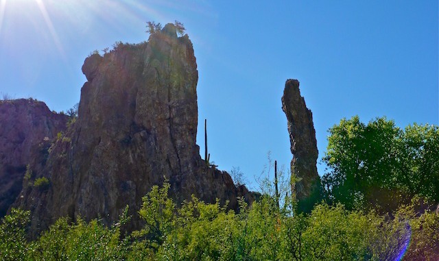
Lots of audible buzzing in the bushes along Arnett Canyon, particularly by the check dam. Not aggressive though. The creek was bone dry. The leaves were all green. At least the cliffs were pretty, but then cliffs don’t often change. ![]()
Not long after I turned west into Telegraph Canyon, I heard voices ahead of me. Even though I could not see them, I called out a “Howdy.” A voice replied “Kingsnake?” What!? How do they know me? Turns out it was Mark (CannondaleKid) and Tracey! Wow, small world. ![]()
I picked up the requisite number of scratches thrashing though the thicker vegetation in Telegraph Canyon. There were some small pools, and almost imperceptible trickle, just east of the moss-covered balancing rock.
I got a good look at the north end of Hill 3595, where Telegraph Canyon turns south. I plan on traversing it sometime this winter. Maybe in December, so I can combine it with a late Fall colors loop into the canyon between Hill 3454 and Hill 3313.
Once off Telegraph Canyon Rd., it was the usual slog the last three miles up the west side of Picketpost, back to the trailhead. ![]() I think the next time I do a hike into Arnett Canyon, I will instead start from the quarry / firing range on Arnett Creek and FR 4.
I think the next time I do a hike into Arnett Canyon, I will instead start from the quarry / firing range on Arnett Creek and FR 4.
GPS File: Picketpost_Circumference
Distance: 9.66 miles
AEG: 827 ft.
Time: 4h 04m
Hike Video
Picketpost Mountain Circumference Hike from Preston McMurry on Vimeo.
