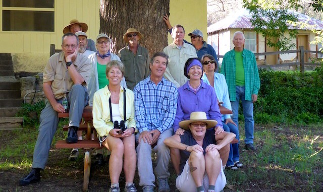
Missed out on the last Aravaipa Property Owners Association (APOA) thru hike, I think it was last year, so I wanted to make sure I made it this year, even though it would mean missing the likely peak colors up Bear Canyon way. Most of the folks stayed at the TNC guest house between Cobra Ranch and the pit toilet TH; my wife and I opted for the Spring Hill Suites in Thatcher. She said the area had much improved since she worked for the Corps of Engineers out there 20 years ago. After a long drive, and checking out the Klondyke Pioneer Cemetery, I was crashing hard. Rather than try one of the area’s good sit-down Mexican joints, I opted for a Taco Bell quickie. (I love quesaritos!)
I woke up about 12:30 a.m. — I don’t sleep well in hotels, even when I bring my own pillow along — and never really got back to sleep. ![]()
We met up with the APOA about 8:00 a.m., intending to drive to the Turkey Creek TH. However, two recent 700 cfs floods, plus two recent 1000 cfs floods, had caused some jeep trail damage. (Mark Haberstich, TNC manager, said normal flow is ~12 cfs.) There was a several foot high shelf about halfway, that our driver did not feel comfortable tackling. Especially not with a dozen people hanging off the hay bales in the back of her pickup.
I hung up front with Chris the Speed Demon the three miles from Turkey Creek to Deer Creek. While we took a break, everyone else caught up, then we started up to Hell Hole, a natural arch ~1.5 miles up canyon. While the majority continued up Deer Creek, past the arch, I stayed back to take Hell Hole pix — about a dozen. (In all, for the weekend, I shot 223 photos and video segments.) When, after awhile, they had not returned, I took to studying caterpillars. After an hour, and worried they may have somehow got back around behind me, and considering it was nearly 1:00 p.m. and I still had 12 miles to go, I headed back to Aravaipa Creek, picking up Bill & Linda (who had been bird-watching) along the way. We hiked together the rest of the day. ![]()
One advantage of the floods was that they had blown away the slime that often covers Aravaipa’s rocks, so footing was pretty good on the many creek crossings. Unfortunately, the flood also made the side areas often quite muddy — as evidenced by the numerous sideways hiker tracks.
My new 5-10 Water Tennies held up real well. I had previously worn some other brand of water shoes, which were so uncomfortable as to cause stabbing pain, crappy old sneakers (which actually did okay), and sandals, from which I had to dig out 1/2″ rocks every 50-100 meters because despite the ~12 cfs flow, Aravaipa’s current is strong enough to move small rocks (or cattle thigh bones). Only a few grains of sand penetrated the shoes, and absolutely no pebbles whatsoever.
Near Javalina Canyon I almost sloshed into a snake swimming in the creek. ![]() When I realized he was enjoying a relaxing swim, instead of attacking, we stopped for a few minutes to watch him.
When I realized he was enjoying a relaxing swim, instead of attacking, we stopped for a few minutes to watch him.
One of our non-hiking neighbors, Langdon, owns the old Wagner Ranch, so we ended our hike there, rather than continuing the final .75 miles to the west end TH. 18.28 miles is the longest I’ve walked in a single day since the 35 miles I accumulated while hitchhiking across Utah in May, 1983, when I was 20 years old. After making sure everyone had made it — Paul was somewhere back up canyon — I met up with my patient wife, who had made the four hour end-to-end shuttle drive. We dropped Bill & Linda off at their place along Aravaipa Rd., took some photos of the Supermoon, then drove all the way back to Sunnyslope. Having only eaten some gorp, I ate twice on the way home: a murderwich from the Dudleyville store (now a Giant) and a supersize Big Mac meal from the Gold Canyon Mickey D’s. ![]()
Despite my right foot being severely sore, I slept like a log.
Distance: 18.28 miles
AEG: 330 ft.
Time: 7h 57m
