

Counter-clockwise from Bronco Trailhead, this is the 1st segment of the Maricopa Trail.
I’ve had this hike on my list for years, at least since the last time I was out here, almost four years ago. I checked with my mine exploring buddy Paul, to see if he wanted to hit the Jersey Lily Mine, south of Prescott, but he was working all weekend. With not much time to put anything else together, and needing some miles, I pulled this out of my files.
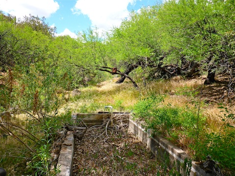
The Bronco Trailhead is on FR 24, just north of the Camp Creek cabins, between milemark MCDOT 7 and MCDOT 8. It’s a huge horse lot, with corrals, and a shot up pit toilet. (FR 24 is a dirt extension of Cave Creek Rd.) My plan was to hike west on Bronco Trail #245 from the trailhead to Bronco Creek, then follow Cottonwood Trail #247 and/or Cottonwood Creek to Cave Creek (the body of water), then follow FR 48 / Cave Creek Trail #4 south to the Spur Cross trailhead in Cave Creek (the city). I was expecting to hike 13 miles and 1500 AEG. (The trail map sign at Bronco TH gives an accurate estimate of 15 miles.)
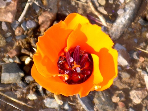
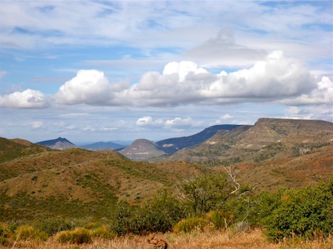
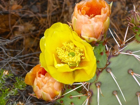
The hike is largely through areas burned during the Cave Creek Complex Fire in June & July, 2005. (At 248,310 acres, it is the third largest wildfire in Arizona history after the Wallow and Rodeo-Chediski fires.) Grass, bushes and cacti recovered years ago, but there are stubs of burnt trees throughout the first half of the hike. The grass is so healthy, and the trail little used, that Trail #245 disappears at several points. The flowers, too, are doing great: I spotted several dozen different species, with Englemann’s Hedgehog Cactus being numerous in the first half of the hike, while Prickly Pears were at peak bloom in the latter half of the hike. Many of the flower species were too small for closeup photos without a decent 35mm camera and macro lens. (As opposed to my pocket camera.) The hike video, below, includes more #flowerporn. ![]()
It rained for a couple of hours the night before my hike, so the grass was wet. The ground on the first half of the hike is more soil, than sand. but it was not muddy. Still, my shoes were wet all day, and I ended up with several hot spots & blisters. During the day, the sky alternated between completely overcast and partly cloudy. When the sun broke through, the #cloudporn was spectacular. ![]() Unbeknownst to me, the sun also burnt me. If I had known I was getting that much UV rays, I would have used sun block.
Unbeknownst to me, the sun also burnt me. If I had known I was getting that much UV rays, I would have used sun block. ![]()
Creek walking in Arizona is kind of interesting: You could have huge boulders you have to scramble over; or lots of ankle breaker rocks where you have to be really careful with your footing; it could be deep sand; it could be choked with grab & stabs, like catclaw; or it could be like Cottonwood Creek, which is relatively smooth travelling for most of the time it cross-crosses Trail #247. (Especially west of the counterweighted gate, Trail #247 is quite rocky; unfortunately, by that point, you need to follow the trail.)
Basically, the first 2/3s of the hike, before I started getting tired, was a pleasant stroll. By the time I hit the second corral, 10 miles in, I was starting to anticipate the ice cold Pabst Blue Ribbon beer I would soon be having at the Buffalo Chip Saloon, the Green Bay Packers bar in Cave Creek. After the counterweighted gate, it was basically once foot in front of the other the last five miles. (But I did see my first wild gila monster, which was cool, and got rattled by a snake, which was not. ![]() )
)
The gila monster crossed my path just after the counterweighted gate, in about the same location I previously encountered a molting baby rattler. It seems like the Cave Creek-Spur Cross area has more rattlers than any other I hike. Indeed, the first snake I ever encountered was nearby, on Cave Creek Trail #4. The dead horse a few miles west of the Bronco TH is still there, but after many years, is now only a few scattered bones. It was interesting to see the rate of decay. I’ve found that one of the best places to spot critters is inside flowers: They are teeming with bugs! ![]()
I took a break when I got to Cave Creek (the body of water), drinking the beer I’d brought with me, Imperial, a Costa Rican beer. (Which unfortunately tasted what it sounds like.) I had thought about pouring it out for the dead horse homie, but was glad I held on to it, both because the hike ended up being two miles longer than I anticipated (and so requiring more liquids), and because it was Bike Week in Cave Creek and a solid mile of downtown was nothing but Harleys and thirsty bikers. Drive-thru Burger King was a let down. ![]()
GPS File: Bronco_to_Cave_Creek
Distance: 15.13 mi.
AEG: 1,856 ft.
Time: 6h 47m
Hike Video
Maricopa Trail: Bronco Trailhead to Spur Cross from Preston McMurry on Vimeo.