

I never want to travel anywhere again without doing a hike or walking tour. Partly for working off vacation food, but mostly to see new things. You see so much more on foot, or on a bike, than you do in a car. Plus, it helps you learn a place and get a feel for it. (When we were house hunting back in 2008, I rode my bike around the neighborhoods we were looking at.) So, this was the first of five planned hikes for our European vacation.
I’d been to the Christmas market in Valkenburg in 2001, and had driven through in 2006 (it was too crowded to stay and we ended up getting a hotel elsewhere), but I never really understood it. After this hike, I know it like the back of my hand.
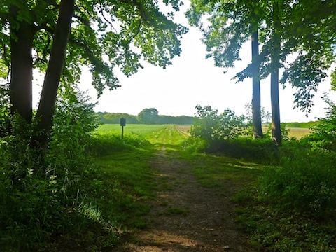
My wife has bad feet, but she accompanied me for the first mile, to Geulpark. It was chilly, but a sunny, peaceful morning. After we split up, she headed back to the hotel, while I picked up my pace heading through some woods towards Sibbe. On the climb out of town, the trail was rutted and very muddy, so I waddled a foot on the less muddy steep side of the trail to avoid getting too messy. ![]() Birds were singing everywhere. As I approached Sibbe, along a sidewalk, I stayed far to the right to avoid any traffic as the roads are very narrow in the area. (Lane and a half at best, sometimes only a lane to handle two directions.) A truck went past me and stopped. Out hopped the guy riding shotgun, who walked back past me. I turned around to look, and he was picking up equipment that fallen off the truck. If it fallen 30 feet later, my hike would have been considerably shorter.
Birds were singing everywhere. As I approached Sibbe, along a sidewalk, I stayed far to the right to avoid any traffic as the roads are very narrow in the area. (Lane and a half at best, sometimes only a lane to handle two directions.) A truck went past me and stopped. Out hopped the guy riding shotgun, who walked back past me. I turned around to look, and he was picking up equipment that fallen off the truck. If it fallen 30 feet later, my hike would have been considerably shorter. ![]() Oh well, at least the sheep were amused.
Oh well, at least the sheep were amused.
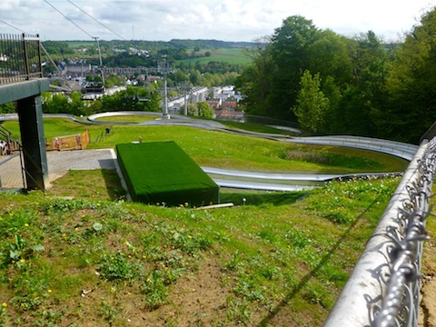
I took a country lane out of Sibbe, back towards Valkenburg’s Kabelbaan tower. Even though the country lanes are paved and narrow, you don’t have to worry much about traffic as they are so little travelled. I only saw cattle. I actually did a little loop around the Kabelbaan — accounting for my extra elevation and distance over the official route — trying to get a good photo of the bobsleddy looking metal chutes.
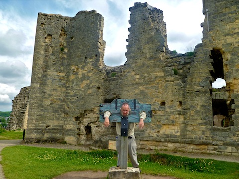
I descended into town, then up towards the castle. It was near 10, and my wife and I were expecting to meet there, but I could not remember if we said 10 or 10:30. I did not see her, so I continued, heading up a side road, then trai, past the ampitheater mausoleum, spa and casino to the Heytgrachtvoetpad, a wide gravel path through another woods. Halfway down the foot path, I expected there to be a side trail to take, but it was barely perceptable. I went up, slipping in the mud, for about a 100 meters before deciding to stick to the foot path. Plus, it was getting close to 10:30. I ended up rushing through a lot of hikes in order to meet my wife somewhere, because I don’t want to end up like this:
So, I hustled back into town along the Plenkerstraat, finishing my hike up at the castle ticket booth. I had a Dutch creamsicle and a “Coca-Cola Light” (their Diet Coke) while we toured. After the tour, we hit Restaurant Row for some food and, more importantly, some delicious Belgian beer. ![]()
GPS File: Valkenburg_Loop
Distance: 6.26 mi.
AEG: 934 ft.
Time: 2h 04m
Hike Video
Valkenburg Castle from Preston McMurry on Vimeo.