
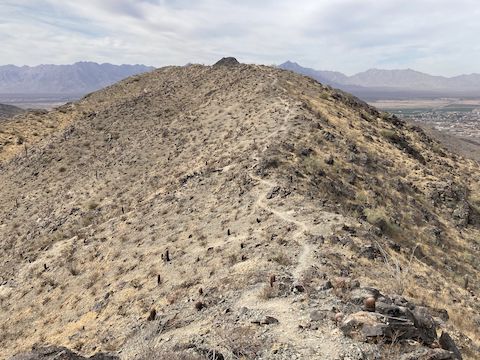
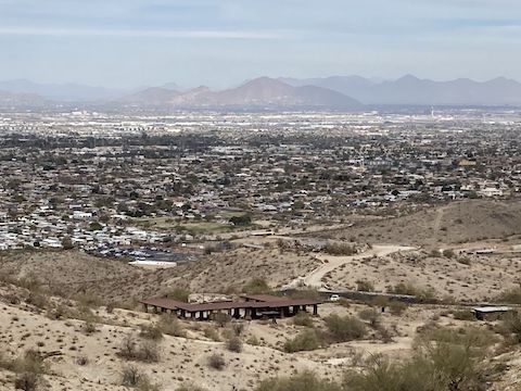
 Shaw Butte, North Mountain, Piestewa Peak, Mummy Mountain, Camelback Mountain and Papago Buttes. Most of the 1,000 ft. Hau'Pal Loop climb is visible.")
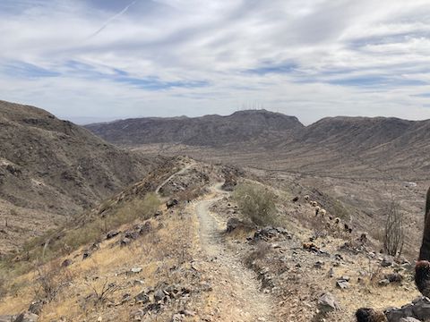
Today, I hiked the first third of Hau’Pal Loop; bits of Alta Trail, Bajada Trail, Max Delta Trail and Crosscut Trail; then finished with the final third of Hau’Pal Loop. That route is 5.5 miles, 1,430 ft. AEG.
Hau’Pal Loop is a 3.0 mile, 1,030 ft. AEG (accumulated elevation gain) hike that starts and ends at the 19th Ave. Trailhead. Despite being an official trail, two-thirds of Hau’Pal Loop is not even shown on the official South Mountain park map. (The other third is mislabelled as “Ma Ha Tauk Trail”.)

I judge “official” by the presence of signs, which are plentiful. Each trail is color-coded: Hau’Pal Loop is green, Alta Trail is purple, Max Delta Trail is light blue, Crosscut Trail is brown, and Bajada Trail is also green. They did not have QR codes. Maybe because cell reception was non-existent even at the top of Hau’Pal Loop, within site of Mount Suppoa’s antenna farm?
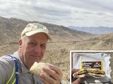
The only flowers I saw was one blooming creosote, when I returned to the 19th Ave. Trailhead. Five of the previous six first weeks of March had plenty of flowers. Only 2021 was the exception, and even that sparse hike had more than today. We need rain soon. (On Friday, after I typed this, South Mountain received 0.35″ of rain.)
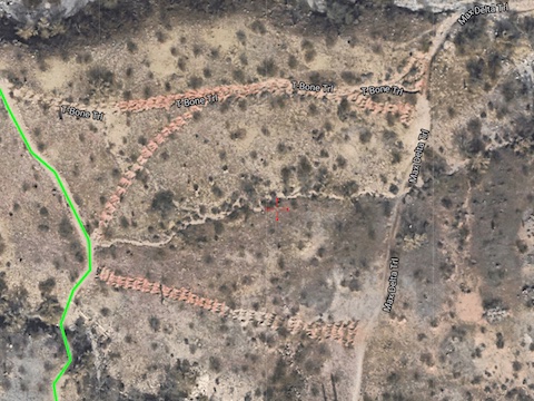
Despite what Google Earth or the park map may claim, on the ground, there is no T-Bone Trail. It, the bottom of Warrior Trail, and various old jeep trails are being remediated, and are posted with various “do not enter” signs.
The 19th Ave. Trailhead has no toilets. The Vista Point / Big Ramada trailhead, inside the park, does. If you hike a lollipop from Vista Point, add 0.6 miles and 200 ft. AEG roundtrip. If you skip Bajada Trail, instead hiking Alta Trail direct to the San Juan Bike Hub, knock 0.5 miles off your expected distance. You could also start at San Juan Bike Hub, but there are no toilets there either. All parking is free.
Directions: The trailhead is at the southernmost end of 19th Ave. Personally, I drove straight down 19th Ave. from Sunnyslope. Bad move. At grade railroad crossing at Lower Buckeye Rd. — right next to a rail yard. Ugh. Fifteen minute delay while they shuffled cars. Instead, from I-17, take exit 196 south onto 7th Ave. In 2.5 miles, turn right on Southern Ave. In 1.0 miles, turn left on 19th Ave. Drive until you can’t go any further (about 2.5 miles).
Park Map: South_Mountain_Park_Trail_Map (pdf)
GPS File: South_Mountain_HauPal_Alta_Bajada_Crosscut
Distance: 5.89 mi.
AEG: 1,443 ft.
Time: 2h 30m
Rumble Video
Vimeo Video
Hiking Hau’Pal Loop, South Mountain from Preston McMurry on Vimeo.