

Sandstone Canyon is a short canyon that starts at Sandstone Tank, and ends only 2¼ miles later at West Leonard Canyon. Sandstone Canyon is dead center on Rim Road, 3½ miles north of Myrtle Point. Sandstone Canyon is flanked to the east by Knoll Ridge, and to the west by Middle Leonard Canyon.
Since my goal is to hike every canyon on the Mogollon Rim, I couldn’t pass this up, but also four miles round trip is hardly worth the long drive from Phoenix. So, after hiking Sandstone Canyon, I figured I would continue down West Leonard Canyon, three miles to where I had previously climbed out. Then I would hike back four miles along FR 295, and possibly FR 9715N.
I was originally going to hike Sandstone Canyon last year, but something came up. I think it was my North Carolina-California trip.
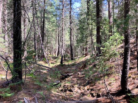
From the trailhead, head west across FR 295. Sandstone Tank is 200 ft. away. From there, follow the low line, off the north side of Sandstone Tank. The first ¾ miles of Sandstone Canyon are easy going. Not rocky. Little understory, other than grass, fallen pine needles, and occasional bracken fern. Few flowers.
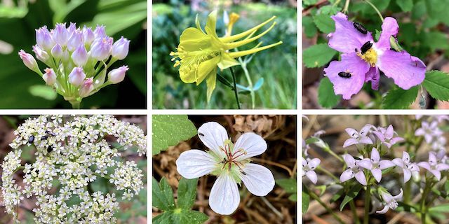
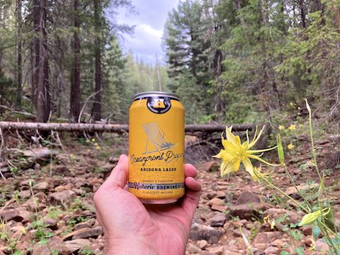
Top Row: Geyer’s onion, yellow columbine, Wood’s rose.
Bottom Row: Parrish’s yampah (?), Richardson’s geranium, pygmy bluet.
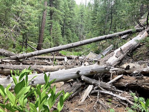
The next 1½ miles are rocky with steady deadfall. Nothing too tangled, or dangerous, but it’s constant up & over, or down & under. There are no shelves to speed your way for a hundred or two yards. However, it is mostly shady. Also, there are more flowers. Not many, but more. Geyer’s onion were most common, followed by yellow columbine. Also spotted alpine false springparsley and dandelion.
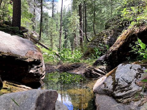
Where Sandstone Canyon meets West Leonard Canyon, there’s a bit of shelf to sit on. At least that part of West Leonard Canyon looks like it has a fair amount of tangley vegetation. I’d started hiking an hour later than intended, at 10:00 a.m. It had taken me 90 minutes to hike the previous 1½ miles. The sky was dark, with distant thunder. Given unknown conditions ahead, I decided to bail. Better safe than sorry.
Before my break, I had identified the east bank of the Sandstone Canyon / West Leonard Canyon junction as a bail point. It didn’t look bad. Not cliffy, no brush or deadfall. But it was steeper than it appeared. Still, I made the 150 ft. to the top in eight minutes. From there, it was easy cross-country for a bit to FR 9715N. I felt occasional raindrops. After a half mile on FR 9715N, I turned right onto FR 295.
The rain increased to the point that at Knoll Lake Rd. I stopped to pull out my trash bag “raincoat”. The problem with a trash bag “raincoat” is it doesn’t breathe, so I got soaked anyway. (From sweat.) Still, it kept my pack dry. Of course, the rain stopped soon thereafter. The thunder didn’t. One crack — there was no flash — was so close & loud I jumped & swore. I finished my hike a mile later, at 1:30 p.m.
I skipped my ice cream stop at Woods Canyon Lake. It started raining again as I approached Star Valley, on AZ-260. When I stopped in Payson for gas, the rain got bibical. Thankfully, it stopped by the time I reached Rye on AZ-87. But in that brief amount of time, Payson received up to 1.78″ rain. That could have been a flash flood in West Leonard Canyon. I chose … wisely.
Directions: From Phoenix, head north on AZ-87, the Beeline Highway, into Payson. Turn right on AZ-260. In 29 miles, after cresting the Mogollon Rim, take the first left onto FR 300 / Rim Rd. 9.4 miles from AZ-260 is a t-intersection. Turn left. (Right is FR 34 to Winslow.) Since late 2024, Rim Rd. pavement ends at MP 31. In just under eight miles, turn right on FR 295, towards Knoll Lake. In two miles, park on the right, opposite Sandstone Tank. Or take I-17 and AZ-260, then drive east on Rim Rd. It’s basically the same time & distance either way.
GPS File: Sandstone_Canyon
Distance: 4.95 mi.
AEG: 354 ft.
Time: 2h 23m
Rumble Video
Vimeo Video
Hiking Sandstone Canyon, Mogollon Rim from Preston McMurry on Vimeo.