
![Confusion was the theme of the day! Sign reads [Promontory "V" Tree]. Supposed location of V62, but etched as "V63". Didn't find any marking on any of the four adjacent large trees -- one broke near base -- and I scanned them 360° all the way up. (In case the mark gained height with tree growth.)](https://prestonm.com/wp-content/uploads/2024/06/IMG_5955-640x381.jpg "Confusion was the theme of the day! Sign reads [Promontory \"V\" Tree]. Supposed location of V62, but etched as \"V63\". Didn't find any marking on any of the four adjacent large trees -- one broke near base -- and I scanned them 360° all the way up. (In case the mark gained height with tree growth.)")
Heading east from Dewey, this is the second part of the 8th segment of General Crook Trail.
The General Crook Trail is named after General George Crook, who surveyed a route between Fort Apache and Fort Whipple, in Prescott, in 1871. As the modern trail makes it’s way east from Ft. Whipple, it is renumbered as it passes through the Prescott National Forest (General Crook Trail #64), Coconino National Forest (General Crook Trail #130) and Apache-Sitgreaves National Forest (General Crook Trail #140). Unnecessarily complicated: The Appalachian Trail isn’t renumbered in every state. 😉
In the early 1970s, the Boy Scouts tried as best they could to retrace the old route, marking it with gabions, cairns, chevrons and mileposts. Currently, no two resources agree on the General Crook Trail’s exact route. Personally, I’m following the chevrons — or pink ribbons and orange ground flags.
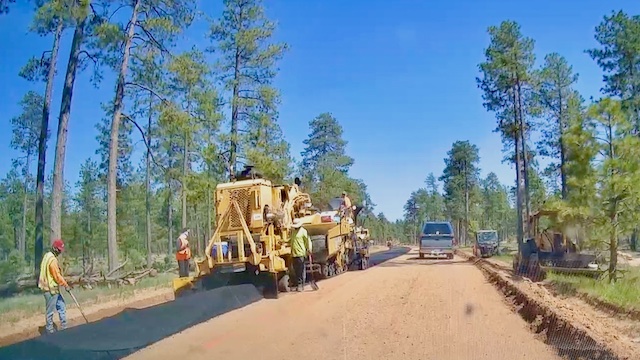
A month ago, I mentioned Rim Rd. / FR 300 has a road project going on west of Woods Canyon Lake. I thought the crew was just widening and smoothing the dirt, but instead they are actually paving it. Flag guy at one ends said “It is going to the ‘Y’ intersection”. (6 miles to FR 195 or 7 miles to FR 34?) I’ve also read the asphalt is going to the Bear Canyon Lake road (10 miles to FR 89). Flag guy at the other end said the blacktop “is going to Strawberry” (40 miles). No matter what … THIS SUCKS! 🤬
Anyway … the hike.
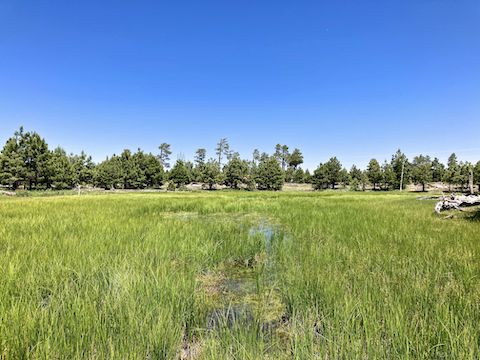
I started at 9:30 a.m. Cloudless sky. Already getting warm. Less breeze than expected on the Rim.
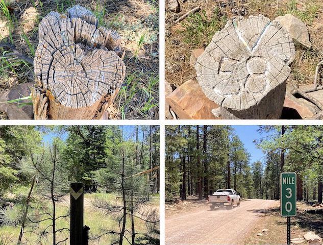
First order of business was another search for V57. I spent 10 minutes fruitlessly wandering its claimed location. Instead, I found V57 400 ft. north, on the east side of Rim Road. Note, the 24″ high, 4″ diameter, log with the faded white mileage etched into the angled top is also 150 ft. west of the chevroned General Crook Trail. Odd.
I followed the chevroned trail back to FR 115. I did not see any chevrons anywhere near the intersection, or up FR 115, so I walked southeast on Rim Road. In 300 yds., I found a chevron leading north, off Rim Road. I followed those chevrons, and the occasional bit of flourescent tape, southeast for the next 1¾ miles to a pair of “no camping” carsonite posts.
Because chevrons sometimes go missing, I hiked slowly, constantly scanning left & right, high & low, for mile markers. That’s how, a half mile into this segment, I spotted V58 from 150 ft. away, on the south side of Rim Road, where it crosses under the powerlines. Cripes. It was a pattern: I would not only have to hike the General Crook Trail, but also regularly divert off it searching for V posts. 🤦🏻♂️
This segment crosses to the south side of Rim Rd. at the 1½ mile mark, then crosses back to the north side 200 yds. later. The road bend that the chevrons cut across is where I estimate V59 is actually located. It certainly wasn’t on the trail itself. I followed chevrons until the 2 mile mark, where General Crook Trail appears to follow Rim Road. (On which I didn’t see another chevron for a quarter mile.)
After a half mile on Rim Road, 2½ miles into this segment, I reached the green “Mile 30” road marker. (Rim Road measures mileage west-to-east.) Still constantly scanning, and despite the presence of chevrons indicating I was “on trail”, I did not encounter Boy Scout marker V60. You can see why I hiked nearly eight miles on a five mile General Crook Trail segment. 😏
At the 3⅓ mile mark, General Crook Trail follows chevrons north, off Rim Road, for 150 yds. before crossing to the south side of the road. Based on V60’s estimated location, that skipped bit of Rim Road is probably where you’ll find V61: It definitely wasn’t where it was previously mapped on FR 76 (Promontory Butte Road). In ten minutes searching, all I found was a lean-to and flowers.
This General Crook Trail segment had multiple nice clusters of pygmy bluet, Wootan’s Ragwort, and spreading fleabane. I found several clusters of Lemmon’s Star: Supposedly rare, this is the third straight year I’ve found them on the Mogollon Rim. At one point, sitting on the ground, I could literally reach out & touch goldenbanner, yellow columbine and Canada violet. (More high country flowers.)
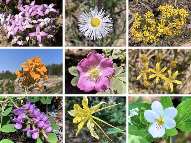
Top Row: pygmy bluet, spreading fleabane, Wootan’s ragwort.
Middle Row: western wallflower, Wood’s rose, Lemmon’s star.
Bottom Row: American vetch, yellow columbine, Canada violet.
From the claimed location of V61, I followed FR 76 for a hundred yards, then crossed to the north side of Rim Road, following chevrons for a half mile. General Crook Trail crosses Rim Road, again, at the 4⅓ mile mark. One of many confusing signs, a new-ish one indicates Carr Lake Trailhead is 4.5 miles to the left, while General Crook Trail #140 is … I guess straight? There is no arrow. 🤷🏻♂️
In 100 yds., what was a jeep trail ends in a small loop. That’s the upper trailhead for See Canyon Trail #184. General Crook Trail splits left as singletrack. At the 4½ mile mark, there is a right-pointing chevron. Given previous estimated V locations, that’s about where V62 should be. It wasn’t. Nor was V62 anywhere in the vicinity of the Promontory “V” Tree a quarter mile later. (See the lead image, above.)
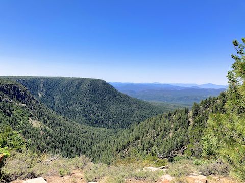
I suppose V62 could also be on the road, but it since Promontory Lookout was only a few minutes away, I instead headed for the finish. I suppose I ought to drive Rim Road soon, just to look for General Crook Trail markers, before they pave paradise and put up a parking lot.
FR 115 Directions: From Phoenix, head north on AZ-87, the Beeline Highway, into Payson. Turn right on AZ-260. In 29 miles, after cresting the Mogollon Rim, take the first left onto Rim Rd. / FR 300. In 3.2 miles, at the Woods Canyon Lake intersection, Rim Road changes to car-drivable dirt. (As of June, 2024, the next several miles are being paved.) 9.4 miles from AZ-260 is a t-intersection. Turn left. (Right is FR 34 to Winslow.) After 2.3 more miles, pass by Promontory Lookout. FR 115 is 5 miles past that.
Promontory Lookout Directions: From FR 115, double back east 5 miles on Rim Rd. / FR 300.
GPS File: General_Crook_Trail_V57_V62
Distance: 7.81 mi.
AEG: 543 ft.
Time: 3h 20m
Rumble Video
Vimeo Video
Hiking General Crook Trail: V57-V62 from Preston McMurry on Vimeo.