

It’s been seven years since I last hiked the Pinaleno Mountains (Cunningham Loop #316). I’d look at Mount Graham, and it’s surroundings, trying to find something for our annual April trip to Thatcher, but nothing hit my sweet spot. Everything was either too short, or too long with too much AEG (accumulated elevation gain). Finally, literally the night before we left, I came up with this loop.
From Hospital Flat Campground, walk south on Swift Trail / AZ-366 for a mile. Where the dirt changes back to pavement, there is a pullout on the east side of the road. You could also start at the pullout, but my non-hiking wife stays behind and the campground has a pit toilet. (Plus grills and picnic tables.) The campground has an $8 day-use fee, but we have an $80 senior lifetime pass, so it was free.
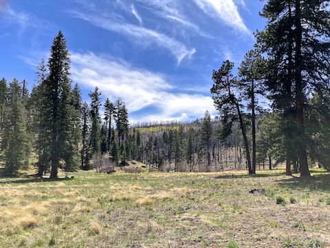
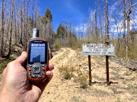
The pullout is the bottom of Graham Ridge Trail #507. Also known as High Peak Road #507, or simply FR 507 — because it is a Coronado National Forest road. A pretty decent one. You could drive your car on FR 507, if not for the locked steel tube gate, 150 yds. up it. FR 507 runs five miles from AZ-366 to the summit of Mount Graham. FR 507 has nice views of Heliograph Peak and down Marijilda Canyon.
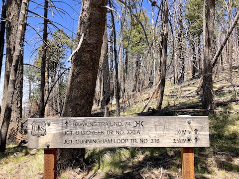
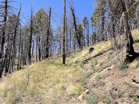
Graham Ridge Trail #507 is a 3.4 mile, 580 ft. AEG round trip, from the pullout. There’s decent spot shade from pine that survived 2017’s Frye Fire. Instead of heading all the way down, I backed up 0.3 miles to a wood sign board that claimed Hawkins Trail #74 lay along my planned route to Big Creek Trail #320A. On satellite view, I’d seen something in the burn scar, but wasn’t sure. So, this was good news!
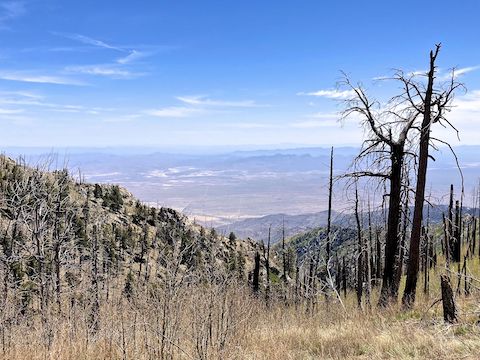
I searched all around the sign, and could not find anything even resembling a trail. Oh well. It’s only a half mile, right? It took me 80 minutes to hike it. Despite working the 6630 ft. contour line, the side sloping took a lot of work, due to deadfall and being steeper than it appears in that photo. Tumbling wouldn’t have been fatal, but it would have been less than positive. Hiking poles really helped.
There was another somehow unburned wood trail sign at the end of Hawkins Trail #74. Left, Big Creek Trail #320A was more old road bed down to AZ-366; right also #320A, but blocked by jillions of young post-Frye Fire aspen. I could have negotiated my way through, but it’s only ⅓ mile up to the red squirrel zone, so not really worth it. (And 100 yds. past that to Graham Ridge Trail #507 — a now illegal loop.)
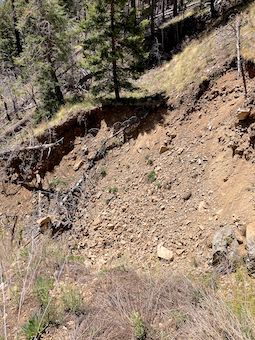 I strolled down Big Creek Trail #320A for ⅓ mile, until I encountered the monster washout you see on the right. Very steep on the far side of Big Creek, it was vertical on my side. There were no use-trail workarounds, like where FR 95 previously crossed Bear Canyon. Well, fudge. What now?
I was under the impression there would be a very tight left-hand switchback on the far side of Big Creek, which implies a second Big Creek crossing to get back to the lower part of the old roadbed I was on. I could also see similar old roadbed extending north, from the far side of the washout.
I slowly backed up 150 yds. until I found a way down. It was steep, and loose, and had big rocks I did not want to kick loose, but at least I could butt-scootch the 30 ft. down. Mission accomplished, I was back on Big Creek Trail #320A.
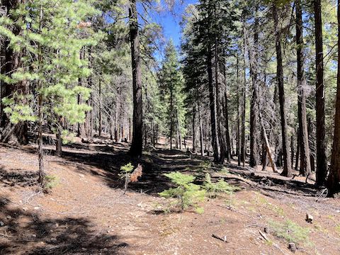
As it was higher up, Big Creek Trail #320A had a flat, grassy, old roadbed occasionally crossed by deadfall. Nothing too difficult, and much easier than bushwhacking down Big Creek itself, or off a Hawkins Trail #74 spur. Big Creek Trail #320A was a pleasant stroll down a shady, unravaged, canyon. I did not lose the old roadbed until maybe 200 yds. from AZ-366, and by then it did not matter.
Once back on AZ-366, it’s just north around the curve to Hospital Flat. The lower portion of Big Creek Trail #320A, would be a nice family hike, 2.2 miles, and 500 ft. AEG from Hospital Flat Campground. Only strong hikers should attempt the full loop, including Hawkins Trail #74, and even then they should only do it counter-clockwise. It was an adventure!
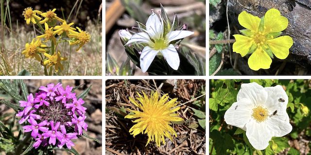
Top Row: Wootan’s ragwort, spreading sandwort, cinquefoil (not sure what kind).
Bottom Row: Chiricahua Mountain mock vervain, dandelion, New Mexico raspberry.
Directions: Whether you take US-70 across the San Carlos Apache Reservation, or take I-10 through Tucson and Willcox, you will find yourself on US-191 (formerly the “Devil’s Highway”, US-666). Just south of Safford, split west onto Swift Trail / AZ-366. From US-191, it is 22.8 very twisty miles to Hospital Flat Campground. Mind your speed: From US-191 it takes an hour. The final mile is car-drivable dirt.
GPS File: Mount_Graham_Trail_507_74_320A_Loop
Distance: 5.94 mi.
AEG: 932 ft.
Time: 2h 51m
Rumble Video
Vimeo Video
Hiking Pinaleno Mountains Loop, Coronado National Forest from Preston McMurry on Vimeo.