
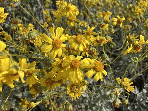
, an invasive species from South Africa, has become widespread in Maricopa County over the last 15 years. Stinknet was the most common flower in Reach 11.")
There’s a good decription of the overall Reach 11 Recreation Area from when I biked the west end last year, so I won’t repeat it, except to note the two ends do not have a safe means of crossing busy Tatum Blvd. It’s odd: There’s canal-side tunnels or underpasses many other places in Phoenix, including all along the Arizona Canal, which I rode yesterday. But not at Reach 11. No. It’s fenced off. WTF!? 🤷🏻♂️
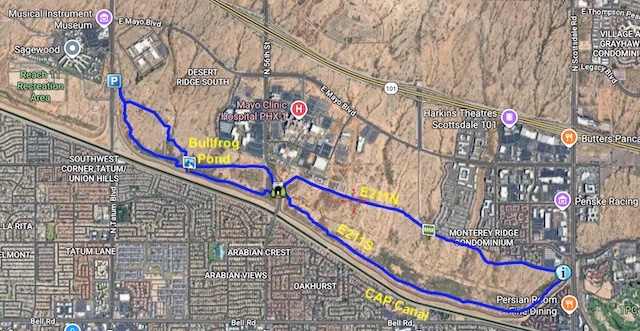
The east end of Reach 11 Recreation Area has a web of trails: The official park map lists eight named trails: Jackrabbit Trail, Barrier Free Nature Trail, Coyote Trail, Javalina Trail [sic], Tatum Loop, Badger Trail, Bobcat Trail, and Ringtail Loop. Plus E211S and E211N.
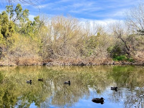
Barrier Free Nature Trail is a paved 1.8 mi. lasso. Horses and mountain bikes are not allowed on pavement, but Barrier Free Access Trail, as it is also known, has an adjacent dirt path. Barrier Free Nature Trail has signs for mourning dove, gray fox, raccoon, javelina, bur sage [sic], creosote, desert cottontail, blue palo verde, and maybe others. Bullfrog Pond is the highlight. 🐸
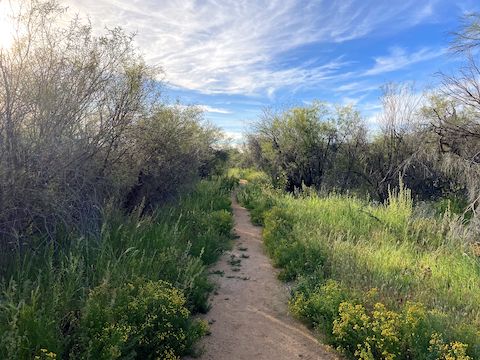
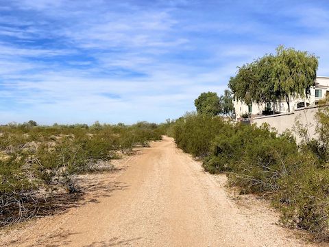
Signage is inconsistent, with many old signs sprinkled in. Generally speaking, I followed the E211S and E211N trails counter-clockwise, a 7.4 mi. loop with no detectable elevation change. Regardless, you would have to really put some effort into getting lost, as roads or buildings are never more than 300 yds. away, and usually a lot less. There’s no toilets, and few places to hide.
East of 56th St., I noticed some of the trail poles had shiny animal stickers. Apparently just trail graffiti, as the animals did not appear to match the trail names. Some of the other poles had mileage on them, painted over and hard to read, counting up on one side, down on the other, and always totalling 4.3 mi. — the distance of the loop between 56th St. and Scottsdale Rd., both of which are locals access only.
There wasn’t a lot of foot traffic today. Two ladies passed me while I was taking flower photos. I’m a fast walker but, mindful of the Heike murder, I walked slow, and took more photos, so I wouldn’t catch up. Didn’t want them to be concerned. No horse riders. I recall no dog walkers. Saw a hummingbird in a palo verde, a few lizards, a northern flicker nest building in a saguaro, and ducks in Bullfrog Pond.
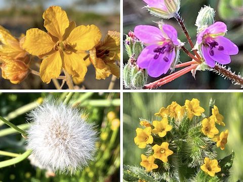
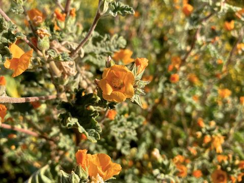
Reach 11 Recreation Area isn’t a destination hike, and isn’t exciting, but is a decent leg-stretcher, with some wildlife potential. If there’s ever a solid winter monsoon, followed by middle heat, the flowers — especially desert globemallow — will be top notch.
East Trailhead Directions: There are two trailheads on Tatum Blvd., just north of the CAP Aqueduct, between Union Hills Dr. and the Loop 101 freeway: This is the one on the east side of Tatum Blvd. The trailhead on the other side accesses the west end of Reach 11 Recreation Area. There is no tunnel under heavily-trafficked Tatum Blvd., which also has guardrails, so making a mad dash across is … dangerous. Pick one side or the other.
Park Map: Reach_11_Recreation_Area_Trail_Map (pdf)
GPS File: Reach_11_Recreation_Area
Distance: 8.40 mi.
AEG: 101 ft.
Time: 2h 53m
Rumble Video
Vimeo Video
Biking Reach 11, Phoenix from Preston McMurry on Vimeo.