

Johnson Creek starts at the base of Hearst Mountain, three miles north of Williams. Johnson Creek winds westward for 20 miles, ending a mile south of Ash Fork, at Ash Fork Draw. The creek’s middle 12 miles pass through Johnson Canyon, beginning at McClellan Reservoir and ending just past Stone Dam and Steel Dam. (That’s their names, and a nearby short hike.)
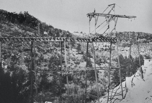
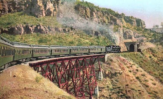
The Atlantic and Pacific Railroad built a line along the 35th parallel, west from New Mexico to California. Construction arrived in Williams in September, 1881. To avoid building miles of extra track, the A&P instead chose to run it’s line through Johnson Canyon. That necessitated building two trestles, and the only tunnel on the line: The 328-foot Johnson Canyon Railroad Tunnel.
Driving from Phoenix takes as long, whether you go through Flagstaff or Prescott. So, my wife & I took the latter route, scooping up my hiking buddy Prescottstyle along the way. Chino Valley and Paulden have certainly grown since I last drove AZ-89 40 years ago! We made one wrong exit on I-40, but once we got off at Corva Rd., we drove right to Welch Siding. (The GPS file below has the correct route.) Cars should park before Johnson Creek — it only adds a mile each way — as the crossing is rough.
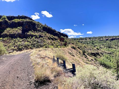
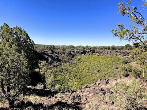
The 2.3 mile hike to Johnson Canyon Railroad Tunnel begins at Welch Siding, two miles north of I-40, near Johnson Crater. All that remains of Welch Siding is a foundation, and scattered garbage. You can shave some distance off your hike by parking just before the pile of rocks in the cut at 0.6 miles. Being a rail trail, the path is flat, mostly obstacle free, and the elevation gain barely noticeable.
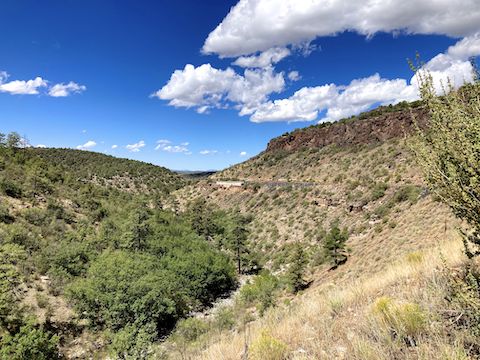
The hike to Johnson Canyon Railroad Tunnel has been thoroughly picked over. Still there are some artifacts here & there: a spike, a splice bar & fish bolt, signal station bases, etc. Johnson Canyon itself is verdant, yet the creek is quite rocky, full of ankle breakers. Might be some artifacts down there, since trains were known to derail in Johnson Canyon. If you’re interested, hike it back to Welch Siding.
The wind, blowing down canyon, accelerated through the Johnson Canyon Railroad Tunnel. Approaching the west portal was like being sandblasted. Inside, there’s no need for a flashlight. Though curved, I could see glow at the far end. Lots of graffiti, but just old, cheap, tags. I went 300 yds. past the east portal: It looked like more of the same, so I turned around. Meantime, Prescottstyle had been exploring the WWII guard station atop the tunnel.
Enjoyable day, in a new part of Arizona for me. Already considering doing it again, on a mountain bike, out & back to Williams!
Welch Siding Directions: From I-40, west of Williams, take exit 151, north onto Corva Road / FR 6. From there, you’ll want to follow the attached GPS route. Only the first two miles are car drivable dirt. Crossing Johnson Creek, and driving up the side of Johnson Crater, is for SUVs or better. After 2.8 miles, you will cross the old right-of-way at Welch Siding. Park wherever.
GPS File: Johnson_Canyon_Railroad_Tunnel
Distance: 5.97 mi.
AEG: 356 ft.
Time: 2h 24m
Rumble Video
Vimeo Video
Hiking Johnson Canyon Railroad Tunnel from Preston McMurry on Vimeo.