This week is my third of likely ten 2021 Wildfire Season forest closure hikes: Five of Arizona’s six national forests, plus all BLM and Arizona State Trust land, are closed until at least September 1st, due to wildfire threat. Other than shoplifting a piece of penny candy — I am that old — when I was eight, my criminal record is clean and I prefer to keep it that way.
To keep from doing something in Prescott for the third straight week, this week I ventured even further north, to Flagstaff. Every hike I’ve done up there — other than walking 10 miles to work in Bellemont one snowy morning — has been on currently closed Coconino National Forest land. 🔥🚫
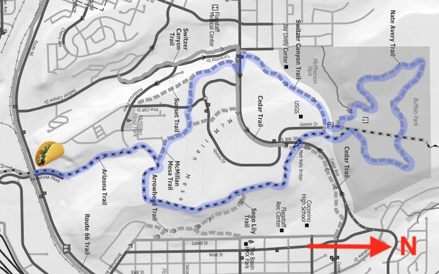
Though I lived in Flagstaff for five years, I never hiked in Buffalo Park. Thankfully, the Flagstaff Urban Trail System (FUTS), is not shut down, at least on McMillan Mesa. The Nate Avery Trail is only a two mile loop, so to add distance I figured I would hike up from Agave Mexican Restaurant on Route 66. (And relax with some cerveza fria afterwards.)
Turns out that the Coconino National Forest lifted their closure order on Tusday morning. That was quick! But with other things to do during the week, like pay bills, I decided to stick with my Buffalo Park & McMillan Mesa plan rather than change it.
The basic loop around Buffalo Park on the Nate Avery Trail is 2.0 miles, 110 AEG (accumulated elevation gain): Flat, other than a steep, but very short, climb just west of the Buffalo Park Trailhead. A loop around McMillan Mesa on McMillan Mesa Trail, Arizona Trail Passage 33 and Switzer Canyon Trail is 3.0 miles, 170 AEG. Taking Oldham Trail #1 from the Nate Avery Loop out & back to the natural gas line on the edge of the Coconino National Forest adds 0.3 miles, 0 AEG. Hiking up from Agave Mexican Restaurant adds 1.5 miles, 150 AEG, round trip. To get some drive time ROI, I did them all. 💪
My wife & I made good time driving up from Phoenix, so I started hiking at only 8:05 a.m.
From Agave Mexican Restaurant, I took the sidewalk north along Ponderosa Pkwy. Just past the fire station, the sidewalk bends left, away from the road. In 200 ft., the trail splits: Left is a driveway; stay right on the Arizona Trail, which climbs 150 ft. in the next ½ mile to the top of McMillan Mesa. (Other than crossing Ponderosa Pkwy., this section is only real shade on this hike.)
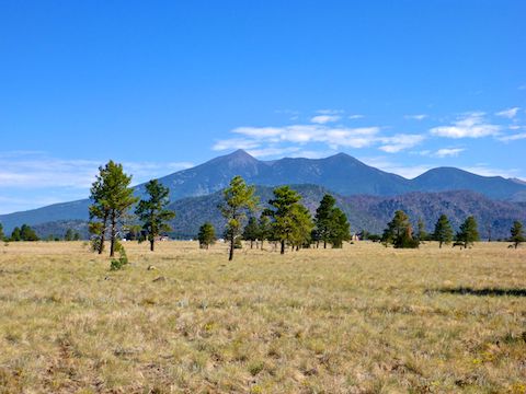
At the top of the climb, is the McMillan Mesa Trail. A loop, I went right, counter-clockwise, to stay on the Arizona Trail. The interior of McMillan Mesa is prairie, dotted with ponderosa pine, gambel oak and alligator juniper. There’s good spot shade, but if you are moving, it only lasts a split second. ☀️
The Arizona Trail passes by a church, before turning north. There are four benches in the next 1¼ miles, with scenic views of Mount Elden, Agassiz Peak, Fremont Peak and/or Doyle Peak. Unfortunately, there’s quite a bit of construction near the electrical substation. Coconino High School, where I used to coach a pee-wee football team in the mid-80s, is below the substation.
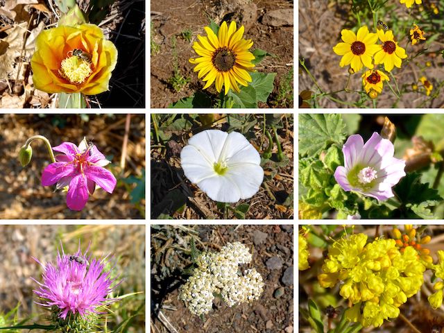
Top Row: twistspine prickly pear, prairie sunflower, calliopsis.
Middle Row: pineywoods geranium, field bindweed, common mallow.
Bottom Row: Wheeler’s thistle, western yarrow, sulphur buckwheat.
Two miles into the hike, the Arizona Trail crosses the Matt Kelly Urban Trail Bridge over Cedar Ave. Just beyond the bridge is the Buffalo Park Trailhead, which has a picnic cabana, three coed restrooms with running water, a bike rack, multiple benches, info signs, and all the other usual developed trailhead amenities. I saw no garbage, but it’s worth noting, both McMillan Mesa Trail and Nate Avery Trail have garbage cans dotted along them.
It’s no surprise Nate Avery Trail is the most popular trail in Flagstaff, there were many dog walkers, mountain bikers, trail runners, and old people gaggles following it around Buffalo Park. In a pleasant departure from the Phoenix Mountains Preserve, all the mountain bikes were polite, and all the dogs leashed. 🐶
Nate Avery Trail has mileage markers every ¼ mile. Just past the second marker, Nate Avery Trail re-crosses the Arizona Trail. After checking out the natural gas line, and the beginning of Oldham Trail #1, I continued around Buffalo Park. Around the 1¼ marker, there remains of some curious stone and cement structures, that look like ranch remains.

Back at the Buffalo Park Trailhead, I turned down Switzer Canyon Trail, past the McPherson Park disc golf course, ⅔ of a mile to Forest Ave. (Use the crosswalk.) I turned left, 150 ft. up the sidewalk, then at the top turned right onto McMillan Mesa Trail. 300 yds. south of Forest Ave. is the memorial for the McMillan Mesa mid-air collision.
Just south of the memorial, McMillan Mesa Trail splits left, passing east through a small retirement community. After crossing Pine Cliff Dr. McMillan Mesa Trail closes it’s loop back at the Arizona Trail. On the way back down the AZT, I took short sit down break in the shady area. 🌲
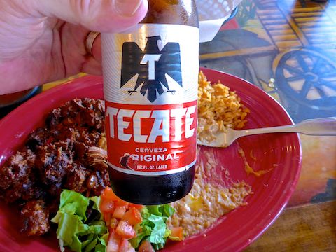
I met my wife back at Agave Mexican Restaurant at 11:20 a.m., where I proceeded to rehydrate with a pair of Tecates. The chile colorado was so delicious, I couldn’t help but finish my plate. No leftovers!
FUTS Map: Flagstaff Urban Trail System Map
GPS File: Buffalo_Park_McMillan_Mesa_Lasso
Distance: 7.39 mi.
AEG: 417 ft.
Time: 2h 26m
Hiking Video
Buffalo Park & McMillan Mesa, Flagstaff from Preston McMurry on Vimeo.
