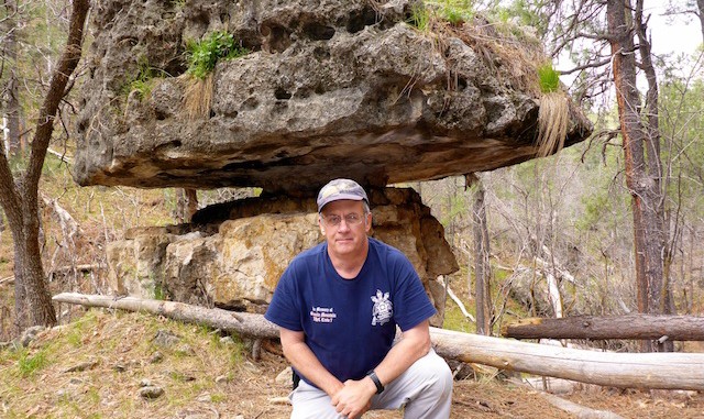
I try to divide my summer time between west and east uplands. Problem turned out to be, it’s not quite summer.
I saw my jacket. I thought about taking my jacket. I decided to leave my jacket behind. After all, last week in Prescott was warm and sunny.
Heading north out of Ft. McDowell, the clouds had let some sun through, which put a shimmering gold curtain in front of Four Peaks. I passed a number of bicyclists, and one SAG wagon, on the miles before the first climb. Later, on the way back, particularly from AZ-260 to Payson, there were dozens of bicycles heading north, most without blinkers, headlights or reflective gear. (In the by then pouring rain.) RAAM isn’t until June, so no idea what was going on.
FR 616 is smooth, but somewhat rocky. It is car drivable to within 200 yards of Pivot Rock Spring.
It was 41° and overcast when I parked off FR 616 in Clover Canyon. I hiked the loop clockwise. Maybe 15 minutes after I set out, it started raining. Not just drizzling. Raining. I thought about turning back. I searched my pack for the Dollar Store “poncho” — really, an especially thin & cheap garbage bag with head & arm holes — which I thought I had. Like I tell my wife, “Don’t think: Know.” (I’m a regular Mr. Miyagi.) I sheltered next to a large pine, face-to-wood, to maximize cover, as standing pack-to-wood would have put me in the rain.
I could hear Pivot Rock Spring before I saw it. Inside, the cave is too small to sit up. I got my rear wet crawling inside. Not that I needed to, because the sun had come out, as it threatened to through most of the morning.
A foot trail led north down Pivot Rock Canyon for about a mile. The canyon was lush, and the water flowing. There are dozens of creek crossings. Just before the first (?) cabin, it turns to old / illegal jeep trail, which continues for several hundred yards after turning south off Tom’s Creek.
The west-east segment at the north end of the loop is rocky, but golf ball-sized, not ankle breakers.
Just after turning south, I started getting pelted. I thought “That’s some hard rain.” Then I realized it was not rain, it was hail. Yahoo. I carried on. It ended after about 10 minutes.
The unnamed canyon was the only real climb of the day, about 400 AEG in .6 miles. Walking at the center bottom of the canyon was actually not bad at all. Less brushy than side-sloping. Only a few logs to step over — which is true of the whole loop.
At the top of the unnamed canyon, at FR 9385J, it started raining again. I had planned to off trail back to my car, but instead took FR 616. For .75 miles, I would walk a hundred yards, then jog a hundred yards. In 4.5 hours, I had only consumed one bottle of water and half a bottle of Gatorade — maybe 40% of my normal liquid intake.
GPS File: Pivot_Rock_Canyon
Distance: 8.01 mi.
AEG: 1,001 ft.
Time: 3h 13m
Hike Video
Hiking Pivot Rock Canyon from Preston McMurry on Vimeo.
