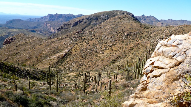
Was looking for something to do this weekend, and hiking the ridgeline to Hill 4053, above White Canyon, is what I came up with. Checked with mnlumberjack, Grasshopper and CannondaleKid to see if they were interested, as all had been in the low parts of White Canyon. Everybody was busy, but each had some good advice, so I ended up going it alone. (Other than my wife in the Mazda 3 “support vehicle”.) Both my original start points looked impractical, especially the BM at the Hwy 177 saddle, so I started from in between them, from that pull out on the east side of the highway. I had planned for a very generous 1.0 mph average, which turned out to be wildly optimistic.
All the hillsides and washes in this area are actual real dirt, not hard pack like most of the rest of the state. Steep climbs and loose dirt made for slow, zig-zaggy going. Not to mention the abundance of prickly plants, and dead century plant step-overs. I eventually got to the point, after several hours, where I resorted to crunching through the dead centuries, dead prickly pear piles and even living cactus of a type I’ve seen many times but can’t name. Leave no trace became, tough luck dude, you need to die. My wife was still picking pricklers out of me at 8pm.
I found the Lime Point BM under a bush, by some barbwire and boards. Like maybe someone had fenced it off at one point. Could see Picketpost and Weavers Needle. Turned to head south, and realized what looks navigable on the topo is no such thing on the ground, it was razorback ridge down to where I had planned to take some pictures of the Ray Mine. Worked my across the east slope of the razorback, and then it was deceptively smooth sailing to my OP. I then planned to head west to 4053, but was blocked by a 50-60 foot down cliff. I could go right (north) or left (south). I chose to go left descending into a prickler-thick wash. (I lost count of how many times I was stabbed by agaves: By the end of the day, I had little red spots all over my pants legs.) When I got to a flat area at the bottom of the wash, I had been hiking three hours, and 4053 was still over a mile away as the crow flies. With a budget of six hours, and likely just as rough terrain ahead, I decided to bail.
I knew if I headed north, up another short wash, I should not be far from the FR, so that’s what I did. By lucky coincidence, where White Canyon begins, said jeep trail turns up a slope that happened to also be the one I was descending. Praise Jeebus! By the time I hit the jeep trail, I was exhausted, but I could not rest because every time I stopped by left quad would seize up and my right toes would cramp so bad they were curling under my feet … or trying to. Total time out was 5:09, 2:31 of that walking. (The rest being route finding.) First stop back in Superior was the gas station for two 40oz fountain drinks, which I guzzled on my way to post-hike Shiners at TexAz.
In summary, I think laid down a good route to the Lime Point BM, but traveling the ridgeline is not the most efficient way to peak Hill 4053. (But then taking the CannondaleKid route would be incredibly steep. ![]() )
)
Distance: 4.11 mi.
AEG: 1,506 ft.
Time: 2h 31m
