

Got a bit later start than normal, leaving home at 5:15 a.m., rather than starting my hike at that time, in order to finish my hike after the west valley rush hour. (If I had finished earlier than 9:00 a.m., I would be stuck in the middle of it, coming back into Phoenix.) As it was, I had to dodge a major accident, two cars totalled in the middle two lanes of west bound I-10, around 43rd Ave. Did not see anyone in the car, and no cop or tow truck in sight. It was just … there. Some aspiring Psych PHD should do her thesis on whether Phoenix traffic causes PTSD.
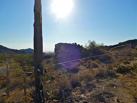
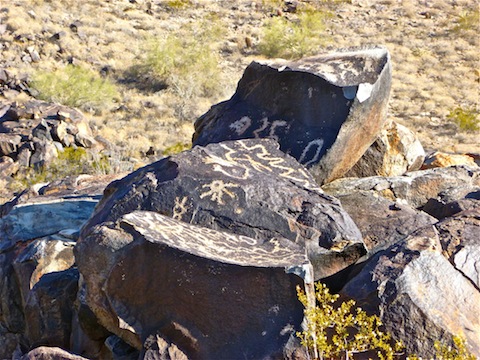
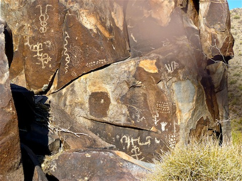
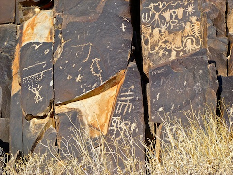
Anyway, got to the trailhead and discovered there were no facilities, not even a garbage can. (Or, perhaps more importantly, no doggie doo station.) Proceeded up the wash for a few minutes, then provided some brush with much needed liquid refreshment. I was considering whether to continue in the wash, or head up the embankment to the jeep trail, but stayed in the wash until I unexpectedly came face-to-face with a rock wall. I started going up the middle, but decided even though it is not that high that my non-technical self did not want to risk doing a Ralston. I went north up an easier route, then cut back across the top of the wall to the petroglyphs. I took lots of pictures, then went looking for a good route up Peak 1976.
There really is none, so it was slow going up the mountain’s north face. (Sounds very Eiger-ish doesn’t it?) There’s actually a few small flat spots on the slope, but there are also some boulders, and plenty of cactus. I took my time mostly to avoid any serpentine encounters. I got to the top at 2025 feet, just northwest of Peak 1976. (A false peak.) Watched a raptor flying below me, while Luke AFB fighters roared overhead. Pretty cool.
Up to that point, I had been considering combining Patrick L’s Peak 1976 and Peak 2212 routes into one large loop. But going off trail up Peak 1976, and looking across the valley to doing more of the same up Peak 2212, I decided instead to bail. (If there had been an established trail I would have done it, but having to bushwhack, I decided doing just one hill was the wiser choice.) I went east off the hill to a foot trail a couple hundred feet down. I started down the foot trail, and soon the bottom of my right hiking shoe got all stabby. Took off my shoe to find all kinds of cholla needles jammed into the sole. It took awhile to remove them, as they were remarkably tweezers resistant. I got back down to the main east-west jeep trail, then headed east back to the trailhead. Good thing too, as it was warming up quick.
Distance: 4.24 mi.
AEG: 849 ft.
Time: 1h 46m