

After trick-or-treating in Hagerstown with our grandaughter Boo last night, my wife & I drove down to the C&O Canal so I could work off some bite-size Twix & Snickers hiking the tow path.
Last year, I hiked milepost 61-69, from Maryland Heights to Antietam Aqueduct. Continuing northwest, this year I hiked milepost 69-77, from Antietam Aqueduct to Snyders Landing. 🛶
There is very little elevation gain on the C&O Canal towpath, even hiking ‘uphill’: The eight miles from milepost 69-77 only gain 55 ft. (My 275 AEG on the day, is due to climbing down to the Potomac River, or up to Killiansburg Cave.)
So, hiking the C&O Canal either direction saves no appreciable effort. Besides hiking south, other options for those without a shuttle driver like my wife, include hiking Antietam Aqueduct to the Rumsey Bridge trailhead (6.6 mi.), Snyders Landing to the Rumsey Bridge trailhead (8.4 mi.), or vice versa on either.
Doing the whole shot, milepost 69-77, takes you clockwise around Sharpsburg, on whose outskirts the Battle of Antietam was fought on September 17, 1862. Driving to either Antietam Aqueduct or Snyders Landing will take you past numerous historical markers related to the bloodiest day in American history. Freedom isn’t free.
I didn’t start hiking until 8:35 a.m., as we stopped at the Waffle House on MD-65 for breakfast. There were no chair-throwing brawls to keep us entertained while we waited seemingly forever to place our order. ⌚️
The quarter mile section of the C&O Canal between Antietam Aqueduct and the campground was filled with water. The remainder of the old canal bed varied from dry to soggy, depending on how exposed to the sun a section is.
The Antietam Creek Campground has 20 numbered spots, each with a firepit, grill and picnic table. The campground has a well handpump, pit toilet and several portapotties. The fee is a whopping $20/night and stealth camping is illegal. 😇
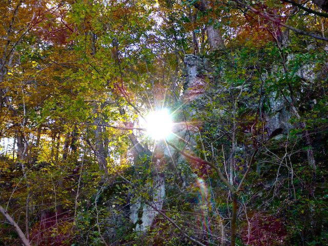
Speaking of sun, there was precious little of it during my hike. Other than the 1.5 miles between Packhorse Ford and Rumsey Bridge, I had to fight overcast for decent, well-lit, photos. 🌥
Another problem was the fading fall color, a situation foretold on our pre-Halloween ride on the Maryland Western Scenic Railroad to the Frostburg turntable. There were no red leaves, precious little orange, and the yellow leaves were falling like snow. Brown predominated.
I was hoping the lower elevations around Sharpsburg would still hold some color, but for the most part there was scant fall color. The area around Killiansburg Cave had the best color, but I was a good week past peak. 🚫🍂
The fallen leaves were all over the C&O Canal towpath, which is on the berm separating the old canal bed from the Potomac River. The hard packed gravel & sand make for good pace. It is only muddy where bicycles have dug ruts in the wet surface.
Between Antietam Aqueduct and Rumsey Bridge, the north side of the C&O Canal is paralleled by Canal Rd. From Rumsey Bridge to Snyders Landing, the side opposite the towpath is bluffs & cliffs.
Just short of Packhouse Ford, on the other side of Canal Rd., there is a large, sloped lawn. At the bottom of the hill is a pond, and atop it is the Conococheague Sportsmens’ Club. Thankfully, despite the presence of numerous loud geese, the firing range is in back.
Packhouse Ford, also know as Boteler’s Ford and Blackford’s Ford is a rocky, hip-deep (under normal conditions), Potomac River crossing used numerous times during the Civil War, when the Union was invading Virginia, or the Confederates were invading Maryland. I’m not sure why neither the Union nor Confederates protected their side with an infantry brigade and several artillery batteries to prevent a crossing. I sure would not want to wade the Potomac River under fire. Heck, a single Confederate regiment prevented Burnside’s corps from crossing the considerably smaller Antietam Creek for the better part of a day.
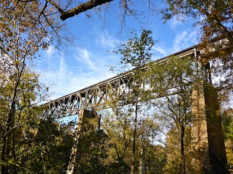
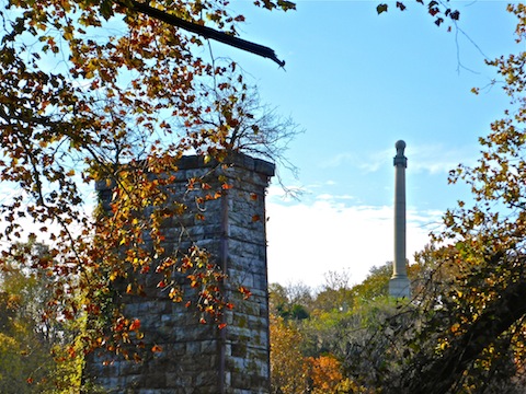
My wife met me at the C&O Shepherdstown Trailhead, a half mile short of Rumsey Bridge. I topped off my water, then continued on. (There is another trailhead at the bridge, beside Shepherdstown Lock 38.) Between the two trailheads, there are four bridges: The old railroad bridge, the current Norfolk Southern Railroad bridge, the old Rumsey Bridge and the new (c. 2006) Rumsey Bridge. On a bluff across the Potomac River, is the Rumsey Monument, dedicated to James Rumsey who, in Shepherdstown, in 1787, 20 years before Fulton, built the first successful steam engine.
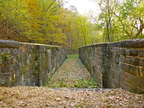
From Rumsey Bridge, the C&O Canal towpath passes Ferry Hill, before arriving at One Mile Lock 39. I sure wish there were info signs explaining what all the lock bits are / were.
There were a number of use trails from the towpath up the bluffs to Snyders Landing Rd.
The Killiansburg Cave Campground, at milepost 75, has only one spot, but at least is free, not a wallet gouging $20. There is also a picnic table, firepit, well handpump and portapotty.
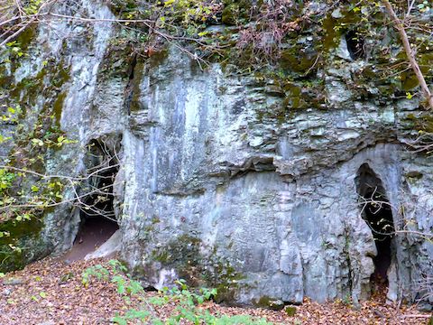
A quarter mile on, I spotted two small caves, which I later found out are the Snyders Landing Caves. The one on the right I had to crawl into; the one on the left, I could stand up. Neither went more than 30 ft. into the bluff.
A couple hundred yards further, halfway up the bluff, is Killiansburg Cave, a large hole where the citizens of Sharpsburg sheltered from the battle.
From Killiansburg Cave, it is only another mile to Snyders Landing. I had hoped to stop at nearby Barron’s C&O Canal Museum for a post-hike ice cream, but unfortunately they are only open on weekends. 🚫🍦😥
Antietam Aqueduct Directions: From Hagerstown, or points east, take exit 29 off I-70 at Sharpsburg Pike MD-65. Head 10.5 miles south to Sharpsburg. Turn right on Main St. then second left onto Mechanic St., which becomes Harpers Ferry Rd. Stay on Harpers Ferry Rd. for 2.6 miles. Turn right onto Canal Rd. The Antietam Aqueduct trailhead at C&O Canal Towpath milepost 69 is 200 yds. ahead on the left. If you continue west on Canal Rd.,
Snyder’s Landing Directions: From Hagerstown, or points east, take exit 29 off I-70 at Sharpsburg Pike MD-65. Head 10.5 miles south to Sharpsburg. Turn right on Main St. In 0.5 miles, turn right onto Snyder’s Landing Rd., which is twisty and narrows to one lane. The trailhead is in 1.5 miles.
GPS File: CO_Canal_MP69_to_MP77
Distance: 9.06 mi.
AEG: 275 ft.
Time: 3h 06m
Hiking Video
Hiking C&O Canal: Antietam Aqueduct to Snyders Landing from Preston McMurry on Vimeo.