I try to get a hike in everywhere I travel: Connecticut, Scotland, Oklahoma, Belgium, etc. It’s difficult finding trails in Florida, as what isn’t swamp tends to be highly developed. I was further constricted in my options by where my wife & I were staying, just a mile north of Orlando International Airport: I didn’t want to drive more than 30 minutes, as I can only take so much Florida Driver PTSD. ✋
In poking aound the intertubez, I found Split Oak Forest, a state Wildlife and Environmental Area. Currently 1,689 acres, Split Oak Forest is one of the most biodiverse areas in Florida (868 species of plants and critters have been spotted in the WEA.) Terrain types include forested wetlands, freshwater marsh, hammock, pasture, pine flatwoods, sandhill, scrub, wet flatwoods, wet prairie and disturbed.
Unfortunately, Split Oak Forest is about to get 160 acres smaller, as the Central Florida Expressway Authority (CFX) recently voted to build Osceola Parkway, nine miles from FL-417, near Boggy Creek, to Cyrils Drive between Del Webb Sunbridge and Weslyn Park by Pulte, in Osceola County. Split Oak Forest will be compensated with 968 acres east of the Isle Of Pine Preserve, and 582 acres south of Moss Park.
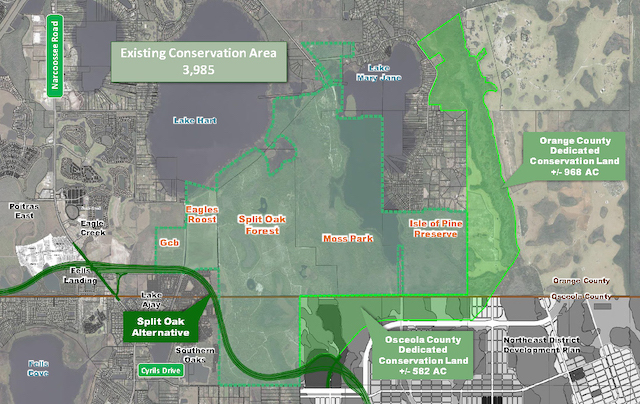
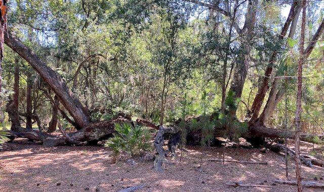
Split Oak Forest has three main trails: Split Oak Loop (5.4 mi.), Center Trail (0.9 mi.) and Lake Loop (0.8 mi.). There are short spurs to Lake Hart, Bonnet Pond and Martin Pond. The WEA is absolutely riddled with old trails. I saw no “keep out!” signs, so you can customize your visit however you like. I planned to hike Split Oak Loop, Lake Loop, Bonnet Pond and Lake Hart. The eponymous Split Oak was a must.
Eagle’s Roost Trailhead is the main access to Split Oak Forest. (Some folks hike in from Moss Park.) There’s no restroom. The info board has a detailed map and plenty of brochures. Two cars were at the trailhead when we arrived just before 8:00 a.m. on Friday, and one different car when we left around noon. Maybe Split Oak Forest is more popular on weekends, evenings, or earlier in the morning? 🤷🏻♂️
I didn’t grab a brochure, as I had downloaded a paper map. Luckily, I took a photo of the info board map before I headed out. I started hiking Split Oak Loop counter-clockwise. I was immediately faced with my first bit of confusion: Heading south, there was a sandy road to my left, and a wide grassy trail to my right. I went left. I chose … poorly.
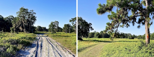
My downloaded map had the proper Split Oak Loop route on it — though not to scale, and using numeric, not alphabetic, trail markers. In ½ mile, amidst a hammock, the trail split. Following my map, I went left. To the west, a new development is going in. (A not uncommon occurrence in Florida.) Osceola Parkway will be rammed through the difference. Think the developer told buyers about that? 😂
At 1.0 miles, I found Post L. Split Oak Loop turns sharply to the east, passing through a section of sandhill. Post K is at 1.45 miles. The Florida Trail splits south, to cross the Osceola Parkway, while Split Oak Loop turns northeast. Intently examining longleaf pine for green blazes, I was unsure which way to go. I also had yet to see a numbered post. I went left. I chose … wisely.
I was surprised how few flowers there were: It’s Florida! They get rain! Tarflower were most common. Salt-marsh pink, with their red-bordered yellow stars, were stunning. I saw decent patch of yellow milkwort. I also spotted what I believe were dense-spike blackroot, but failed to snap their picture. Florida Wildflower Foundation helped me identify the unfamiliar species.
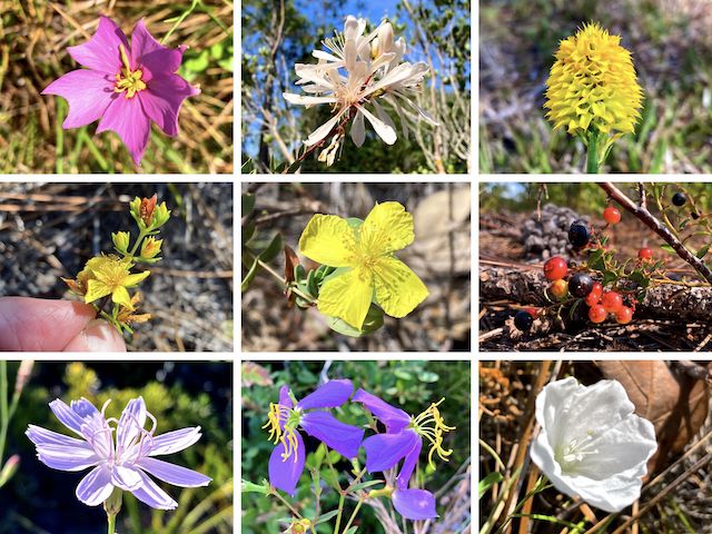
Top Row: salt-marsh pink, tarflower, yellow milkwort.
Middle Row: Atlantic / roundpod St. Johnswort, fourpetal St. Johnswort, sand holly.
Bottom Row: rose rush, Maryland meadowbeauty, coastal plain dawnflower.
It was getting quite warm by 9:00 a.m., and there was little shade amongst the pine flatwoods as I approached Sawgrass Pond, a saltwater marsh. At Post J (2.0 mi.), there is an observation platfom overlooking the marsh. The view has become blocked by vegetation since the deck was built in 2019. A quarter mile later, Split Oak Loop got really confusing.
Post I is a four-way intersection. Still looking for any green blaze, I saw a yellow blaze to the left. I tried left. I tried right. I ended up going straight. In all, my confusion ended up adding two miles to what should have been a six mile hike. I was back on track by the time I crossed the old canal (2.6 mi.).
Split Oak Forest does not allow dogs or bicycles. Not that you would want to ride a MTB through the deep, mushy, white sand that comprises two-thirds of the loop. Hiking it was drudgery enough. I used the firmer edges. Good thing I brought two bottles of water. 😅
Considering the heat, I thought about cutting it short when I reached Center Trail at Post H (3.1 mi.), but I really wanted to see Split Oak!
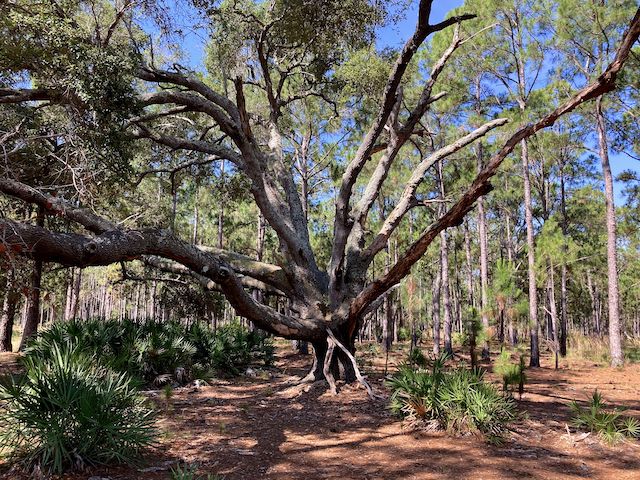
By the time I reached Post G, I was using my photo of the trailhead mapboard to navigate. Post G is where the orange-blazed Florida Trail splits north from Split Oak Loop, which turns west. The first blue blaze for Lake Loop is at Post F (3.9 mi.). Split Oak is 200 ft. is straight up the middle of the “wedge” between the yellow/orange blazes and the blue blaze. Mission accomplished! 👍
Lake Loop was thankfully also shaded. From Post E, the spur trail is only 100 yds. to Bonnet Pond. The observation deck was closed. The pond was basically a mud flat. The Lake Hart Spur has a sign, but no letter post. The trail is a marshy 200 yds. to Lake Hart, which had water. I would have given my do-rag a cooling dip in Lake Hart, but it was protected by 50 yds. of mud. I rejoined Split Oak Loop at Post D.
From Post D (4.3 mi.), Split Oak Loop skirts wet flatwoods to Post C (4.6 mi.). The Back to Nature Wildlife Refuge is 300 yds. west. Continuing south, I was exposed to the sun as the trail split scrub and forested wetlands. There was yet another unmarked confusing side trail (5.1 mi.) before I reached Post B (5.2 mi.) and Center Trail. From Post B, it is just a couple minutes west to the trailhead at Post A (5.4 mi.).
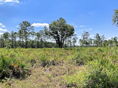
In summary, Split Oak Forest is currently a pleasant stroll through nature, but whatever you do, avoid any map with numbered waypoints! I can’t find a letter-posted map, so download this instead.
Directions: From the Florida 428 freeway, just northeast of Orlando International Airport, take exit 13 south, onto Narcoossee Rd. /FL-15. In 7¼ miles, turn left on Clapp Simms Duda Rd. It’s paved, but a bit obscure. I’m not the only one who has driven past it. In 1½ miles, the Eagles Roost Trailhead will be on the right. This will likely change after Osceola Parkway is completed.
GPS File: Split_Oak_Forest
Distance: 8.08 mi.
AEG: 92 ft.
Time: 2h 54m
Rumble Video
Vimeo Video
Hiking Split Oak Forest, Florida from Preston McMurry on Vimeo.
