
 was present in multiple areas across Sunrise Mountain, usually in good clusters.")
Personally, I avoid doing the same hike a second time. Heck, the first sixty times I hiked the desert behind my house, I only repeated the same route once. I just can’t do the same thing over & over like some hikers. I like finding new stuff. So, poking around on the map, I “discovered” Peoria Sunrise Mountain Preserve.
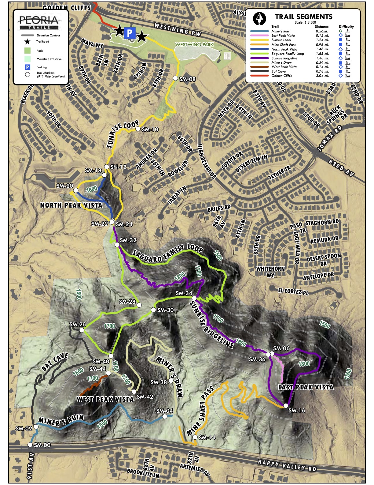
Peoria Sunrise Mountain Preserve has ten official trails, totaling 9.3 miles. (Located just off 83rd Ave. in Peoria, it shares a trailhead with West Wing Mountain.) My plan was to hike parts of Sunrise Loop, Saguaro Family Loop, Sunrise Ridgeline, Miner’s Shaft Pass, Miner’s Draw, and West Peak Vista, for a total of 5.9 miles, 925 ft. AEG (accumulated elevation gain). See the GPS file below.
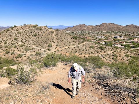
Sunrise Loop, is actually a “lasso”. (An in & out stem, with a loop at the far end.) Sunrise Loop is rated 🟦 for moderate. Though listed at 1.24 mi., you will hike almost two miles by the time you return to Westwing Park trailhead. Sunrise Loop starts by heading out the east end of the parking lot. Bend south, past a retention basin. At the bench, turn right onto foot trail. Squeezing between houses, Sunrise Loop climbs 175 ft. in the next 0.7 mi., to signpost SM-24.
Saguaro Family Loop is an actual loop, 1.65 mi. around. Rated 🟦 moderate, Saguaro Family Loop begins at SM-24, with a short, but steep (16% slope) and rocky, climb to SM-32. There’s a slightly easier bypass to the right, which I saw an older mountain biker heading up. Saguaro Family Loop rolls along for a quarter mile, with a bit of mid-morning shade, drops steeply (18%) for a hundred yards, then switchbacks up 120 ft. in just under a quarter mile (12%) to SM-34.
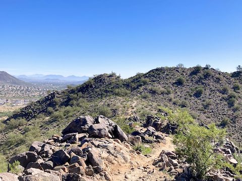
Sunrise Ridgeline is a 1.48 mi. lasso, rated 🔷 , for moderately difficult. I thought it was easier than Saguaro Family Loop. Like Sunrise Loop, the distance does not include the hike back along stem. The loop part of Sunrise Ridgeline trail goes around East Peak Vista. (Which I skipped, saving it for a future visit.) Sunrise Ridgeline was my favorite trail of the day, as it wound around knolls on both sides of the ridge, then the south slope of East Peak Vista. I split left onto Miner’s Shaft Pass at SM-16.
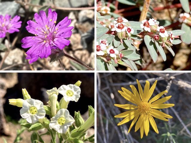
Miner’s Shaft Pass is a 0.98 mile trail with a hilarious name. (“Miner’s shaft” meaning something different than “mine shaft”.) Rated 🟦 moderate, Miner’s Shaft Pass drops 290 ft. (6% slope) to a old mine shaft adjacent to Happy Valley Rd. Unfortunately, there’s no trailhead on Deer Valley Rd., unless you count a cul-de-sac on the corner of 92nd Ave., near SM-00. Not sure the legalities there, though. Overall desert flower coverage was light but, including chinchweed (top), I did find five new species:
Miner’s Draw trail starts 100 yds. north of Happy Valley Rd. There is no signpost where Miner’s Draw starts. Miner’s Draw is 0.89 mi., and rated 🟦 moderate. Miner’s Draw climbs 275 ft. at a 6% slope. Whoever laid out the Peoria Sunrise Mountain Preserve trail system did an impressive job. At the top of Miner’s Draw trail, maybe 100 ft. from signpost SM-44, is a nice spot of mid-day sitting shade. Unfortunately, I forgot to bring lunch. 😕
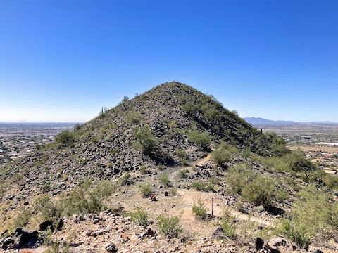
West Peak Vista is listed at 0.14 mi., but what goes up, must come down. So, basically, a quarter mile (and change). Climbing 80 ft. in that short distance, West Peak Vista is rated 🔷 , for moderately difficult. Not just the slope (10%), but the rockiness of the often barely there trail. It’s not scrambling per se, just sometimes indistinct. Look for wear patterns on the ground, and keep heading up.
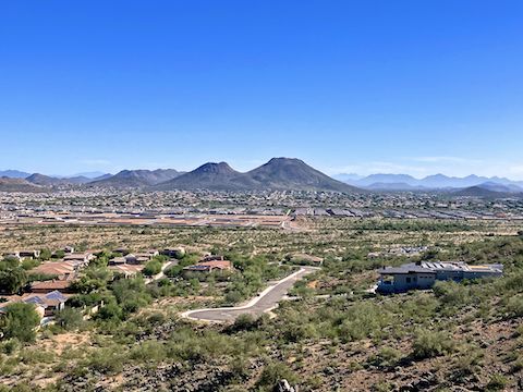
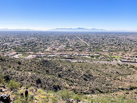
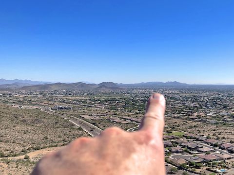
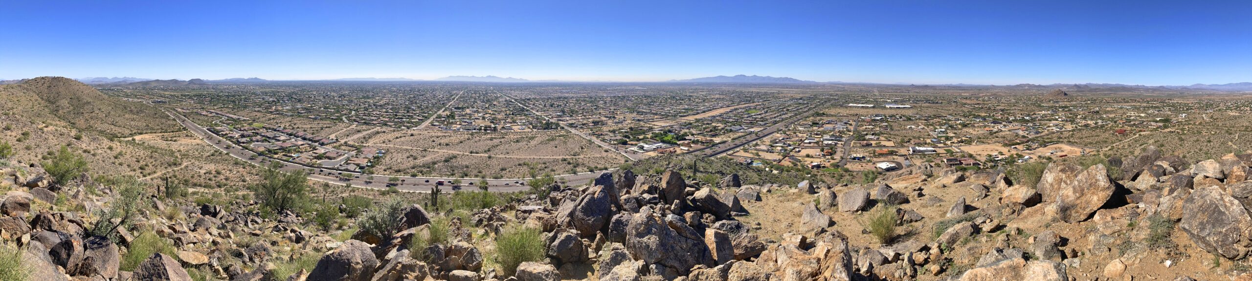
Great 360° views on top: Besides the above mentioned formations, Thunderbird Conservation Park, North Mountain, Piestewa Peak, South Mountain, the White Tank Mountains, the Bradshaw Mountains, New Waddell Dam (at Lake Pleasant), and Pyramid Peak. It was 83℉ on top.
Back down at SM-44, I picked up the west segment of Saguaro Family Loop at SM-40, then Sunrise Loop at SM-24, covering the mile and a half back to Westwing Park in thirty-six minutes. It was a toasty 87℉ when I finished, so it was off to Mickey D’s for a salt-restoring super-size fries and Filet-O-Fish. 👍
Directions: Really depends on where you live in the Valley. Personally, from I-17, I took exit 218, west onto Happy Valley Pkwy. In just under 7 miles, after crossing New River, turn right on 83rd Ave. In 2 miles, Sunrise Mountain Trailhead is on the left, but you can’t turn directly into it. Instead, turn left on Black Rock Blvd., then left into the parking lot, then curl right, around the church / shops to the trailhead.
Park Map: Peoria_Sunrise_Mountain_Preserve_Trail_Map (jpg)
GPS File: Peoria_Sunrise_Mountain_West_Vista
Distance: 6.21 mi.
AEG: 955 ft.
Time: 2h 37m
Rumble Video
Vimeo Video
Hiking Sunrise Mountain, Peoria, Arizona from Preston McMurry on Vimeo.