

Heading east from Dewey, this is the 12th segment of General Crook Trail.
The General Crook Trail is named after General George Crook, who surveyed a route between Fort Apache and Fort Whipple, in Prescott, in 1871. A hundred years later, the Boy Scouts tried as best they could to retrace the old route, marking it with mileposts, and other trail markers such as gabions, cairns, and chevrons.
Because no two resources agree on the General Crook Trail’s modern hiking route, I’m following the chevrons. (Being unsure which route to follow got me confused when I hiked the previous segment, from Forest Lakes to FR 487, eighteen months ago, when I was still new to this trail.) 👶🏻
Before I started hiking, I scouted the route my shuttle-driving wife would need to take to pick me up. From FR 487, Rim Road mile 52-54 was okay. Mile 54-58 was quite rocky. Mile 58 to FR 125 (mile ~60.6) was better. FR 125 was okay. Driving up the east side of Phoenix park was rutted & slow. It took us sixty minutes to drive the 19.4 miles from AZ-260, mostly at 10-15 mph in an SUV. Cars should avoid!
My wife was okay with the drive, so she took off ahead of me. Facing FR 487, I picked up the first General Crook Trail chevron across FR 300 / Rim Road on the right (the northeast corner). The GPS route attached below indicates my best attempt to follow the Boy Scouts’ chevrons, but does not include every chevron I found. There’s just too many. Instead, I waypointed chevrons every quarter mile or so.
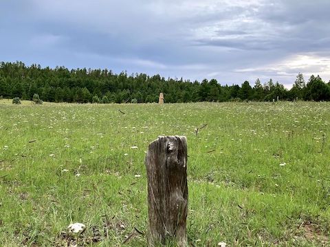
The General Crook Trail was paralleling FR 300 / Rim Road, but 50-100 ft. to its north. It was easy cross country travel: no obstacles, relatively flat. After a ½ mile, entering an area of youthful pine — a Rodeo-Chediski Fire recovery area — I made a 90° left, away from the chevrons. Following the edge of the young pines, in 300 yds. I found a wikiup and two graves. 🙏🏻
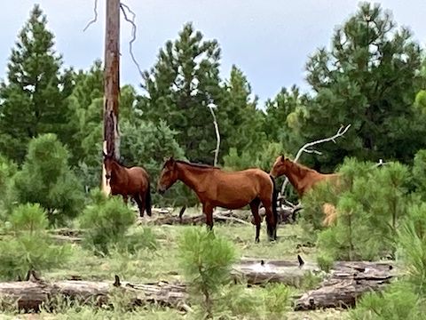
Back on the General Crook Trail — which in this area does not exist as singletrack — I continued following chevrons, right onto FR 300. Rim Road was much easier hiking than driving. Two hundred yards past Rim Road mile 53, the chevrons veered right, off road. Chevrons were sparse off road, but I did find a few. And wild horses. Lots of droppings & small equine herds all along today’s hike.
The chevrons rejoined FR 300 / Rim Road 1½ miles into my hike. I did not see any General Crook Trail mile markers for over an hour so I judged distance by the white-on-green Rim Road mile signs. I wasn’t running, but the miles seemed to go by like I was. Hiking actually seemed faster than driving!
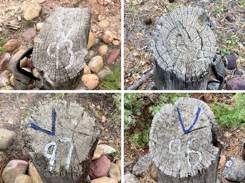
3⅓ miles into my hike, 40 ft. to the left (north) of FR 300, I spotted V93. Every other General Crook Trail mile marker was next to the road. Only V97 was on the right; the others all on the left. I did not see V94 until I had covered 4¾ miles. V96 was three miles after V93, which means if V95 exists, it would be about three-quarters of a mile from both V94 and V96. V98 is only two thirds of mile past V97. 🤷🏻♂️
After 5½ mile of this General Crook Trail segment, I met my wife at the intersection of FR 51 and FR 300 / Rim Road. I planned the meetup because I wanted to make sure our SUV was still in good shape. It was, so we had lunch & chatted — me eating a wet slice of gas station pizza I had stashed in my pack. Still, not bad for hiking food.
At the FR 51 and FR 300 intersection, General Crook Trail diverts off Rim Road, following FR 51. At least that is the chevroned route. I suspect the actual Old West trail continued to following Rim Road to what is now Show Low. After 150 yds., the chevrons split left, off road. Why? The chevrons rejoined FR 51 after 250 yds., at it’s intersection with FR 51C. General Crook Trail turned right onto FR 51C.
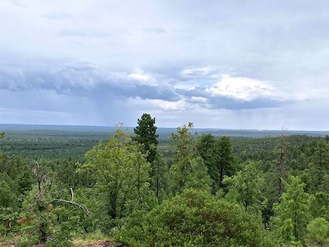
FR 51C slowly descends a spur towards Phoenix Park. FR 51C was much rockier than FR 300. There were also puddles from the continuing drizzle. FR 51C has nice views north, and south into West Park Draw, where I could see FR 125 among the pines. The sun never came out, but past V97 — 7⅔ miles into my hike — the sun at least shined through the clouds. More importantly, it stopped drizzling. 🌦
The topo map shows red gate symbols at both ends of FR 51C. That is why I originally scouted FR 125. But I never saw any gate, of any sort, not even old and collapsed. Nor any cattle grate. Topos may be up to 50 years old, so I wasn’t surprised. There was some nice paintbrush along FR 51C though.
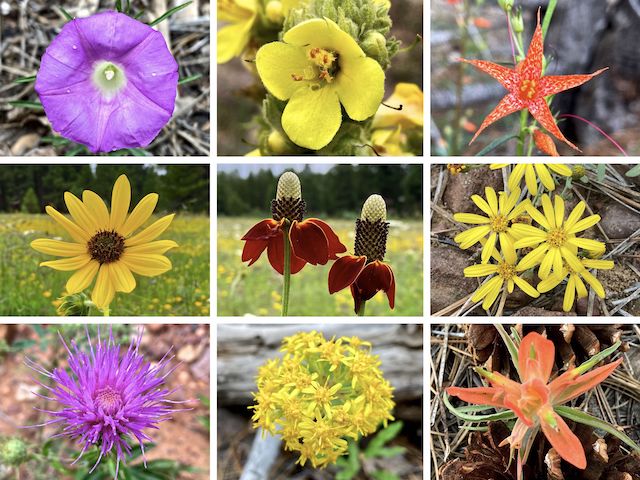
Top Row: Huachuca Mountain morning glory, mullein, skyrocket.
Middle Row: common sunflower, Mexican hat, ???.
Bottom Row: Wheeler’s thistle, Wright’s goldenrod, paintbrush.
Other high country flowers included spreading fleabane (Erigeron divergens), western yarrow (Achillea millefolium), ragleaf bahia (Hymenothrix dissecta), pinewoods geranium (Geranium caespitosum), red & yellow pea (Acmispon wrightii), ground-cover milkvetch (Astragalus humistratus) and — near the ruins — western dayflower (Commelina dianthifolia) and pinewoods spiderwort (Tradescantia pinetorum).
Seeing all the yellow flowers in Phoenix Park was pretty cool. I could have spent all day there, taking photos. But after photographing all the easily visible species, I got back on FR 125, following that up to the Holcomb Homestead “driveway”, where my wife was waiting. Felt great. Not even tired. 🤗
We drove out via Heber-Overgaard, so we could have a “date night” dinner at the Red Onion. The initial mile of FR 125, along the west side of Phoenix Park was heinous, but SUV-able. After that it was merely rocky. FR 124 and the final miles on FR 51 into town were car-drivable. I may have to make a scouting trip up there, to check out forest road quality for my shuttle driving wife, before I hike the penultimate General Crook Trail segment.
FR 487 TH Directions: From Phoenix, head north on AZ-87, the Beeline Highway, into Payson. Turn right on AZ-260. In 38.4 miles, just past AZ-260 mile marker 291, turn right onto dirt Rim Road / FR 300. Notice the Rim Road mile markers every mile. In little over 8 miles, just past Rim Road mile marker 52, FR 487 is on the left. Park wherever.
Phoenix Park TH Directions: Continue past FR 487. In another 8.4 miles, after Rim Road mile marker 60, turn left on FR 125 / Park Road. Phoenix Park is the clearing in 2.3 miles. Veer right, parking on the far north end, near the Daniel Boone Holcomb Homestead ruins.
GPS File: General_Crook_Trail_V89_V99
Distance: 11.32 mi.
AEG: 297 ft.
Time: 3h 54m
Rumble Video
Vimeo Video
Hiking General Crook Trail: V89-V99 from Preston McMurry on Vimeo.