Unfinished business from last June, when I got off track, I was short on time and it was hot.
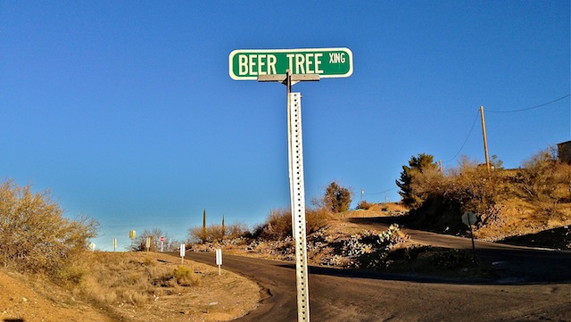
In Search Of … Anyone remember that show? Gosh, I loved it. A great source of info about off beat subjects two decades before Wikipedia or Google. Got the idea to kind of make that the theme of my hike video when I saw that Globe actually has a street named — no lie — “Beer Tree”. It was a good omen for the day, as I only discovered that street due to making a wrong turn.
Note that the gravel pit trailhead doubles as a firing range, and that there are also a fair number of nails in the dirt, so exercise caution where you park.
So, today I did a counterclockwise loop of Check Dam Trail #190, Six Shooter Trail #197, FR 112, Una Del Oso Trail #201 and Toll Road Trail #200. Preston the yeti’s subtitle for the Check Dam Trail description — “brushy banality” — pretty much describes the whole hike. There’s some good views from up on FR 112 and Una Del Oso, and the upper reaches of Pine Creek are shady with good sitting rocks, but otherwise, it’s nothing spectacular.
There’s at least a dozen cattle tanks on the loop, round and rectangular; wind or solar powered; cement, metal or dirt; in all combinations thereof. Judging by the brand marks on several tanks, DC Ranch has the concession in this area. Since it was 32° when I started, the tanks with water had all crusted over with ice, as had the creek crossed by Six Shooter Trail between the CCC Campground and FR 112. (I could hear water trickling under the ice.) There are tons of manzanita all along the hike, but that same section of trail has the biggest manzanita I have ever seen: I swear some are 20 feet high with trunks 4-6″ diameter. ![]() I saw evidence of MTBs around most of the loop, but it must not get much traffic as there were many, many spots where cat claw was growing in the middle of the trail. Just north of Big Spur Tank, Toll Road Trail was briefly completely obscured by brush.
I saw evidence of MTBs around most of the loop, but it must not get much traffic as there were many, many spots where cat claw was growing in the middle of the trail. Just north of Big Spur Tank, Toll Road Trail was briefly completely obscured by brush.
I took my first break at the CCC, which is a really nice campground, large, with great views, picnic tables, burn pits and even a latrine building. FR 112, which goes to the CCC, and then further on up the hill, is a wide, very smooth dirt road. (Actually much smoother than the half mile to the gravel pit trailhead.) FR 112 is easily drivable by car.
As I was hiking up Six Shooter, I bumped into some calves. I could hear mom mooing on the other side of the trail. I did not want to get between the two, so I waited. The calves were not moving — imagine that! ![]() — so I resorted to making lots of noise, and after a few minutes they finally decided to put some space between themselves and the crazy man. A couple hundred yards further up, the topo claims there are two buildings on the west side of the trail. There are not. I beat the thick brush searching. The northern building simply does not exist at all, and all that remains of the southern building are some chunks of brick & mortar, and some rebar.
— so I resorted to making lots of noise, and after a few minutes they finally decided to put some space between themselves and the crazy man. A couple hundred yards further up, the topo claims there are two buildings on the west side of the trail. There are not. I beat the thick brush searching. The northern building simply does not exist at all, and all that remains of the southern building are some chunks of brick & mortar, and some rebar.
I took my second break along Pinal Creek, after turning north from Una Del Oso onto Toll Road Trail. I took off my hiking shoes and socks, and kicked my feet up on a conveniently located granite ottoman, while I enjoyed the fruit of the Beer Tree, a Vinifera Stout: “Divine * Wrath * Irrigate * Cultivate” — sounds positively pagan. ![]() The rocks eventually got really cold on my feet, so I booted up and continued on …
The rocks eventually got really cold on my feet, so I booted up and continued on …
Distance: 9.71 mi.
AEG: 1,735 ft.
Time: 3h 44m
In Search Of … The Beer Tree
Check Dam Trail #190, Tonto National Forest from Preston McMurry on Vimeo.
