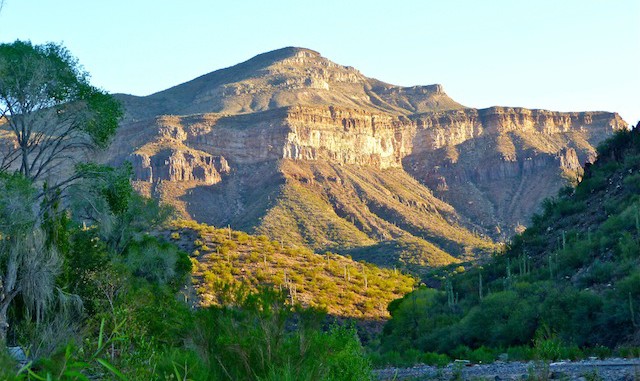
I hate to make the 2.5 hour trip to Aravaipa for the property owner’s meeting and not get a hike in, and I’ve been wanting to do Brandenburg Mountain for years, so my wife and I left Phoenix at 5:30 a.m. I’d all along been planning on going up the ridgeline, but had just two weeks ago that there was a shorter route up the unnamed wash next to the ranger station. (Hereafter mnemonically named Ranger Station Wash. ![]() ) On Haz satellite view, with labels, you will see the ridgeline jeep trail. Only problem is, it passes right through some guy’s yard, so I found alternate access starting at the double green gate across from Aravaipa Farms. To give me time to make the 3:00 p.m. APOA meeting, I planned on descending Ranger Station Wash. I hit the trail at 8:04.
) On Haz satellite view, with labels, you will see the ridgeline jeep trail. Only problem is, it passes right through some guy’s yard, so I found alternate access starting at the double green gate across from Aravaipa Farms. To give me time to make the 3:00 p.m. APOA meeting, I planned on descending Ranger Station Wash. I hit the trail at 8:04.
The first three miles of the jeep trail, to the head of Ranger Station Wash, there are five intersecting jeep trails: One each at .5 miles (the trail through the guy’s house), 1.25, 1.5, 1.75 and 3 miles. The 1.25 trail leads east to a padlocked gate, behind which is a tank you can see as you climb the main route. The other four trails all lead west or northwest. There are six fence lines across the trail in those three miles, all easily bypassed. (Other than the one that guards the tank.) The trail is rocky, but not break-your-ankle rocky like if you are hiking in a dry creek. The sole reason I proceeded at what the stats erroneously show as slothful pace is due to the cholla. ![]() Lots and lots of cholla. Some growing right in the middle of the jeep trail. So many cholla, I had to tip-toe and bob-and-weave to avoid getting hit more than the three times I did. (Plus a prickly pear and, just for Outdoor Lover, bapping my head into a strand of barb wire.)
Lots and lots of cholla. Some growing right in the middle of the jeep trail. So many cholla, I had to tip-toe and bob-and-weave to avoid getting hit more than the three times I did. (Plus a prickly pear and, just for Outdoor Lover, bapping my head into a strand of barb wire.)
When I hit the “peak” of the ridge line, at 3408 feet, I could see from the Ray Mine south to well past Mammoth. ![]() Just east of there was a cairn, which I thought might be the trail down Ranger Station Wash — I’d been told Ranger Patrick had marked it — but after a few minutes exploring had no discernable purpose. (There is a second cairn, in the saddle, at the head of Ranger Station Wash / foot of the escarpment, and an obvious foot trail down, which I of course missed on my way up.)
Just east of there was a cairn, which I thought might be the trail down Ranger Station Wash — I’d been told Ranger Patrick had marked it — but after a few minutes exploring had no discernable purpose. (There is a second cairn, in the saddle, at the head of Ranger Station Wash / foot of the escarpment, and an obvious foot trail down, which I of course missed on my way up.)
There’s a nice little canyon on the north side of the saddle and for the first half mile of the climb up the escarpment. The cacti change from prickly pear, barrel cactus and a metric shit-ton of cholla to succulents and saguaro. A strong hiker might not have trouble descending the west side of the final summit, but I took one look and was like “not happening”. The trail surface is less rocky on the escarpment, and a few small washes have interesting light green chips, rather than sand or pebbles.
By the time I got to my resting place opposite Flat Top Mountain I was 11:15. I might have been able to make the summit in my alloted time — from the water catch, via the northeast face — but no way would I have been able to get back down, circle 3/4s of the way back around Brandenburg, then exit via Ranger Station Wash in my remaining 2 hours 45 minutes. Plus, I was getting low on liquids. So, after enjoying a murderwich, I bailed.
Back down the escarpment jeep trail I went. At the saddle I discovered the second cairn I had earlier missed. ![]() The trail into Ranger Station Wash is real obvious, and well-traveled — I hear birders climb up it — though I did lose it for about a quarter mile near the bottom. Plenty of cholla on it as well. Once I hit the wash bottom it was a highway the last mile to Aravaipa Road. (Flat and sandy, but fast.)
The trail into Ranger Station Wash is real obvious, and well-traveled — I hear birders climb up it — though I did lose it for about a quarter mile near the bottom. Plenty of cholla on it as well. Once I hit the wash bottom it was a highway the last mile to Aravaipa Road. (Flat and sandy, but fast.)
—–
Later, at the APOA meeting, I had several neighbors offer to go up with me next time, including one lady who uses Brandenburg to train for her annual Grand Canyon rim-to-rim.
Distance: 6.92 mi.
AEG: 1,653 ft.
Time: 3h 27m
