

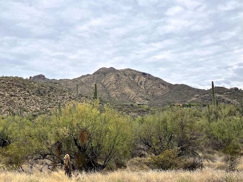
Arizona has at least six Black Mountains, including two in Pima County. Today’s Black Mountain is in Cave Creek. (Technically, the summit is in Carefree, while the trailhead is in Cave Creek.) This Black Mountain is a straight forward hike, 1.1 miles (one-way) and 1,216 ft. straight up a ridge to the summit.
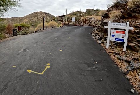
Black Mountain has an official trailhead, but it’s more a series of spaces along Mark Way and Military Road, either side of Schoolhouse Road. There are no amenities. I peed at the Circle K around the corner, while picking up a couple of waters for my hike. (And a fountain drink after.) Supposedly, the parking is packed, but that must be weekends, as on Wednesday at 8:00 a.m. there were plenty of open spaces.
Out of curiousity, I broke down the remaining Black Mountain grade by tenths of a mile:
- .40 … 85 ft. … 16.1%
- .50 … 121 ft. … 22.9%
- .60 … 156 ft. … 29.6% (lookout)
- .70 … 140 ft. … 26.5%
- .80 … 184 ft. … 34.9%
- .90 … 130 ft. … 24.6%
- 1.00 … 99 ft. … 18.8%
- 1.10 … 123 ft. … 23.3% (summit)
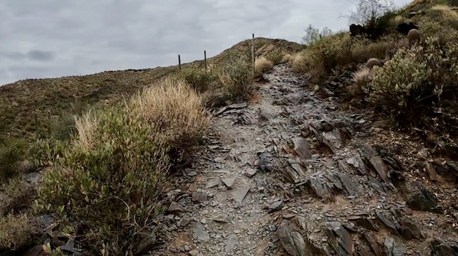
Overall, Black Mountain has a 21% grade.
I wanted to do it like North Mountain: Slow & steady, no stops. Couldn’t. On the way up Black Mountain, I took two multi-minute sit down breaks. If you count quick breathers and photo ops, it was … ahh … err … sixteen. Yikes! Didn’t realize I was sucking that much wind. 😬
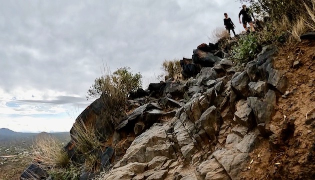
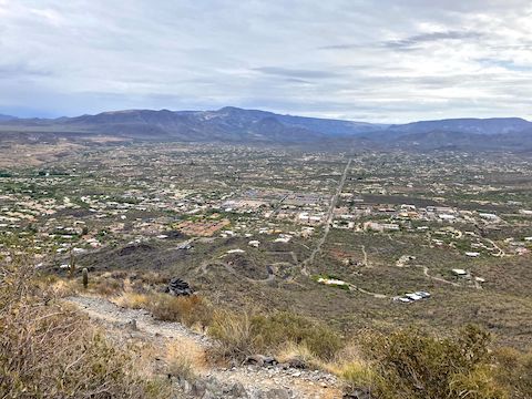
Foot traffic was light: Much less than Piestewa Peak. No litter, boomboxes, or perfume. While caching a bottle of water for my descent, I bumped into BobP, from HikeArizona. Only desert flowers were some creosote and ocotillo just below Black Mountain’s summit. Nice view up top. Met a friendly doggo. Saw rock etchings going back as far as 1953.
I intended to take uphill pointing photos on my way back down, but BobP caught up to me on his second lap, so we ended up chatting instead. 😁
Directions: From the Loop 101 / Pima Freeway in north Phoenix, take exit 28 north onto Cave Creek Rd. In 12.7 miles, in “downtown” Cave Creek, turn right on Schoolhouse Rd. In 250 yds., just after crossing the wash, is Military Rd. / Mark Way. Park either to the left or right in the spaces on the side of Military Rd. Parking is free, but respect homeowner’s frontage.
GPS File: Black_Mountain_Cave_Creek_2026
Distance: 2.40 mi.
AEG: 1,222 ft.
Time: 1h 27m
Rumble Video
Vimeo Video
Hiking Black Mountain, Cave Creek, Arizona from Preston McMurry on Vimeo.