Heading east from Dewey, this is the 13th segment of General Crook Trail.
I believe the original General Crook Trail continues along Rim Road to Show Low. However, the modern hiking trail diverts off Rim Road in the middle of the previous segment. The mile markers and chevrons posted by Boy Scouts in the early 70s certainly lead to Phoenix Park. Every topo map claims a different route, and Eldon Bowman’s “A Guide to the General Crook Trail” (1978) another, but I’ve found chevrons to be the truest indicator. Where chevrons are not available, look for cairns, cut logs and ribbons. 🧭
Phoenix Park is a bit remote, so a month ago, I scouted the roads. Phoenix Park is the only trailhead not accessible by car. So, if you don’t have at least an SUV, you will have to hike an extra 1⅓ miles on FR 125 to the first chevron.
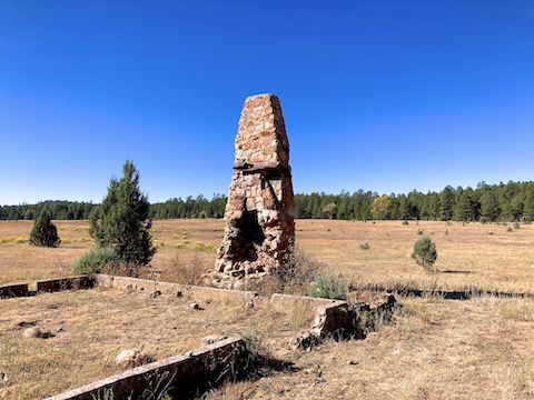
I intended to hike the General Crook Trail from Phoenix Park to ZB Draw two weeks ago, but had to bail due to the multiple construction delays. (The earliest I could have started would be 12:30 p.m.) Today, on the way up, I managed to avoid the worst delays. After taping my intro at the Holcomb Homestead in Phoenix Park, I started hiking at 10:00 a.m.
The first three miles of this General Crook Trail segment are on FR 166. I’ve seen sources that refer to FR 166 as “FR 166B”. I’m going with the sign actually on the road. Two-thirds of this eight mile segment are on decommissioned forest roads, including FR 166. Other than FR 146, there should be no need to worry about speeding vehicles. 👍
Even though the weather was pleasant — mid-70s, partly cloudy — few high country flowers remained along the General Crook Trail. At the same time, there was little fall color, due to the unseasonably warm autumn. I found scattered pathetic yarrow, two skyrocket (near Decker Wash), a few showy goldeneye (near Decker Wash and ZB Draw), and a single fleabane (near ZB Draw).

Mile marker V100 is 1.2 miles from what I believe may be V99. (A post next to the homestead’s “driveway”, just off FR 166.) The Boy Scouts did not have GPS when they installed the markers in 1976, so the word “mile” should be taken with a grain of salt. Indeed, V101 is only 0.7 miles from V100. Previous hikers waypointed V100 and V101 in the past decade, so I was reasonably certain they existed.
V102, V104 and V106 I was unsure about, and so guesstimated their locations by distance relative to known General Crook Trail mile markers. When I got within a quarter mile of where I thought V102 might be located, I hiked slower, closely scanning each side of FR 166. I found V102 1.1 miles past V101. At 18″, V102 is half the height of other markers, and 2″ wider. No “V” either.
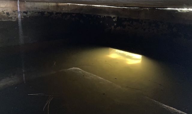
After crossing FR 124, the General Crook Trail becomes actual trail, passing an old corral and a cattle tank. I saw the day’s first wild horses by the corral. I also saw lots of squirrels and a jack rabbit. On the drive in, my wife exclaimed, “Watch out! Deer!” I thought, “That’s an odd looking deer.” Looked to my left and saw one with hooked antlers. The “deer” were pronghorn. 😆
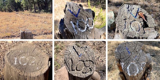
Top Row: V99 (?) with possible wagon ruts, V100 and V101.
Bottom Row: V102, V103 and V105.
The General Crook Trail “cuts the corner” of FR 124 and FR 146. Just before the trail joins FR 146, 3⅔ miles into this segment, I found a big pile of animal bones near an old fire ring. No skull or leg bones, but pretty much everything else. Odd. ☠️
FR 146 gets more vehicle traffic than other nearby roads. Some folks vehicle camp along FR 146, though not as many as on FR 144. Most folks were responsible drivers, but one guy was hauling ass. FR 146 has white on green mile markers, counting down as you hike north. Decker Wash parallels FR 146. V104 should be near Decker Wash, but I could not find it.
Following the chevrons, General Crook Trail veers off FR 146, towards Decker Wash, at 5¼ miles. The relief lasts for only half a mile. Along the way, I found a chevron laying on ground. I used my multitool to nail it back up.

V105 is obvious 50 yds. before General Crook Trail splits off FR 146 onto unsigned FR 146C. After a short, rocky, climb out of the forested Decker Wash basin, FR 146C enters the severe burn area where the Rodeo and Chediski Fires collided on June 23, 2002. Not much vegetation left, other than grass and scrub, with some young post-fire oak. AZ-260 is visible a half mile north. I had 3-bar Verizon reception.
FR 146C descends to ZB Draw. V106 should be somewhere near the intersection of FR 146C and FR 124C, which heads south, up ZB Draw. I could not find V106. The General Crook Trail continues east, on the same dirt track, which is renumbered as FR 9863S. The hillside between ZB Draw and FR 124 is dotted with 18″ tall plastic cones, apparently a reforestation project. 🌾
After finishing this General Crook Trail segment, my wife & I headed home. Or so we thought. The AZ-260 construction delay near Forest Lakes was 50 — FIFTY!!! 🤬 — minutes. Three times vehicles were waved east before our westboound traffic was allowed to move. There was some very aggressive driving heading towards Payson. Like Daytona, with similar speeds. I was still pissed when I got home …
Phoenix Park TH Directions: From AZ-260 in Overgaard, at milepost 308.2, turn right (south) onto “F.S. 51”, which is car-drivable dirt. In 1.6 miles, turn left onto FR 124, which is also car-drivable dirt. In 2.1 miles, turn right onto FR 125, which is car-drivable dirt for the first 1.5 miles. The next 1.3 miles of FR 125 around the south end of Phoenix Park, to the Holcomb Homestead, require an SUV, or better.
ZB Draw Directions: Double back to FR 124. At FR 124, turn right (east). You can drive 8.7 miles all the way to ZB Draw. Instead, after 3.6 miles, I turned left (north) on FR 146, which is car-drivable dirt. In 3.5 miles, turn right (east) on AZ-260. In 1.6 miles, at the very next road, turn right on FR 124. Park wherever.
GPS File: General_Crook_Trail_V99_V107
Distance: 10.19 mi.
AEG: 432 ft.
Time: 3h 51m
Rumble Video
Vimeo Video
Hiking General Crook Trail: V99-V107 from Preston McMurry on Vimeo.
