
 at the south end of the second enclosure.")
I was going to hike hike Porcupine Ridge, near Woods Canyon, at the east end of the Mogollon Rim, but AZ-87 to Payson was closed down due to the Sand Stone Fire,. I’ve hit the west end of the Rim pretty hard over the years, but was able to able to come up with this surprisingly quickly. 🙇🏻♂️
Houston Draw is located between Telephone Ridge (on the west) and Dick Hart Ridge (on the east). The head of Houston Draw is three miles north of Rim Road, at the junction of FR 139 and FR 139A. Houston Draw empties into the C.C. Craigan Reservoir six miles later.
Houston Brothers Trail #171 is a seven mile trail from Rim Road to Pinchot Cabin, four miles down Houston Draw. My plan was to hike the trail from the top of Houston Draw to Pinchot Cabin, then return via FR 95B and FR 139A, an eight-mile round trip. (A car could drive FR 139A to within a quarter mile of Pinchot Cabin, no problem.)
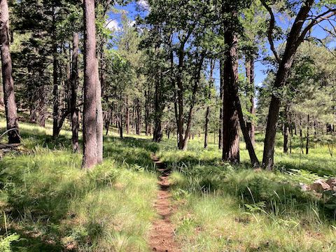
It would not be obvious where Houston Brothers Trail #171 crosses FR 139A except for the fading white-on-brown announcing the trail’s presence. Descending 170 ft. in the first mile, the trail was often rooty, or rocky. Flowers were minimal. Fungi — despite the summer monsoon and overhead cover — nonexistent. But the overhead cover provided solid walking shade. Didn’t need it yet, though.
After a mile, Houston Brothers Trail #171 breaks out into the open at the south end of the first fenced enclosure. Despite signs, the fence is no longer electrified. I checked. (And not by peeing!) Even if the fence was electrified, it could easily be walked across due to being collapsed. Not sure what it was protecting. The 1500′ x 150′ enclosure’s highlight was its tons of yellow coneflower. 🤗
At the 1¼ mile mark, there were several piles of large, white, rocks next to Houston Brothers Trail #171. Not boulders, but like rip rock, except basketball-sized. The boulders looked placed, like they were dumped for a long ago project, rather naturally random.
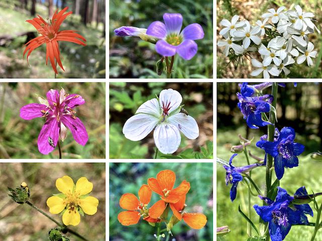
Top Row: Mexican silene, alpine woodsorrel (?), Nuttall’s linanthus.
Middle Row: pineywoods geranium, Richardson’s geranium, upland larkspur.
Bottom Row: woolly cinquefoil, western wallflower.
At the 1½ mile mark, there was a metal pole. McFarland Spring is 120 yds. southwest, across Houston Draw. I could not find a spring pipe, but water was trickling from the boulders.
Back on Houston Brothers Trail #171, I saw five young gals hiking up the trail. No, correction: Rather than in a file, they were line abreast. Turns out, they were doing a flower survey. (I think for the Forest Service.) Hey, me too! I told them what I had found so far. 🤓
Houston Brothers Trail #171 continued to hug the treeline to the second fenced enclosure. The fence was intact, but no longer electrified. Again, no indication what the fence was protecting, other than a really nice patch of silvery lupine. (I low crawled the unbarbed fence for a closeup.) The dog-legged enclosure is 1100′ x 150′. The north end of the enclosure is the 2-mile mark.
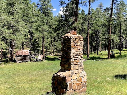
Aspen Spring is at the 2⅓ mile mark of Houston Brothers Trail #171. The spring pipe was bone dry, even in the small cave around the corner. A trickle of water seeped from the hillside. I was surprised to find a cabin, as I had not heard there was one at Aspen Spring. There was an old stove, falling apart, outside the cabin. The gas pipe had a bullet hole, but the cabin’s collapse was not due to an explosion.
North of Aspen Spring, Houston Draw tightens up. Houston Brothers Trail #171 moves up slope about 50 ft., rolling over small spurs and side creeks. I started finding many tight clusters of Nuttal’s linanthus flowers. Just past the 3-mile mark, there were three rather fat pine trees. I didn’t measure, but they had to be 4′ diameter! I marked the pines as the “Three Kings” on the attached GPS route (below). 👑
Pinchot Springs is supposedly around the 3⅓ mile mark of Houston Brothers Trail #171. Despite five minutes of searching, I couldn’t even find a trickle. Good thing I carry plenty of liquids. No hiking beer today, though.
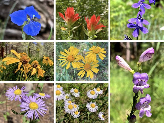
Top Row: western dayflower, paintbrush, Apache lobelia.
Middle Row: yellow coneflower, orange sneezeweed (?), wandbloom penstemon.
Bottom Row: showey fleabane, spreading fleabane.
Other high country flowers I spotted include alpine false springparsley (Cymopterus lemmonii), common mullein (Verbascum thapsus), skyrocket (Ipomopsis aggregata), pygmy bluet (Houstonia wrightii), western yarrow (Achillea millefolium), and a red cinquefoil (Potentilla thurberi) that was much smaller than normal. I wonder how many species the flower survey gals found?
Houston Brothers Trail #171 reached Pinchot Cabin at the 3¾ mile mark. Unlike Buck Springs Cabin, which was locked, Pinchot Cabin’s door was nailed shut. It’s too bad Coconino National Forest doesn’t rent the cabins out, like the C&O Canal does some of their old lockhouses. 😉👈
After enjoying a picnic of hot Takis chips, gorp and a gas station murderwich, I headed back across the creek, and started up decommissioned FR 95B. I jumped when a nearby dog barked. (The leashed dog, and its owner, were on the opposite side of a tree.) FR 95B was short, but steep. At the top, there was log-fenced pullout / trailhead on FR 139A. Disregarding 13 minutes of breaks, I made the 3¾ mile trip back to Houston Brothers Trail #171 in 1h 09m — an average speed of 3.27 mph.
Directions: From Phoenix, head north on AZ-87, the Beeline Highway, through Payson, Pine and Strawberry. (Alternately, take I-17 north, then AZ-260 east.) 2.6 miles north of AZ-260, turn right onto Rim Rd. / FR 300, which — unlike the east end near FR 34 — is still, thankfully, unpaved. In 16.3 miles, turn left onto FR 139. In 3.2 miles, turn left onto FR 139A. Park where Houston Brothers Trail #171 crosses the road.
GPS File: Houston_Brothers_Trail_171_FR139A_Loop
Distance: 9.73 mi.
AEG: 663 ft.
Time: 3h 34m
Rumble Video
Vimeo Video
Hiking Houston Brothers Trail #171, Mogollon Rim from Preston McMurry on Vimeo.