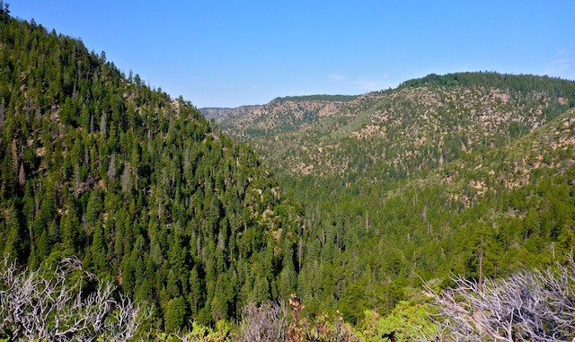
Recently, I was trying to remember where it was I saw this hike, and thought it was Payson. After casting a wider circle, and basically clicking every route in MapDex, I found it. I knew my wife couldn’t do it, so to make it a date, I figured we could hit Tonto Natural Bridge on the way back.
For some reason, Google wants to send you up I-17, then east on 260 to get to the northern trailhead, which is baloney, as 17 is basically one lane for most of its length. (Due to traffic volume and slow people in the fast lane.) At least on 87, there is less traffic, so if you want to zip by people at 75 on the curves, you are able to do so. ![]() (Really, the only two places you need to slow down are a couple of right hand southbound curves halfway between Payson and Rye.) Also, as we discovered, semis turning west onto 260 from southbound 87, have a problem making the turn, and hitting whoever happens to be waiting at that intersection — which would have been us, if we had trusted The Great Goog.
(Really, the only two places you need to slow down are a couple of right hand southbound curves halfway between Payson and Rye.) Also, as we discovered, semis turning west onto 260 from southbound 87, have a problem making the turn, and hitting whoever happens to be waiting at that intersection — which would have been us, if we had trusted The Great Goog. ![]()
I started at 0840 under partly cloudy skies.
The first .6 miles south are on jeep trail. Then the switchbacks start, about 600 feet in .75 miles. (The total climb from the floor of Pine Canyon is greater, but the slope is very gentle.) So, the switchback slope is not as steep as the climb south from Camp Lo Mia. (Or, I assume, north from the AZT trailhead to Dripping Springs.)
So, it was a pleasant stroll south for the first four miles, the vistas of the switchbacks, followed by the lush bottom of Pine Canyon. I met a couple on their way north, and told them I did not think the switchbacks would be as severe as expected. (Nor as long, as the sign at the bottom erroneously claims them to be “2 miles”.) It was peaceful, cool and shady, and a really good trail surface with no stabby plants. ![]() Every side canyon, spring and interesting site is well marked. You would have to try to get lost.
Every side canyon, spring and interesting site is well marked. You would have to try to get lost.
It got dark overhead a few times, but unfortunately never rained. ![]()
After 4.0 miles, the climb up from Camp Lo Mia is steep, rocky and exposed. (Thanx to cdeperro, who followed me by a few hours — but got his triplog up quicker ![]() — the misconception of south being “easy” has been corrected.) By the time I got to the top, by the Bruce & Joe’s East Rim intersection, I was zapped. I’m not sure why, as I was drinking plenty of fluid, and have been hiking at least once a week for several months. Probably the altitude. Here’s an embarassing example of how my body was breaking down: During a break, I went from not having to pee at all, to suddenly facing an emergency situation. I did not have time to look for cover, hoping that no one from Camp Lo Mia decided that was the moment they should go for a hike.
— the misconception of south being “easy” has been corrected.) By the time I got to the top, by the Bruce & Joe’s East Rim intersection, I was zapped. I’m not sure why, as I was drinking plenty of fluid, and have been hiking at least once a week for several months. Probably the altitude. Here’s an embarassing example of how my body was breaking down: During a break, I went from not having to pee at all, to suddenly facing an emergency situation. I did not have time to look for cover, hoping that no one from Camp Lo Mia decided that was the moment they should go for a hike. ![]() Thankfully, it was lunchtime.
Thankfully, it was lunchtime. ![]()
Regardless of where you are on the trail, there are plenty of good rocks and tree trunks to sit on.
As I worked my way south, I dreaded each 30 foot wash crossing. At 6.5 miles, by the “Good Enough Trail” sign, just before Dripping Springs, I got diverted onto a faint locals trail. By the time I realized my mistake, I was 150 feet downslope, and in no mood to trudge back up. As the spur I was on was smooth and open, I figured I would book down to what looked on my GPS like FR roads. Halfway down I had to negotiate a couple hundred yards of brush and deadfall, but then I picked up an even better locals trail, emerging at an actual city street called Manzanita Trail. It’s a signed trailhead, so you could legally park there. But my wife did not have an auto GPS, so I walked another 1.8 miles out to Hwy 87, emerging at 1330 just a half mile north of the AZT trailhead, having hiked an extra mile. (But at least it was downhill.) I could not have walked another inch.
I was still sore two days later. The soreness migrated around my body, and in the course of those two days there was not a single muscle was not affected. I also had a hard time sleeping the next two nights.
GPS File: Pine_Canyon_Trail_26
Distance: 9.05 mi.
AEG: 1,177 ft.
Time: 3h 57m
Tiny Cave Video
There was a video here, but YouTube deleted my account: I’m now on Vimeo.

