

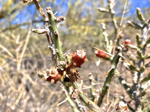
Today’s plan was to hike to the Cholla Benchmark, atop Yavapai Point, in Lake Pleasant Regional Park. 2025 has been the worst flower season since I moved back to Arizona in 2004. Lake Pleasant seems to usually get more rain than Phoenix, so I was hoping that paid off in desert flowers. 🙏🏻
Lake Pleasant does not have a lot of hiking trails, as it is geared more to RV camping and boating. (The ferry to Catalina Island , last September, was the first time I’d been on a boat in five years.) So, I don’t get out to the area very often. There are several short & moderate routes you can take up Yavapai Point:
- Cottonwood Trailhead: Out & back is 3.3 miles, 540 ft. AEG (accumulated elevation gain).
- Pipeline Canyon Trailhead: Out & back is 4.8 miles, 780 ft. AEG.
- ✅ North Gate: Out & back is 5.6 miles, 740 ft. AEG.
- Cottonwood Short Loop: 1.4 mile, 180 ft. AEG non-summit lasso — which is not worth the long drive from Phoenix. Might as well take a spin around Dreamy Draw, or wherever.
Yavapai Point Trail is hiking only. The other trails — Cottonwood Trail and Pipeline Canyon Trail are multiuse (i.e. for mountain bikes and horses, as well as hikers).
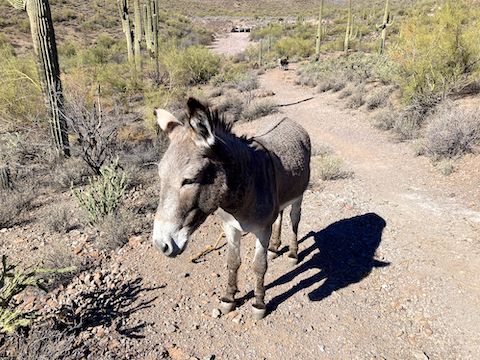
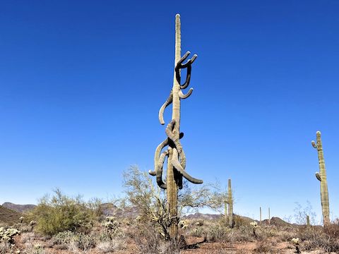
When I started hiking Cottonwood Trail from North Gate at 9:45 a.m., it was 57℉, but windy & chilly. I spotted burro poo, which is everywhere around Lake Pleasant. My wild burro encounter while crossing Cottonwood Wash reminded me of the one I had with wild horses on the Mogollon Rim last summer.
Cottonwood Trail ends at Pipeline Canyon Trail after 1.2 miles. Left to Cottonwood Trailhead, right to continue. Cottonwood Trailhead has dozens of parking spaces, over twenty picnic cabanas, bear box garbage, dog doo bags, and a mapboard. The restrooms were closed, though four portapotties were available. There’s too many hikers heading up Yavapai Point Trail to duck behind a bush.
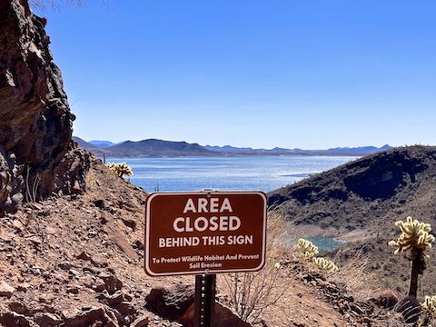
After checking out Cottonwood Trailhead, I hiked Pipeline Canyon Trail for a mere 100 yds., before turning left onto Yavapai Point Trail. The trail began a mild climb, crossing two small washes, before arriving at the William Gerchar bench — this hike’s first decent view of Lake Pleasant.
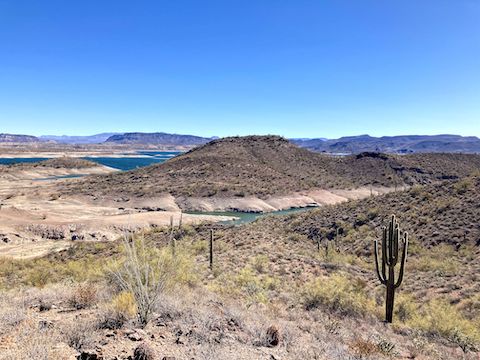
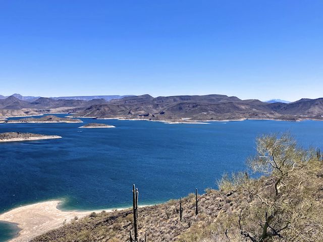
I arrived at the Gerber memorial bench atop Yavapai Point after 1h 20m of hiking. Actual movement, not counting photo stops. The badly scarred Cholla Benchmark was easily visible just ten feet past the bench. I spent the next twenty minutes fruitlessly searching for reference marks, then ten minutes enjoying the 240° views. (Blocked only by the higher ridge on the other side of Pipeline Canyon.)
I had zero bars Verizon at North Gate, two bars by the antenna on Cottonwood Trail, one bar at Cottonwood Trailhead (aka Yavapai Point Trailhead), and only one bar on op of Yavapai Point. All the folks that left Yavapai Point before me, I passed them on the way down. I bet I jogged a third of the 2.7 miles back to North Gate. Using the Short Loop connector, I made it back in only 45 minutes. 💪
Directions: From Phoenix, head north on I-17. Take exit 223B onto Carefree Highway / AZ-74. Drive west for 11.5 miles. At the top of the climb from the Agua Fria River, turn right on Castle Hot Springs Rd. In 5.6 miles, at the stop sign, turn right on Castle Creek Dr. The day use entry fee is currently $7. There is a small lot just past the gate, which is where I started. Or, for a shorter hike, drive 0.4 miles past the gate, taking the first right onto Cottonwood Ln. Cottonwood Trailhead is in 0.5 miles, at the end of Cottonwood Ln.
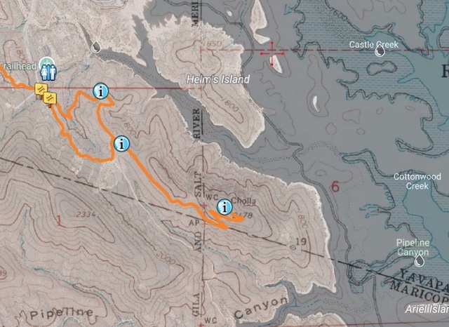
Park Map: Lake_Pleasant_Regional_Park_Map
GPS File: Lake_Pleasant_Yavapai_Point
Distance: 5.95 mi.
AEG: 724 ft.
Time: 2h 03m
Rumble Video
Vimeo Video
Hiking Yavapai Point, Lake Pleasant from Preston McMurry on Vimeo.