Starting to drive down the forest road, I quickly realized that would be a mistake, and attempted to back up. I suck at backing up. Always have. I was looking back over my shoulder, using the mirror, etc. I still managed to smack the fender against a post at the cattle grate. And I was only backing up 10 feet. Oh, and it was my wife’s car. ![]() Thankfully, she was very understanding.
Thankfully, she was very understanding. ![]() (Probably because I only cracked a tail light.)
(Probably because I only cracked a tail light.)
After successfully executing a parking maneuver, I headed back down the eroded forest road on foot.
A little over a mile in, I heard a truck slowly approaching. I waved; they stopped. It was a couple of bow hunters, driving in from Skull Valley, looking for deer, and wondering how to get back to the highway. I pointed out the trailhead, which is easily visible from most parts of this hike, and told them to basically stay on the jeep trail they were on. I also told them I had not seen any deer, or deer sign. A mile or so later, just after USMM 3770 (3-bar reception), I saw two deer. Probably right where the hunters had driven by 30 minutes earlier.
When I got to Mint Shaft, I was startled to see two owls in the larger shaft. I did not have my camera ready, so I was surprised I was able to get the photos of them I did.
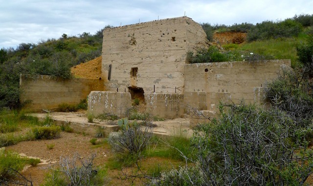
After Mint Shaft, I hit the mining complex I call the “blockhouse”. (Because from a distance it looks more like a fortification, than a mine building.) After exploring, I recalled the J. Geils Band. ![]()
Just before the blue tank was the first beer can of the day, a Budweiser. According to this week’s NY Times Magazine the most “popular” source of alcohol-related emergency room visits is good ol’ Bud.
After checking out the mine at the blue tank — which is visible from many parts of the hike, including the trailhead — I headed up Hill 5635. (3-bar reception on top.) I had planned on working my way around the south slope to another mine, but decided the hill was there, so why not? Good decision. Great view, and brush was easily avoided. Same on the way down, until the last hundred yards. Bashing my way those last few feet put a bunch of bruises and scratches on my shins. ![]()
When I was at the corral, a couple of dirt bikers stopped to see if I was okay before continuing east on the Hill 6276 trail. That was nice of them. ![]() They were just puttering along, not tearing it up.
They were just puttering along, not tearing it up.
When I closed the lollipop, I had to step aside for some ATVs. The eroded road had a bunch more ATV ruts in it. ![]()
My wife had not picked up any beer while I was hiking, so we stopped at the store in Peeples Valley, picked some up, then a few minutes later sipped one — and only one ![]() — each at the US 89 Yarnell overlook.
— each at the US 89 Yarnell overlook.
GPS File: Wilhoit_Mine_Loop_1
Distance: 9.30 mi.
AEG: 1,520 ft.
Time: 4h 00m
Hike Video
There was a video here, but YouTube deleted my account: I’m now on Rumble and Vimeo.

